North DeLand, Florida | |
---|---|
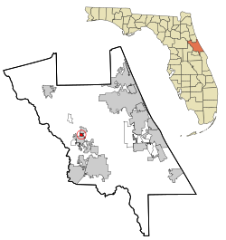
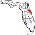
![]() Location in Volusia County and the state of Florida | |
Coordinates: 29°2′49″N81°17′52″W / 29.04694°N 81.29778°W | |
Country | ![]() |
State | ![]() |
County | Volusia |
Area | |
• Total | 0.53 sq mi (1.36 km2) |
• Land | 0.53 sq mi (1.36 km2) |
• Water | 0.00 sq mi (0.00 km2) |
Elevation | 79 ft (24 m) |
Population (2020) | |
• Total | 1,510 |
• Density | 2,876.19/sq mi (1,111.55/km2) |
Time zone | UTC-5 (Eastern (EST)) |
• Summer (DST) | UTC-4 (EDT) |
ZIP code | 32724 [2] |
Area code | 386 |
FIPS code | 12-49275 [3] |
GNIS feature ID | 1867180 [4] |
North DeLand is a census-designated place (CDP) in Volusia County, Florida, United States. The population was 1,510 at the 2020 census. [5]
North DeLand is located at 29°2′49″N81°17′52″W / 29.04694°N 81.29778°W (29.046854, -81.297914). [6]
According to the United States Census Bureau, the CDP has a total area of 0.54 square miles (1.4 km2), all land.
Census | Pop. | Note | %± |
---|---|---|---|
2020 | 1,510 | — | |
U.S. Decennial Census [7] |
As of the census [3] of 2000, there were 1,327 people, 532 households, and 347 families residing in the CDP. The population density was 868.4/km2 (2,253.7/mi2). There were 563 housing units at an average density of 368.4/km2 (956.2/mi2). The racial makeup of the CDP was 90.96% White, 2.56% African American, 0.68% Native American, 1.73% Asian, 2.11% from other races, and 1.96% from two or more races. Hispanic or Latino of any race were 7.69% of the population.
There were 532 households, out of which 29.3% had children under the age of 18 living with them, 43.0% were married couples living together, 16.0% had a female householder with no husband present, and 34.6% were non-families. 26.3% of all households were made up of individuals, and 11.7% had someone living alone who was 65 years of age or older. The average household size was 2.49 and the average family size was 2.99.
In the CDP, the population was spread out, with 25.8% under the age of 18, 7.8% from 18 to 24, 28.3% from 25 to 44, 22.1% from 45 to 64, and 16.1% who were 65 years of age or older. The median age was 37 years. For every 100 females, there were 95.7 males. For every 100 females age 18 and over, there were 86.0 males.
The median income for a household in the CDP was $30,288, and the median income for a family was $44,583. Males had a median income of $29,408 versus $28,542 for females. The per capita income for the CDP was $17,489. About 7.4% of families and 11.8% of the population were below the poverty line, including 16.9% of those under age 18 and none of those age 65 or over.
Queen Valley is a census-designated place (CDP) in north central Pinal County, Arizona, United States. The population was 820 at the 2000 census.
Corralitos is a census-designated place (CDP) in Santa Cruz County, California, United States. It is a rural area known for its agriculture of apples and strawberries, and its notable Corralitos Market and Sausage Co. Moreover, its location near the Pacific Ocean optimizes viticulture.
Phoenix Lake-Cedar Ridge is an unincorporated community and a former census-designated place (CDP) in Tuolumne County, California, United States. The population was 5,108 at the 2000 census.
Oak Ridge is a census-designated place and unincorporated area in Orange County, Florida, United States. The population was 22,685 at the 2010 census. It is part of the Orlando–Kissimmee–Sanford, Florida Metropolitan Statistical Area.
Combee Settlement is a census-designated place and unincorporated area in Polk County, Florida, United States. The population was 5,436 at the 2000 census. It is part of the Lakeland–Winter Haven Metropolitan Statistical Area. The area includes the separate unincorporated community of Country Club Estates.
East Palatka is a census-designated place (CDP) in Putnam County, Florida, United States. It is located on the east side of the City of Palatka at the intersection of U.S. Route 17/State Road 20/State Road 100 and the southwestern terminus of State Road 207. The population was 1,654 at the 2010 census.
West DeLand is a census-designated place (CDP) in Volusia County, Florida, United States. The population was 3,908 at the 2020 census.
Manor Creek is a home rule-class city in Jefferson County, Kentucky, United States. The population was 140 at the 2010 census, down from 221 at the 2000 census.
Fort Polk South is a census-designated place (CDP) in Vernon Parish, Louisiana, United States. The population was 11,000 at the 2000 census.
Old Agency is a census-designated place (CDP) in Sanders County, Montana, United States. The population was 95 at the 2000 census.
Hillside Lake is a hamlet and census-designated place (CDP) in Dutchess County, New York, United States. The population was 1,084 at the 2010 census. It is part of the Poughkeepsie–Newburgh–Middletown, NY Metropolitan Statistical Area as well as the larger New York–Newark–Bridgeport, NY-NJ-CT-PA Combined Statistical Area.
Ballville is a census-designated place (CDP) in Sandusky County, Ohio, United States, adjacent to Fremont. The population was 3,255 at the 2000 census.
Woodside is a census-designated place (CDP) in Bucks County, Pennsylvania, United States. The population was 2,425 at the 2010 census.
Conneaut Lakeshore is a census-designated place (CDP) in Crawford County, Pennsylvania, United States. The population was 2,395 at the 2010 census.
Mayo is a census-designated place (CDP) in Spartanburg County, South Carolina, United States. The population was 1,592 at the 2010 census.
East Sumter is a census-designated place (CDP) in Sumter County, South Carolina, United States. The population was 1,220 at the 2000 census. It is included in the Sumter, South Carolina Metropolitan Statistical Area.
Adwolfe is a census-designated place (CDP) in Smyth County, Virginia, United States. The population was 1,530 at the 2010 census.
Bradley is a census-designated place (CDP) in Raleigh County, West Virginia, United States, named in honor of General Omar Bradley, a field commander in North Africa and Europe during World War II and a General of the Army. The population was 2,040 at the 2010 census.
MacArthur is a census-designated place (CDP) in Raleigh County, West Virginia, United States. Originally, it was named Hollywood and renamed MacArthur after General of the Army Douglas MacArthur in 1942. The population was 1,500 at the 2010 census.
Falmouth is a census-designated place (CDP) consisting of the primary settlement in the town of Falmouth in Barnstable County, Massachusetts, United States. The population of the CDP was 3,799 at the 2010 census, out of 31,532 in the town as a whole. It was named after Falmouth, Cornwall, England.