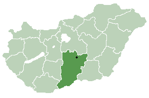
Pest is a county (megye) in central Hungary. It covers an area of 6,393.14 square kilometres (2,468.41 sq mi), and has a population of 1,213,090 (2009). It surrounds the national capital Budapest and the majority of the county's population live in the suburbs of Budapest. It shares borders with Slovakia and the Hungarian counties Nógrád, Heves, Jász-Nagykun-Szolnok, Bács-Kiskun, Fejér, and Komárom-Esztergom. The River Danube flows through the county. The capital of Pest County is Budapest, but it is planned to completely separate the capital from the county at least until 2020, as it loses catch-up aids from the European Union because of the high development of Budapest.

Central Hungary is one of the seven statistical regions in Hungary. It includes Budapest and Pest County.

Leányfalu is a riverside village in Pest county, Budapest metropolitan area, Hungary. It is just north of Szentendre located at 47°43′36″N19°5′22″E. Located between the branch of the Little Danube (Kis-Duna) and the spurs of the Visegrád Mountains, Leányfalu stretches some 5 kilometres in length. It was declared a holiday resort in 1936 and became an independent municipality in 1949.

Kéleshalom is a village in Bács-Kiskun county, in the Southern Great Plain region of southern Hungary.

Doboz is a village in Békés County, in the Southern Great Plain region of south-east Hungary.

Komádi is a town in Hajdú-Bihar county, in the Northern Great Plain region of eastern Hungary.
Hencida is a village in Hajdú-Bihar County in Hungary with a population of 1,191 people (2015).

Kismarja is a village in Hajdú-Bihar county, in the Northern Great Plain region of eastern Hungary.

Fülpösdaróc is a small village in Szabolcs-Szatmár-Bereg county, in the Northern Great Plain region of eastern Hungary.

Jármi is a village in Szabolcs-Szatmár-Bereg county, in the Northern Great Plain region of eastern Hungary.

Papos is a village in Szabolcs-Szatmár-Bereg county, in the Northern Great Plain region of eastern Hungary.

Porpác is a village in Vas county, Hungary.

Délegyháza is a village in Pest county, Budapest metropolitan area, Hungary. It has a population of 2,930 (2007).

Felsőpakony is a village in Pest county, Budapest metropolitan area, Hungary. It has a population of 3,282 (2007).

Gomba is a village in Pest county, Hungary.

Kakucs is a village in Pest county, Hungary.

Márianosztra is a village in Pest county, Hungary.

Penc is a village in Pest county, Hungary.

The Hungarian Central Statistical Office is a quango responsible for collecting, processing and publishing statistics about Hungary, its economy, and its inhabitants. The office provides details for parliamentary and administrative offices, local councils and academia, financial institutions, the public at large and the media.

Monor is a district in central-eastern part of Pest County. Monor is also the name of the town where the district seat is found. The district is located in the Central Hungary Statistical Region.


