Radar is a system that uses radio waves to determine the distance (ranging), direction, and radial velocity of objects relative to the site. It is a radiodetermination method used to detect and track aircraft, ships, spacecraft, guided missiles, motor vehicles, map weather formations, and terrain.

A Doppler radar is a specialized radar that uses the Doppler effect to produce velocity data about objects at a distance. It does this by bouncing a microwave signal off a desired target and analyzing how the object's motion has altered the frequency of the returned signal. This variation gives direct and highly accurate measurements of the radial component of a target's velocity relative to the radar. The term applies to radar systems in many domains like aviation, police radar detectors, navigation, meteorology, etc.

Millimeter-wave cloud radars, also denominated cloud radars, are radar systems designed to monitor clouds with operating frequencies between 24 and 110 GHz. Accordingly, their wavelengths range from 1 mm to 1.11 cm, about ten times shorter than those used in conventional S band radars such as NEXRAD.

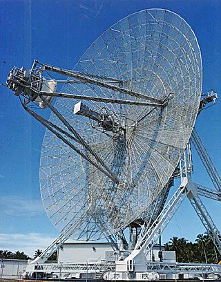
NEXRAD or Nexrad is a network of 159 high-resolution S-band Doppler weather radars operated by the National Weather Service (NWS), an agency of the National Oceanic and Atmospheric Administration (NOAA) within the United States Department of Commerce, the Federal Aviation Administration (FAA) within the Department of Transportation, and the U.S. Air Force within the Department of Defense. Its technical name is WSR-88D.

Synthetic-aperture radar (SAR) is a form of radar that is used to create two-dimensional images or three-dimensional reconstructions of objects, such as landscapes. SAR uses the motion of the radar antenna over a target region to provide finer spatial resolution than conventional stationary beam-scanning radars. SAR is typically mounted on a moving platform, such as an aircraft or spacecraft, and has its origins in an advanced form of side looking airborne radar (SLAR). The distance the SAR device travels over a target during the period when the target scene is illuminated creates the large synthetic antenna aperture. Typically, the larger the aperture, the higher the image resolution will be, regardless of whether the aperture is physical or synthetic – this allows SAR to create high-resolution images with comparatively small physical antennas. For a fixed antenna size and orientation, objects which are further away remain illuminated longer – therefore SAR has the property of creating larger synthetic apertures for more distant objects, which results in a consistent spatial resolution over a range of viewing distances.

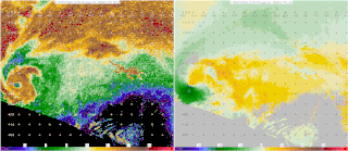
Weather radar, also called weather surveillance radar (WSR) and Doppler weather radar, is a type of radar used to locate precipitation, calculate its motion, and estimate its type. Modern weather radars are mostly pulse-Doppler radars, capable of detecting the motion of rain droplets in addition to the intensity of the precipitation. Both types of data can be analyzed to determine the structure of storms and their potential to cause severe weather.
Imaging radar is an application of radar which is used to create two-dimensional images, typically of landscapes. Imaging radar provides its light to illuminate an area on the ground and take a picture at radio wavelengths. It uses an antenna and digital computer storage to record its images. In a radar image, one can see only the energy that was reflected back towards the radar antenna. The radar moves along a flight path and the area illuminated by the radar, or footprint, is moved along the surface in a swath, building the image as it does so.
A pulse-Doppler radar is a radar system that determines the range to a target using pulse-timing techniques, and uses the Doppler effect of the returned signal to determine the target object's velocity. It combines the features of pulse radars and continuous-wave radars, which were formerly separate due to the complexity of the electronics.
The National Severe Storms Laboratory (NSSL) is a National Oceanic and Atmospheric Administration (NOAA) weather research laboratory under the Office of Oceanic and Atmospheric Research. It is one of seven NOAA Research Laboratories (RLs).

ARMOR Doppler weather radar is a C-Band, Dual-Polarimetric Doppler Weather Radar, located at the Huntsville International Airport in Huntsville, Alabama. The radar is a collaborative effort between WHNT-TV and the University of Alabama in Huntsville. Live data for the radar is only available to a limited audience, such as UAH employees and NWS meteorologists. All ARMOR data is archived at the National Space Science and Technology Center located on the UAH campus.
Moving target indication (MTI) is a mode of operation of a radar to discriminate a target against the clutter. It describes a variety of techniques used for finding moving objects, like an aircraft, and filter out unmoving ones, like hills or trees. It contrasts with the modern stationary target indication (STI) technique, which uses details of the signal to directly determine the mechanical properties of the reflecting objects and thereby find targets whether they are moving or not.

The Verification of the Origins of Rotation in Tornadoes Experiment are field experiments that study tornadoes. VORTEX1 was the first time scientists completely researched the entire evolution of a tornado with an array of instrumentation, enabling a greater understanding of the processes involved with tornadogenesis. A violent tornado near Union City, Oklahoma was documented in its entirety by chasers of the Tornado Intercept Project (TIP) in 1973. Their visual observations led to advancement in understanding of tornado structure and life cycles.

The Advanced Radar Research Center (ARRC) is an academic radar program within the United States. Its core mission revolves around the realm of interdisciplinary research, where it researches radar solutions to address a myriad of complex societal challenges.
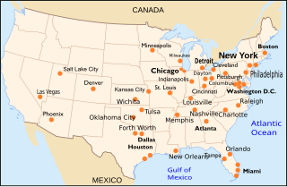
Terminal Doppler Weather Radar (TDWR) is a Doppler weather radar system with a three-dimensional "pencil beam" used primarily for the detection of hazardous wind shear conditions, precipitation, and winds aloft on and near major airports situated in climates with great exposure to thunderstorms in the United States. As of 2011, all were in-service with 45 operational radars, some covering multiple airports in major metropolitan locations, across the United States & Puerto Rico. Several similar weather radars have also been sold to other countries such as China (Hong Kong). Funded by the United States Federal Aviation Administration (FAA), TDWR technology was developed in the early 1990s at Lincoln Laboratory, part of the Massachusetts Institute of Technology, to assist air traffic controllers by providing real-time wind shear detection and high-resolution precipitation data.
Range ambiguity resolution is a technique used with medium pulse-repetition frequency (PRF) radar to obtain range information for distances that exceed the distance between transmit pulses.

High Resolution Wide Swath (HRWS) imaging is an important branch in synthetic aperture radar (SAR) imaging, a remote sensing technique capable of providing high resolution images independent of weather conditions and sunlight illumination. This makes SAR very attractive for the systematic observation of dynamic processes on the Earth's surface, which is useful for environmental monitoring, earth resource mapping and military systems.

Multifunction Phased Array Radar (MPAR) was an experimental Doppler radar system that utilized phased array technology. MPAR could scan at angles as high as 60 degrees in elevation, and simultaneously track meteorological phenomena, biological flyers, non-cooperative aircraft, and air traffic. From 2003 through 2016, there was one operational MPAR within the mainland United States—a repurposed AN/SPY-1A radar set loaned to NOAA by the U.S. Navy. The MPAR was decommissioned and removed in 2016.
The railSAR, also known as the ultra-wideband Foliage Penetration Synthetic Aperture Radar, is a rail-guided, low-frequency impulse radar system that can detect and discern target objects hidden behind foliage. It was designed and developed by the U.S. Army Research Laboratory (ARL) in the early 1990s in order to demonstrate the capabilities of an airborne SAR for foliage and ground penetration. However, since conducting accurate, repeatable measurements on an airborne platform was both challenging and expensive, the railSAR was built on the rooftop of a four-story building within the Army Research Laboratory compound along a 104-meter laser-leveled track.

The RapidX-bandPolarimetric Radar, commonly abbreviated as RaXPol, is a mobile research radar designed and operated by the University of Oklahoma, led by Howard Bluestein. RaXPol often collaborates with adjacent mobile radar projects, such as Doppler on Wheels and SMART-R. Unlike its counterparts, RaXPol typically places emphasis on temporal resolution, and as such is capable of surveilling the entire local atmosphere in three dimensions in as little as 20 seconds, or a single level in less than 3 seconds.
Starting in the mid-1900s, mobile radar vehicles were being used for academic and military research. In the late 1900s, mobile doppler weather radars were designed and created with the goal to study atmospheric phenomena.


