Ohio Township | |
|---|---|
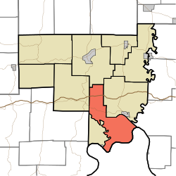 Location of Ohio Township in Crawford County | |
| Coordinates: 38°11′57″N86°24′57″W / 38.19917°N 86.41583°W | |
| Country | United States |
| State | Indiana |
| County | Crawford |
| Government | |
| • Type | Indiana township |
| Area | |
• Total | 30.73 sq mi (79.6 km2) |
| • Land | 30.1 sq mi (78 km2) |
| • Water | 0.62 sq mi (1.6 km2) |
| Elevation | 594 ft (181 m) |
| Population (2020) | |
• Total | 653 |
| • Density | 21.7/sq mi (8.38/km2) |
| Zip Code | 47118 |
| Zip Code | 47137 |
| FIPS code | 18-56142 [2] |
| GNIS feature ID | 453683 |
Ohio Township is one of nine townships in Crawford County, Indiana. As of the 2020 census, its population was 653 and it contained 329 housing units. [3]
Contents
- Geography
- Unincorporated towns
- Adjacent townships
- Major highways
- Cemeteries
- References
- External links
| Census | Pop. | Note | %± |
|---|---|---|---|
| 1890 | 1,199 | — | |
| 1900 | 1,133 | −5.5% | |
| 1910 | 883 | −22.1% | |
| 1920 | 774 | −12.3% | |
| 1930 | 683 | −11.8% | |
| 1940 | 794 | 16.3% | |
| 1950 | 555 | −30.1% | |
| 1960 | 490 | −11.7% | |
| 1970 | 467 | −4.7% | |
| 1980 | 508 | 8.8% | |
| 1990 | 568 | 11.8% | |
| 2000 | 689 | 21.3% | |
| 2010 | 742 | 7.7% | |
| 2020 | 653 | −12.0% | |
| Source: US Decennial Census [4] | |||
