Ong's Hat, New Jersey

Last updated

Ong's Hat, New Jersey
Former village
Ongs Hat, NJ.jpg
Along Magnolia Road (CR 644)
Location map of Burlington County, New Jersey.svg
Red pog.svg
Ong's Hat
USA New Jersey location map.svg
Red pog.svg
Ong's Hat
Usa edcp location map.svg
Red pog.svg
Ong's Hat
Coordinates: 39°54′39″N74°37′15″W / 39.91083°N 74.62083°W / 39.91083; -74.62083
Country Flag of the United States.svg  United States
State Flag of New Jersey.svg  New Jersey
County Burlington
Township Pemberton
Elevation
[1]
30 m (98 ft)
Time zone UTC−05:00 (Eastern (EST))
  Summer (DST) UTC−04:00 (Eastern (EDT))
GNIS feature ID878993 [1]

Ong's Hat (also Ong) is a ghost town in Pemberton Township, Burlington County, in the U.S. state of New Jersey. [2] It is located on Magnolia Road (County Route 644) west of the Four Mile Circle, where New Jersey Route 72 intersects with New Jersey Route 70. [3] It is the northern terminus of the Batona Trail.

Contents

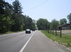
Although it was never more than one hut ("Ong's Hut") it still appeared on some maps as of 2006. [4] A road in the area is named Ong's Hat Road. It is also called the Buddtown-Ong's Hat Road. It was completed in 1929, replacing an earlier dirt path. [5]

Name

The name of the place may have originally been Ong's Hut, referring to an overnight shelter built by a farmer of that name; see below.

A well-known folk story attributes the name to a local man who was a fixture at local dances, wooing women with his suave attire, especially his silk hat. The surname Ong was common among early Pine Barrens settlers, and one of the earliest settlers was named Jacob Ong. One story of the origin of the name is that at one such dance, a jealous lover stomped on his hat, ruining it, and in frustration Ong tossed it in the air, where it caught on a high branch of a pine tree. The hat remained there for many years, serving as landmark which identified the small village. [3] At least four other versions of this legend circulate. One version simply ends with his hat being stomped on, while the most widely circulated one ends with him throwing it in the tree. The other two hold that Ong was a tavern keeper who either painted a silk hat on his sign or threw his hat into a tree after getting angry with a woman. [6]

History

The name of the area predates the revolutionary war.[ citation needed ] The location "Ong's" appears on a 1778 map of Hessian encampments in New Jersey. According to Forgotten Towns of Southern New Jersey by Henry Charlton Beck, Ong's Hat was a real village. According to Beck, around the 1860s, Ong's Hat was a lively town and served as a social center for the surrounding area. It was known for the availability of alcohol and one of the first arrests of a bootlegger occurred at Ong's Hat. Prizefighting was also popular. [7]

Ong's Hat, c. early 1970s Ong's Hat tree.jpg
Ong's Hat, c. early 1970s

Beck says that a Polish couple, the Chininiskis, moved to Ong's Hat in the early 20th century. By that time only seven residents remained. The Chininiskis disappeared soon after. Years later, hunters found a female skeleton at Ong's Hat, which police speculated was that of Mrs. Chininiski. Tracking Mr. Chininiski to New York but unable to prove anything, Burlington County Sheriff Ellis Parker kept the skull in his office for many years as a reminder of the unsolved case. [7]

By 1936, Ong's Hat was still on maps but nothing was there except a clearing, an abandoned shed, and bits of brick and roofing suggesting houses had once been there. When Beck visited he found only Eli Freed, a 79-year-old farmer who moved to the area from Chicago. In the foreword to the 1961 edition of the book, Beck reports that Freed no longer lived at Ong's Hat and that additional legends concerning the village had emerged. [7]

A 1968 letter published in The New York Times , written by an Ong family descendant, claims reports of an actual town are a misnomer. Instead, he says his ancestors lived in Little Egg Harbor in the early 17th century and transported their grain to Burlington, New Jersey for grinding. They built a hut midway through the route where they could rest overnight, and according to the letter the name Ong's Hut was added to maps and gradually corrupted to Ong's Hat. [8]

In his 1944 book Jersey Genesis, Beck himself says in reporting on Ong's Hat he fell for "elaborate traps" and that the story he had earlier repeated was a "fairy tale". He then subscribes to the explanation that the name is a corruption of Ong's Hut, a stopover point for a farmer from Little Egg Harbor. [9]

Urban legend

The town of Ong's Hat was the setting for a series of fictional conspiracy theory themed [10] stories from the 1980s onwards, known as Ong's Hat , in which a group of scientists was able to travel to a parallel dimension from a site in the township.

The story originated in Joseph Matheny’s book, The Incunabula Papers: Ong's Hat And Other Gateways To New Dimensions. [11] In his book, written in the first person, he tells the story of an investigative journalist trying to uncover the truth about the mysterious town, detailing everything that is happening there. [12]

Matheny intended the book to be entertaining and viewed as a work of fiction, but many regarded the stories as factual evidence of a scientific conspiracy, with Matheny's denials being a result of government persecution. [13]

Related Research Articles

<span class="mw-page-title-main">Chesterfield Township, New Jersey</span> Township in Burlington County, New Jersey, United States

Chesterfield Township is a township in Burlington County, in the U.S. state of New Jersey. As of the 2020 United States census, the township's population was 9,422, an increase of 1,723 (+22.4%) from the 2010 census count of 7,699, which in turn reflected an increase of 1,744 (+29.3%) from the 5,955 counted in the 2000 census. The township, and all of Burlington County, is a part of the Philadelphia-Reading-Camden combined statistical area and the Delaware Valley.

<span class="mw-page-title-main">Mount Laurel, New Jersey</span> Township in Burlington County, New Jersey, United States

Mount Laurel is a township in Burlington County in the U.S. state of New Jersey. The township, and all of Burlington County, is a part of the Philadelphia-Reading-Camden combined statistical area and the Delaware Valley. As of the 2020 United States census, the township's population was 44,633, its highest decennial count ever and an increase of 2,769 (+6.6%) from the 2010 census count of 41,864, which in turn reflected an increase of 1,643 (+4.1%) from the 40,221 counted in the 2000 census. It is the home of NFL Films.

<span class="mw-page-title-main">Pemberton Township, New Jersey</span> Township in Burlington County, New Jersey, United States

Pemberton Township is a township in Burlington County, in the U.S. state of New Jersey. As of the 2020 United States census, the township's population was 26,903, a decrease of 1,009 (−3.6%) from the 2010 census count of 27,912, which in turn reflected a decline of 779 (−2.7%) from the 28,691 total in the 2000 census. The township, and all of Burlington County, is a part of the Philadelphia-Reading-Camden combined statistical area and the Delaware Valley.

<span class="mw-page-title-main">Washington Township, Burlington County, New Jersey</span> Township in Burlington County, New Jersey, United States

Washington Township is a township in Burlington County, in the U.S. state of New Jersey. As of the 2020 United States census, the township's population was 693, an increase of 6 (+0.9%) from the 2010 census count of 687, which in turn reflected an increase of 66 (+10.6%) from the 621 counted in the 2000 census. The township, and all of Burlington County, is a part of the Philadelphia-Reading-Camden combined statistical area and the Delaware Valley.

<span class="mw-page-title-main">Essex, New York</span> Town in New York, United States

Essex is a town in Essex County, New York, United States overlooking Lake Champlain. The population was 621 at the 2020 census. The town is named after locations in England.

<span class="mw-page-title-main">New Jersey Pine Barrens</span> Coastal pine barrens in southern New Jersey, United States

The New Jersey Pine Barrens, also known as the Pinelands or simply the Pines, is the largest remaining example of the Atlantic coastal pine barrens ecosystem, stretching across more than seven counties of New Jersey. Two other large, contiguous examples of this ecosystem remain in the northeastern United States: the Long Island Central Pine Barrens and the Massachusetts Coastal Pine Barrens. The name pine barrens refers to the area's sandy, acidic, nutrient-poor soil. Although European settlers could not cultivate their familiar crops there, the unique ecology of the Pine Barrens supports a diverse spectrum of plant life, including orchids and carnivorous plants. The area is also notable for its populations of rare pygmy pitch pines and other plant species that depend on the frequent fires of the Pine Barrens to reproduce. The sand that composes much of the area's soil is referred to by the locals as sugar sand.

<span class="mw-page-title-main">Mullica River</span> River

The Mullica River is a 50.6-mile-long (81.4 km) river in southern New Jersey in the United States. The Mullica was once known as the Little Egg Harbor River.

Ong's Hat is one of the earliest Internet-based secret history conspiracy theories. It was created as a piece of collaborative fiction by four core individuals, dating back to the 1980s, although the membership propagating the tale changed over time. Ong's Hat is often cited as the first ARG on many lists of alternate reality games.

Eric Pålsson Mullica was an early Finnish settler to New Sweden. He and his family were the source of the name of several geographic features and places in New Jersey.

<span class="mw-page-title-main">Columbus, New Jersey</span> Populated place in Burlington County, New Jersey, US

Columbus is an unincorporated community located within Mansfield Township in Burlington County, in the U.S. state of New Jersey. The area is served as United States Postal Service ZIP Code 08022. Most of Mansfield Township's governmental offices are located in and around Columbus. It is also the main business district in the township with many businesses lining the main roads in the area. It is located at the junction of County Route 543 and U.S. Route 206 which is a major highway that heads north and south. US 206 originally passed through the center of Columbus on Atlantic Avenue and New York Avenue until it was moved to a short four-lane bypass of downtown in the late 1950s/early 1960s. The old surface route became state-maintained New Jersey Route 170 but became a county-maintained road in 1986.

<span class="mw-page-title-main">Harrisville, New Jersey</span> Populated place in Burlington County, New Jersey, US

Harrisville is an unincorporated community and ghost town located about 6 miles (9.7 km) northwest of New Gretna within Bass River Township in Burlington County, in the U.S. state of New Jersey, in the New Jersey Pine Barrens.

<span class="mw-page-title-main">New Lisbon, New Jersey</span> Populated place in Burlington County, New Jersey, US

New Lisbon is an unincorporated community located within Pemberton Township in Burlington County, in the U.S. state of New Jersey. It is a settlement along Four Mile Road where it intersects Mount Misery Road. The community is located along the Philadelphia and Long Branch Railway, later a part of the Pennsylvania Railroad, and featured a train station.

<span class="mw-page-title-main">Joseph Matheny</span> American writer and transmedia artist

Joseph Wayne Matheny is an American writer and transmedia artist who has created works using alternate reality gaming and transmedia storytelling methods. He holds patents for prediction, recommendation and behavioral analysis algorithms and software design. He is a published author of screenplays, white papers, technology, sci-fi, marketing and gaming books. He currently resides in Eugene, OR. He is probably best known for the avant-garde work Ong's Hat, which has been called the proto-Alternate Reality Game. Ong's Hat is often cited as the first ARG on many lists of alternate reality games.

<span class="mw-page-title-main">Smithburg, New Jersey</span> Populated place in Monmouth County, New Jersey, US

Smithburg is an unincorporated community located where the municipal boundaries of Freehold, Manalapan and Millstone townships intersect in Monmouth County, in the U.S. state of New Jersey. County Route 527 and Monmouth Road pass through the center of the quaint village of Smithburg.

<span class="mw-page-title-main">Leeds Point, New Jersey</span> Populated place in Atlantic County, New Jersey, US

Leeds Point is an unincorporated community and census-designated place (CDP) located within Galloway Township, Atlantic County, in the U.S. state of New Jersey. Leeds Point is 5.7 miles (9.2 km) northeast of Absecon. Leeds Point has a post office with ZIP Code 08220, which opened on December 18, 1827. The town is named after the Leeds family, whose first American member, Daniel Leeds, Surveyor General of West Jersey around the beginning of the 18th century, after immigrating to New Jersey from the city of Leeds in England, claimed the land which now makes up Leeds Point; some of his descendants lived in Leeds Point from then on.

<span class="mw-page-title-main">Red Valley, New Jersey</span> Populated place in Monmouth County, New Jersey, US

Red Valley is an unincorporated community located within Upper Freehold Township in Monmouth County, in the U.S. state of New Jersey. The settlement is located at the intersection of County Route 526 and Red Valley Road (south) and Yellow Meetinghouse Road (north) near the township's eastern border with Millstone Township. Except for some single-family houses located along the roads in the area, the area is primarily made up of farmland.

<span class="mw-page-title-main">Red Lion, Burlington County, New Jersey</span> Populated place in Burlington County, New Jersey, US

Red Lion is an unincorporated community located within Southampton Township in Burlington County, in the U.S. state of New Jersey.

High Crossing is a ghost town in Tabernacle Township, in Burlington County, in the U.S. state of New Jersey.

<span class="mw-page-title-main">Henry Charlton Beck</span> American author (1902-1965)

Rev. Henry Charlton Beck was an author, journalist, historian, ordained Episcopal minister and folklorist. He authored six books about New Jersey history, forgotten towns, and regional folklore which were published by E.P. Dutton & Co. and later reprinted by Rutgers University Press. He chronicled vignettes and anecdotal remembrances about such quaint—and often vanished—New Jersey locales as Ong's Hat, Penny Pot, Recklesstown, Apple Pie Hill, Calico, Varmintown, Pickle's Mountain, and Owltown.

References

  1. 1 2 U.S. Geological Survey Geographic Names Information System: Ong's Hat, New Jersey
  2. Locality Search, State of New Jersey. Accessed December 14, 2014.
  3. 1 2 Sceurman, Mark (2006). "Weird N.J. Volume 2". Sterling Publishing Company. pp. 68–69. ISBN   1-4027-3941-9.
  4. Scheller, Kay (2006). New Jersey Off the Beaten Path (8th ed.). Globe Pequot. p. 145. ISBN   0-7627-4055-8.
  5. Dickinson, Leon A. "IT'S THE SEASON NOW UP IN THE CATSKILLS; Good Roads Make Many Resorts Easily Accessible to Trippers and Vacationists--Road Conditions in New York, Pennsylvania and Vermont--Other Highway News" (subscription required), The New York Times , June 23, 1929. Accessed December 14, 2014. "A new road between Buddtown and Ong's Hat, in Burlington county, is now open for traffic."
  6. Cicetti, Fred (September 5, 1976). "'Scrappy Corner' Put Up a Good Fight". The New York Times. p. 236.
  7. 1 2 3 Beck, Henry Charlton (1984) [1961]. Forgotten Towns of Southern New Jersey. Rutgers University Press. pp. 6, 19–25. ISBN   978-0-8135-1016-3.
  8. Cook, Ross K. (June 30, 1968). "Ong's Hat". The New York Times . pp. BR 16–17.
  9. Beck, Henry Charlton (1983) [1944]. Jersey Genesis. Rutgers University Press. pp. 302–303. ISBN   978-0-8135-1015-6.
  10. Matheny, Joseph (May 31, 2021). "Ong's Hat: Is Princeton Opposed to Satire?". Archived from the original on November 30, 2021. Retrieved November 30, 2021.
  11. Matheny, Joseph (1999). The Incunabula Papers: Ong's Hat And Other Gateways To New Dimensions. iMMERSION New Media. ISBN   9780967489018.
  12. "Ong's Hat: The Early Internet Conspiracy Game That Got Too Real". Gizmodo. February 21, 2019. Retrieved November 8, 2021.
  13. Deep, Jayaditya (May 31, 2021). "The Fiction of Ong's Hat: Too Good to be False". Tortoise. Retrieved November 8, 2021.
  14. "The Durango Laramie Matter," CBS Radio, 2/23/58