Orrville, Alabama | |
---|---|
Coordinates: 32°18′20″N87°14′43″W / 32.30556°N 87.24528°W | |
Country | United States |
State | Alabama |
County | Dallas |
Area | |
• Total | 1.04 sq mi (2.68 km2) |
• Land | 1.04 sq mi (2.68 km2) |
• Water | 0.00 sq mi (0.00 km2) |
Elevation | 190 ft (58 m) |
Population (2020) | |
• Total | 150 |
• Density | 144.65/sq mi (55.87/km2) |
Time zone | UTC-6 (Central (CST)) |
• Summer (DST) | UTC-5 (CDT) |
ZIP code | 36767 |
Area code | 334 |
FIPS code | 01-57240 |
GNIS feature ID | 0152821 |
Website | www |
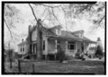
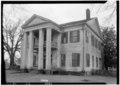
Orrville is a town in Dallas County, Alabama, United States. At the 2020 census, the population was 150. According to the 1910 U.S. census, Orrville incorporated in 1908, though it was listed as an incorporated community prior to that.
Orrville is located in western Dallas County at 32°18′20″N87°14′43″W / 32.30556°N 87.24528°W (32.305584, -87.245378). [2] Alabama State Route 22 passes through the town, leading northeast 15 miles (24 km) to Selma, the county seat, and west 8 miles (13 km) to Safford.
According to the U.S. Census Bureau, Orrville has a total area of 1.0 square mile (2.7 km2), all land. [3]
Census | Pop. | Note | %± |
---|---|---|---|
1880 | 270 | — | |
1890 | 321 | 18.9% | |
1910 | 255 | — | |
1920 | 341 | 33.7% | |
1930 | 394 | 15.5% | |
1940 | 416 | 5.6% | |
1950 | 416 | 0.0% | |
1960 | 422 | 1.4% | |
1970 | 362 | −14.2% | |
1980 | 349 | −3.6% | |
1990 | 234 | −33.0% | |
2000 | 230 | −1.7% | |
2010 | 204 | −11.3% | |
2020 | 150 | −26.5% | |
U.S. Decennial Census [4] 2013 Estimate [5] |
As of the census [6] of 2000, there were 230 people, 105 households, and 59 families residing in the town. The population density was 222.5 inhabitants per square mile (85.9/km2). There were 118 housing units at an average density of 114.2 per square mile (44.1/km2). The racial makeup of the town was 51.30% White, 48.26% Black or African American, and 0.43% from two or more races. 0.43% of the population were Hispanic or Latino of any race.
There were 105 households, out of which 20.0% had children under the age of 18 living with them, 42.9% were married couples living together, 10.5% had a female householder with no husband present, and 42.9% were non-families. 41.9% of all households were made up of individuals, and 19.0% had someone living alone who was 65 years of age or older. The average household size was 2.19 and the average family size was 3.03.
In the town, the population was spread out, with 19.6% under the age of 18, 7.0% from 18 to 24, 26.1% from 25 to 44, 26.1% from 45 to 64, and 21.3% who were 65 years of age or older. The median age was 43 years. For every 100 females, there were 88.5 males. For every 100 females age 18 and over, there were 85.0 males.
The median income for a household in the town was $28,571, and the median income for a family was $31,719. Males had a median income of $29,583 versus $30,000 for females. The per capita income for the town was $15,418. About 9.9% of families and 15.7% of the population were below the poverty line, including none of those under the age of eighteen and 22.2% of those sixty-five or over.
Orrville is an incorporated town, governed by a mayor/town council structure. Current Mayor Louvenia Lumpkin was first elected in 2012, [7] defeating incumbent Mayor Gene McHugh; she was re-elected in 2016. Herman Majors is Orrville's Town Council President and its longest-serving town councilmember, first appointed in 1970 and re-elected every term since then. Other councilmembers elected or re-elected in 2016 include Jewell Williamson, William Lumpkin (husband of Mayor Louvenia Lumpkin), Jerry Phillips and Jim Brunson. [8]
At the height of the expansion of the recreational boating industry, Orrville was home to Baker-Jewell Inc., a small manufacturing company which produced small fiberglass boats for the recreational market. They featured iconic styling of the late 1950s era, including automotive-type tailfins and seating. [9]
Today a small factory in Orrville manufactures portable buildings.
Orrville Farmers Market [10] opened in 2016 in the heart of town and sells locally grown farm-fresh produce, artisan foods, agricultural-based products and country-themed gifts. The market also serves hot breakfast and lunch six days a week, Monday through Saturday. Orrville Farmers Market gives local farmers the opportunity to develop a personal relationship with their customers and to cultivate consumer loyalty to the farmer who grows the produce and produces farm-fresh products.
Below are photographs taken of structures in Orrville as part of the Historic American Buildings Survey:
Brent is a city in Bibb County, Alabama, United States. At the 2020 census, the population was 2,972.
Belk is a town in Fayette County, Alabama, United States. Its citizens voted to incorporate in January 1969. At the 2020 census, the population was 186.
Newbern is a town in Hale County, Alabama, United States. As of the 2020 census, the population of the town was 133.
Thomaston is a town in Marengo County, Alabama, United States. At the 2020 census the population was 326, down from 417 at the 2010 census.
Oakwood Hills is a village in McHenry County, Illinois, United States. It was founded in 1959. The population was 2,076 at the 2020 census.
Plymouth is a city in Cerro Gordo County, Iowa, United States, along the Shell Rock River. The population was 375 at the time of the 2020 census. It is part of the Mason City Micropolitan Statistical Area.
Charlotte is a town in Washington County, Maine, United States. The town was named for the wife of legislator William Vance. The population was 337 at the 2020 census.
Harrisville Township is a civil township of Alcona County in the U.S. state of Michigan. The population was 1,307 at the 2020 census. Harrisville Township surrounds the city of Harrisville, but the two are administered autonomously.
Fairfield Township is a civil township of Shiawassee County in the U.S. state of Michigan. As of the 2010 census, the township population was 755.
Fort Sumner is a village in and the county seat of De Baca County, New Mexico, United States. The population was 1,031 at the 2010 U.S. Census, down from the figure of 1,249 recorded in 2000. Fort Sumner is the spring and fall home of the Columbia Scientific Balloon Facility, and is home to the burial site of famed outlaw of the American West, Billy the Kid, who was shot and killed there in 1881.
Lasker is a town in Northampton County, North Carolina, United States. The population was 122 at the 2010 census. It is part of the Roanoke Rapids, North Carolina Micropolitan Statistical Area.
Hanoverton is a village in western Columbiana County, Ohio, United States. The population was 354 at the 2020 census. It is part of the Salem micropolitan area, 23 miles (37 km) miles east of Canton and 28 miles (45 km) southwest of Youngstown.
Orrville is a city in Wayne County, Ohio, United States. It is about 9 miles east of Wooster and 20 miles southwest of Akron. The population was 8,452 at the 2020 census. It is part of the Wooster micropolitan area, and the city is best known as the headquarters of The J.M. Smucker Company, an American food and beverage company mostly known for its production of namesake jellies.
Saxton is a borough in Bedford County, Pennsylvania, United States. The population was 726 at the 2020 census.
Noonday is a city in Smith County, Texas, United States. The population was 612 at the 2020 census. It is part of the Tyler, Texas Metropolitan Statistical Area.
Walla Walla East is a census-designated place (CDP) in Walla Walla County, Washington, United States. The population was 1,672 at the 2010 census.
Marmet is a town in Kanawha County, West Virginia, United States, along the Kanawha River. The population was 1,501 at the 2020 census.
Reeseville is a village in Dodge County, Wisconsin, United States. The population was 763 at the 2020 census.
Cudahy is a city in Milwaukee County, Wisconsin, United States. The population was 18,204 at the 2020 census.
Franklinville is a town in Cattaraugus County, New York, United States. The population was 2,811 at the 2020 census.