Tijuana is the most populous city in the state of Baja California, located on the northwestern Pacific Coast of Mexico. Tijuana is the municipal seat of the Tijuana Municipality and the hub of the Tijuana metropolitan area. It has a close proximity to the Mexico–United States border, which is part of the San Diego–Tijuana metro area.
Tijuana is the most populous city in the state of Baja California, located on the northwestern Pacific Coast of Mexico. Tijuana is the municipal seat of the Tijuana Municipality and the hub of the Tijuana metropolitan area. It has a close proximity to the Mexico–United States border, which is part of the San Diego–Tijuana metro area.
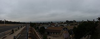
San Ysidro is a district of San Diego, California, immediately north of the Mexico–United States border. It neighbors Otay Mesa West to the north, Otay Mesa to the east, and Nestor and the Tijuana River Valley to the west; together these communities form South San Diego, a practical exclave of the City of San Diego. Major thoroughfares include Beyer Boulevard and San Ysidro Boulevard.

Rosarito is a coastal city in Playas de Rosarito Municipality, Baja California, on the Pacific Coast of Mexico. As of 2010, the city had a population of 65,278. Located 10 miles (16 km) south of the US–Mexico border, Rosarito is a part of the greater San Diego–Tijuana region and one of the westernmost cities in Mexico. Rosarito is a major tourist destination, known for its beaches, resorts, and events like Baja Beach Fest.

Tijuana Municipality is a municipality in the Mexican state of Baja California. Its municipal seat is located in the city of Tijuana. According to the 2020 census, the municipality had a population of 1,922,523. Montserrat Caballero of the MORENA is the current mayor. The municipality comprises the largest part of the Tijuana metropolitan area.

The South Bay, also known as South County, is a region in southwestern San Diego County, California, consisting of the cities and unincorporated communities of Bonita, Chula Vista, East Otay Mesa, Imperial Beach, Lincoln Acres, National City, and South San Diego.
Otay Mesa is a community in the southern exclave of San Diego, California, just north of the U.S.–Mexico border.
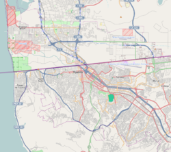
San Diego–Tijuana is an international transborder agglomeration, straddling the border of the adjacent North American coastal cities of San Diego, California, United States, and Tijuana, Baja California, Mexico. The 2020 population of the region was 5,456,577, making it the largest bi-national conurbation shared between the United States and Mexico, and the second-largest shared between the US and another country. The conurbation consists of San Diego County, in the United States and the municipalities of Tijuana, Rosarito Beach (126,980), and Tecate (108,440) in Mexico. It is the third most populous region in the California–Baja California region, smaller only than the metropolitan areas of Greater Los Angeles and the San Francisco Bay Area.
South San Diego is a district within San Diego, and is in the larger South Bay region of southwestern San Diego County, California. It is a practical exclave of San Diego, having no land connection with the rest of the city. It is the only part of the city which borders Mexico. South San Diego includes four of the city's official community planning areas: Otay Mesa, Otay Mesa-Nestor, San Ysidro, and the Tijuana River Valley.
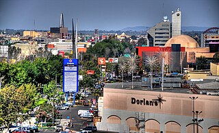
Zona Río is an official zone, and the main modern business district, of the city of Tijuana, Mexico.

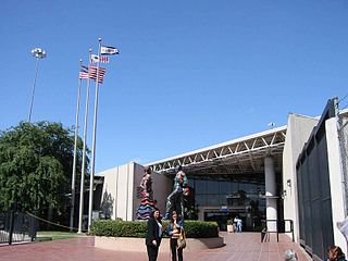
The San Ysidro Port of Entry is the largest land border crossing between San Diego and Tijuana, and the fourth-busiest land border crossing in the world with 70,000 northbound vehicles and 20,000 northbound pedestrians crossing each day, in addition to southbound traffic. It connects Mexican Federal Highway 1 on the Mexican side with Interstate 5 on the American side. The San Ysidro Port of Entry is one of three ports of entry in the San Diego–Tijuana metropolitan region.
The Otay Mesa Port of Entry is one of three ports of entry (POE) in the San Diego–Tijuana metropolitan region, in the U.S. state of California, connecting Otay Mesa in San Diego with the Otay Centenario borough of Tijuana. The facility was opened in 1983, and was constructed primarily to divert growing commercial truck traffic from the busy San Ysidro Port of Entry, located 5.2 miles (8.4 km) west. Since then, significant passenger vehicle and pedestrian traffic has grown as development in the area around the crossing has grown. Commercial importations through Otay Mesa accounts for billions of dollars' worth of freight.

The Tecate Port of Entry is one three ports of entry in the San Diego–Tijuana metropolitan region. The land port is located between Tecate, California, in San Diego County's Mountain Empire and Tecate Municipality in Baja California. It connects California State Route 188 with Paseo Lázaro Cárdenas, a spur of Mexican Federal Highway 2, as well as Federal Highway 3 to the south. It is a minor port in comparison to the larger San Ysidro Port of Entry and the Otay Mesa Port of Entry. This is attributed in part to the fact that reaching the crossing on the US side requires driving on narrow, winding mountain roads.

Dorian's was a department store chain based in Tijuana, Baja California, Mexico.
The Otay Mesa East Port of Entry is a planned border crossing between San Diego and Tijuana, approximately two miles east of the existing Otay Mesa Port of Entry. The crossing will connect the Otay Centenario borough of Tijuana with East Otay Mesa in unincorporated San Diego County, an as-yet undeveloped area slotted for future development including a business park. Although the crossing will allow cars and pedestrians, it is mainly designed for trucks and commercial vehicles.
East Otay Mesa is an as-yet undeveloped area in the South Bay region of unincorporated San Diego County, California.

The Cross Border Xpress (CBX) is a border crossing and port of entry that connects San Diego in the United States and Tijuana International Airport in Mexico. Operational since December 2015, CBX consists of a terminal building located in the Otay Mesa community that is connected to the airport with a dedicated 120-meter (390 ft) pedestrian bridge that travels over the United States–Mexico border.

Rio Alamar or Arroyo de Alamar is a river mainly in northern Baja California, Mexico with a small portion in California, United States. The riparian corridor that is the Alamar has a wooded area home to: riparian, aquatic and migratory birds, abundant species of fish, and amphibians. The wildlife and natural vegetation in the Arroyo Alamar was historically a vital resource for fishing, bathing, and even drinking. The stream is formed by the confluence of Cottonwood Creek and Tecate Creek a short distance north of the Mexico–United States border. It flows generally west for about 25 kilometres (16 mi) through the San Ysidro Mountains and the Tijuana urban area before joining with the Arroyo de las Palmas in central Tijuana, to form the Tijuana River. The Rio Alamar tributary makes up almost one third of the larger bi-national Tijuana River Watershed that spans approximately 1,750 square miles and impacts the lives of more than 1.4 million people. The major tributary as part of the Tijuana River Estuary has been deemed one of the 21 wetlands of international importance by the RAMSAR Convention.
The 2015 opening of the Cross Border Xpress terminal and bridge to the Tijuana Airport, also referred to as the Tijuana Cross-border Terminal and the Puerta de las Californias, was preceded by a quarter century of negotiations that were impacted by political, economic and security issues.