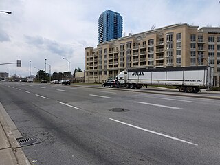
Roncesvalles Avenue is a north-south arterial street in Toronto, Ontario, Canada. It begins at the intersection of Queen Street West, King Street West and the Queensway running north to Dundas Street West. At its southern starting point, King Street West traffic continues northward onto Roncesvalles Avenue unless the traffic turns east or west onto Queen Street West or the Queensway. At its northern end point, traffic continues onto Dundas Street, which is essentially a straight-line northern extension of Roncesvalles. Roncesvalles Avenue takes its name from the Battle of Roncesvalles, which took place in the Roncesvalles Pass in Spain in 1813. At this gorge, Colonel Walter O'Hara—an early 19th-century Irish settler who played a significant role in the establishment of the neighbourhood—led a regiment that fought against the retreating army of Napoleon.

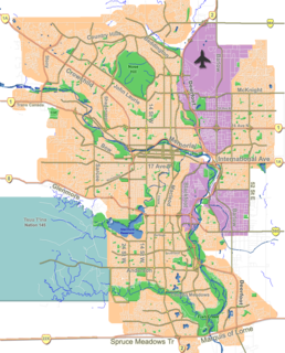
Parkdale is a mature, inner city neighbourhood in the city of Calgary, Alberta along the north bank of the Bow River between the communities of West Hillhurst and Point McKay. It is bounded on the south by the Bow River, 28 St NW to the east, Shaganappi Trail NW to the west and on the north by 16th Avenue. Parkdale is in close proximity to both the Foothills Medical Centre and the Alberta Children's Hospital constructed in 2006, as well as the University of Calgary. Memorial Drive provides access to downtown Calgary and to Highway 1 which leads to the Rocky Mountains. Parkdale was annexed to the City of Calgary in 1910 when Calgary began to experience a "major economic and building boom." The boom ended in 1913 and further development of the Parkdale Addition as it was called, was halted because of World War I. Following World War II in the 1950s the dominant housing type that characterized Parkdale, was the bungalow. By 2014 Parkdale, like other inner city communities in Calgary, was experiencing gradual gentrification with small cottage-style bungalows being replaced by spacious flat roofed, Prairie School Frank Lloyd Wright inspired infills attracting young families with children away from the long commute suburbs to inner city ease of access to downtown, transit and work.

The Markham Centennial Centre is a 2,300-seat arena located in the Toronto suburb of Markham.

Rosedale Field was a grandstand stadium located in Rosedale Park at 20 Scholfield Avenue, Toronto, Ontario, Canada.

Victoria Village, sometimes referred to as Sloane, is a neighbourhood in the city of Toronto, Ontario, Canada bounded on the west by the Don Valley, on the north by Lawrence Avenue East, on the east by Victoria Park Avenue, and on the south by Eglinton Avenue East, although there is a small area south of Eglinton to Sunrise Avenue that is sometimes included. It is located in the southeast of the former city of North York. Its population is diverse in ancestral backgrounds with a larger proportion of South Americans than most of the city.

Don Valley Village is a neighbourhood in the city of Toronto, Ontario, Canada. It is located in the former suburb of North York. It is located north of Highway 401, and is bounded by Sheppard Avenue to the south, Leslie Street to the west, Finch Avenue to the north and Highway 404 to the east. Like the nearby Don River Valley, the neighbourhood has hill and dale topography.

Bayview Woods-Steeles is a neighbourhood located in the northern tip of the city of Toronto, Ontario, Canada, formerly in North York before it was amalgamated into Toronto in 1998. It is part of federal and provincial electoral district Willowdale, and Toronto electoral ward 24: Willowdale (East). In 2006, it had a population of 13,295. The area is divided by a series of ravines, and is often not considered a neighbourhood unto itself. Rather the sections are more often divided between the neighbouring areas of Hillcrest Village, Bayview Village, and Newtonbrook.
Richmond Green, also known as the Richmond Green Sports Centre and Park is a city-owned and operated facility in Richmond Hill, Ontario, Canada. It is located on 102 acres (0.41 km2) of land on the northwest corner of Leslie Street and Elgin Mills Road. Next to Richmond Green to its north is Richmond Green Secondary School and Richmond Green Public Library.

Pine Point Park is a park in Toronto, Ontario, located on the east end junction of Allenby Avenue and Hadrian Drive, near the intersection of Highway 401 and Islington Avenue. The park itself is bordered by Albion Road to the west, Highway 401 to the south, and Humber River to the east.

Parkdale Avenue, is a Lower City arterial road in Hamilton, Ontario, Canada. It starts off just South of Lawrence Road at Hixon Road and is a two-way street throughout, stretching northward through the city's North End industrial neighbourhood and ends just north of the Nikola Tesla Boulevard East overpass at the front gates of Triple M Metal LP, a scrap & waste management company.

Davenport is a provincial riding in Toronto, Ontario, Canada. It elects one member to the Legislative Assembly of Ontario.
Mohawk Sports Park, is a large park on the east mountain of Hamilton, Ontario, 1100 Mohawk Road East, also known as Commonwealth Park and Upper King's Forest Park.

York South—Weston is a provincial electoral district in Toronto, Ontario, Canada, that has been represented in the Legislative Assembly of Ontario since 1999.

Sunnyside Amusement Park was a popular amusement park in Toronto, Ontario, Canada that ran from 1922 to 1955, demolished in 1955 to facilitate the building of the Metro Toronto Gardiner Expressway project. It was located on the Lake Ontario waterfront at the foot of Roncesvalles Avenue, west of downtown Toronto.

Runnymede Park is a medium-sized public park located in The Junction neighbourhood of Toronto, Canada, one block east of Runnymede Road. Its southern boundary is the West Toronto Yard used by the Canadian Pacific Railway, its northern boundary is Ryding Avenue, while a laneway and parking lot make up the western and eastern boundaries respectively. It is relatively flat, and features many soaring mature oak trees.
Parkdale is a Charlotte, North Carolina neighborhood that generally includes the streets of Manning Dr., Wintercrest Ln., and Scofield Rd.. It is located about 1 mile (1.6 km) northwest of the SouthPark Mall and about 1 mile (1.6 km) south of the historic Park Road Shopping Center.
The Church of the Epiphany and St. Mark, Parkdale, is a small inclusive parish of the Anglican Church of Canada located in Toronto, Ontario. The church was founded upon the amalgamation of The Church of the Epiphany and The Church of St. Mark, Parkdale in 1983.
Confederation Beach Park is a Tourist Area/Park in Hamilton, Ontario. The park includes: Wild Waterworks, an outdoor waterpark; Adventure Village, an amusement centre with laser tag, bumper cars and an 18-hole mini golf course; and a fast food diner restaurant with a 1950s motif called Hutch's. There is also a restaurant/entertainment centre called Barangas on the Beach. There is an observation tower, a beachfront restaurant, a swimming pool, beach and trail, and a go-kart track. There was a full-sized amusement park until 1978. It is also the namesake for nearby planned GO train station, Confederation GO Station.
Inch Park is a public park in the city of Hamilton, Ontario, Canada, located in the Mountain Inch neighborhood. The park opened in 1948, when the Inch family gave part of their family farm to the city for use as a park.