Parker, Idaho

Last updated
Parker, Idaho
Fremont County Idaho Incorporated and Unincorporated areas Parker Highlighted 1660760.svg
Location of Parker in Fremont County, Idaho.
Coordinates: 43°57′31″N111°45′33″W / 43.95861°N 111.75917°W / 43.95861; -111.75917 Coordinates: 43°57′31″N111°45′33″W / 43.95861°N 111.75917°W / 43.95861; -111.75917
Country United States
State Idaho
County Fremont
Area
[1]
  Total0.35 sq mi (0.90 km2)
  Land0.35 sq mi (0.90 km2)
  Water0.00 sq mi (0.00 km2)
Elevation
4,928 ft (1,502 m)
Population
 (2010) [2]
  Total305
  Estimate 
(2019) [3]
291
  Density838.62/sq mi (323.57/km2)
Time zone UTC-7 (Mountain (MST))
  Summer (DST) UTC-6 (MDT)
ZIP code
83438
Area code 208
FIPS code 16-60760
GNIS feature ID0397007

Parker is a city in southeastern Fremont County, Idaho, United States. The population was 305 at the 2010 census. It is part of the Rexburg, Idaho Micropolitan Statistical Area.

Contents

Geography

Parker is located at 43°57′31″N111°45′33″W / 43.95861°N 111.75917°W / 43.95861; -111.75917 (43.958477, -111.759204). [4]

According to the United States Census Bureau, the city has a total area of 0.35 square miles (0.91 km2), all of it land. [5]

Demographics

Historical population
CensusPop.
1910 432
1920 49614.8%
1930 286−42.3%
1940 38434.3%
1950 306−20.3%
1960 284−7.2%
1970 266−6.3%
1980 262−1.5%
1990 2889.9%
2000 31910.8%
2010 305−4.4%
2019 (est.)291 [3] −4.6%
U.S. Decennial Census [6]

2010 census

As of the census [2] of 2010, there were 305 people, 99 households, and 76 families residing in the city. The population density was 871.4 inhabitants per square mile (336.4/km2). There were 107 housing units at an average density of 305.7 per square mile (118.0/km2). The racial makeup of the city was 94.8% White, 2.3% Native American, and 3.0% from other races. Hispanic or Latino of any race were 4.6% of the population.

There were 99 households, of which 48.5% had children under the age of 18 living with them, 68.7% were married couples living together, 7.1% had a female householder with no husband present, 1.0% had a male householder with no wife present, and 23.2% were non-families. 20.2% of all households were made up of individuals, and 12.1% had someone living alone who was 65 years of age or older. The average household size was 3.08 and the average family size was 3.66.

The median age in the city was 28.2 years. 37.7% of residents were under the age of 18; 7% were between the ages of 18 and 24; 25.6% were from 25 to 44; 18.7% were from 45 to 64; and 11.1% were 65 years of age or older. The gender makeup of the city was 49.8% male and 50.2% female.

2000 census

As of the census [7] of 2000, there were 319 people, 96 households, and 74 families residing in the city. The population density was 901.8 inhabitants per square mile (348.2/km2). There were 101 housing units at an average density of 285.5 per square mile (110.2/km2). The racial makeup of the city was 97.49% White, 1.88% from other races, and 0.63% from two or more races. Hispanic or Latino of any race were 2.19% of the population.

There were 96 households, out of which 50.0% had children under the age of 18 living with them, 67.7% were married couples living together, 5.2% had a female householder with no husband present, and 22.9% were non-families. 22.9% of all households were made up of individuals, and 13.5% had someone living alone who was 65 years of age or older. The average household size was 3.32 and the average family size was 3.99.

In the city, the population was spread out, with 41.4% under the age of 18, 9.4% from 18 to 24, 26.3% from 25 to 44, 12.5% from 45 to 64, and 10.3% who were 65 years of age or older. The median age was 24 years. For every 100 females, there were 98.1 males. For every 100 females age 18 and over, there were 83.3 males.

The median income for a household in the city was $28,750, and the median income for a family was $34,444. Males had a median income of $30,000 versus $16,250 for females. The per capita income for the city was $9,265. About 13.2% of families and 16.1% of the population were below the poverty line, including 14.6% of those under age 18 and 22.5% of those age 65 or over.

See also

Related Research Articles

<span class="mw-page-title-main">Arimo, Idaho</span> City in Bannock County, Idaho, United States

Arimo is a city in the Marsh Valley in central Bannock County, Idaho, United States, that is part of the 'Pocatello Metropolitan Statistical Area'. The population was 355 at the 2010 census.

<span class="mw-page-title-main">Bloomington, Idaho</span> City in Idaho, United States

Bloomington is a city in Bear Lake County, Idaho, United States. The population was 206 at the 2010 census. It was first settled in 1864.

<span class="mw-page-title-main">Georgetown, Idaho</span> City in Idaho, United States

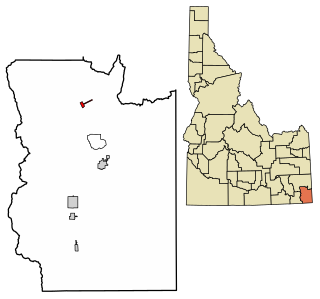
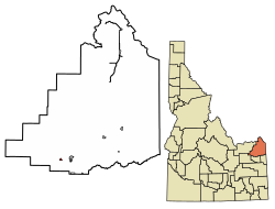
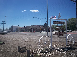
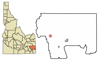
Georgetown is a city in the Bear River Valley in Bear Lake County, Idaho, United States, at the center of a farming area between the river and the mountains to the east. It was settled by Mormon pioneers on the route of the Oregon Trail and was named after George Q. Cannon. Georgetown was first settled in 1864 The population was 476 at the 2010 census. U.S. Route 30 passes through the town.

<span class="mw-page-title-main">St. Charles, Idaho</span> City in Idaho, United States

St. Charles is a city in southern Bear Lake County, Idaho, United States, that is located near the northwestern shore of Bear Lake. Its population was 131 at the 2010 census, down from 156 in 2000.

<span class="mw-page-title-main">Firth, Idaho</span> City in Idaho, United States

Firth is a city in Bingham County, Idaho, United States. The population was 477 at the 2010 census.

<span class="mw-page-title-main">Irwin, Idaho</span> City in Idaho, United States

Irwin is a city in Bonneville County, Idaho, United States. It is part of the Idaho Falls, Idaho Metropolitan Statistical Area. The population was 219 at the 2010 census.

<span class="mw-page-title-main">Swan Valley, Idaho</span> City in Idaho, United States

Swan Valley is a city in Bonneville County, Idaho, United States. It is part of the Idaho Falls, Idaho Metropolitan Statistical Area. The population was 204 at the 2010 census.

<span class="mw-page-title-main">Ucon, Idaho</span> City in Idaho, United States

Ucon is a city in Bonneville County, Idaho, United States. It is part of the Idaho Falls, Idaho Metropolitan Statistical Area. The population was 1,108 at the 2010 census. Ucon was first settled in 1883.

<span class="mw-page-title-main">Bancroft, Idaho</span> City in Caribou County, Idaho, United States

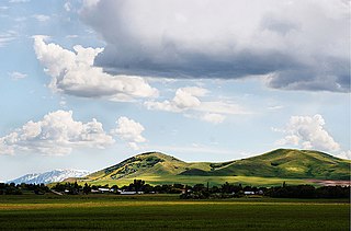
Bancroft is a city in the Gem Valley in Caribou County, Idaho, United States. The population was 377 at the 2010 census.

<span class="mw-page-title-main">Clayton, Idaho</span> City in Idaho, United States

Clayton is a city in Custer County, Idaho, United States. The population was 7 at the 2010 census, down from 27 in 2000. It is adjacent to the Salmon River.

<span class="mw-page-title-main">Franklin, Idaho</span> City in Idaho, United States

Franklin is a city in Franklin County, Idaho, United States. The population was 641 at the 2010 census. It is part of the Logan, Utah-Idaho Metropolitan Statistical Area.

<span class="mw-page-title-main">Weston, Idaho</span> City in Idaho, United States

Weston is a city in Franklin County, Idaho, United States. The population was 437 at the 2010 census. It is part of the Logan, Utah-Idaho Metropolitan Statistical Area. It was first settled in 1865. The community was so named on account of its location at the west bank of the Bear River.

<span class="mw-page-title-main">Drummond, Idaho</span> City in Idaho, United States

Drummond is a city in Fremont County, Idaho, United States. The population was 16 at the 2010 census. It is part of the Rexburg, Idaho Micropolitan Statistical Area.

<span class="mw-page-title-main">Teton, Idaho</span> City in Idaho, United States

Teton is a city in Fremont County, Idaho, United States. The population was 735 at the 2010 census. It is part of the Rexburg, Idaho Micropolitan Statistical Area.

<span class="mw-page-title-main">Warm River, Idaho</span> City in Idaho, United States

Warm River is a city in Fremont County, Idaho, United States. The population was 3 at the 2010 census, making it the least populous city in Idaho. It is part of the Rexburg, Idaho Micropolitan Statistical Area.

<span class="mw-page-title-main">Hamer, Idaho</span> City in Idaho, United States

Hamer is a city in Jefferson County, Idaho, United States. It is part of the Idaho Falls Metropolitan Statistical Area. The population was 48 at the 2010 census.

<span class="mw-page-title-main">Kendrick, Idaho</span> City in Idaho, United States

Kendrick is a city in Latah County, Idaho, United States. Its population was 303 at the 2010 census, a decrease from 369 in 2000.

<span class="mw-page-title-main">Victor, Idaho</span> City in Idaho, United States

Victor is the largest city in Teton County, Idaho, United States. The population was 1,928 at the 2010 census, up from 840 at 2000. It is part of the Jackson, WY–ID Micropolitan Statistical Area.

<span class="mw-page-title-main">Gravity, Iowa</span> City in Iowa, United States

Gravity is a city in Taylor County, Iowa, United States. The population was 154 at the time of the 2020 census.

<span class="mw-page-title-main">Minneiska, Minnesota</span> City in Minnesota, United States

Minneiska is a city in Wabasha and Winona counties in the U.S. state of Minnesota. The population was 111 at the 2010 census.

References

  1. "2019 U.S. Gazetteer Files". United States Census Bureau. Retrieved July 9, 2020.
  2. 1 2 "U.S. Census website". United States Census Bureau . Retrieved 2012-12-18.
  3. 1 2 "Population and Housing Unit Estimates". United States Census Bureau. May 24, 2020. Retrieved May 27, 2020.
  4. "US Gazetteer files: 2010, 2000, and 1990". United States Census Bureau. 2011-02-12. Retrieved 2011-04-23.
  5. "US Gazetteer files 2010". United States Census Bureau. Archived from the original on January 12, 2012. Retrieved 2012-12-18.
  6. "Census of Population and Housing". Census.gov. Retrieved June 4, 2015.
  7. "U.S. Census website". United States Census Bureau . Retrieved 2008-01-31.

Commons-logo.svg Media related to Parker, Idaho at Wikimedia Commons