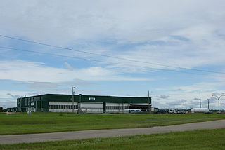
Arcola Airport is located adjacent to Arcola, Saskatchewan, Canada. Burton Ag Air Ltd. operates a fixed base at the airport.
Camsell Portage Airport is located adjacent to Camsell Portage, Saskatchewan, Canada.
Canora Airport is located adjacent to Canora, Saskatchewan, Canada.
Cudworth Municipal Airport is located adjacent to Cudworth, Saskatchewan, Canada.
Davin Lake Airport, formerly TC LID: CKW6, was located adjacent to Davin Lake Lodge, a fly-in fishing lodge in northern Saskatchewan, Canada.
Dinsmore Aerodrome is located adjacent to Dinsmore, Saskatchewan, Canada.
Key Lake Airport is a regional airport near the Key Lake mine in Saskatchewan, Canada.
Points North Landing Airport is a regional airport adjacent to Points North Landing in Saskatchewan, Canada.

Stony Rapids Airport is located adjacent to Stony Rapids, Saskatchewan, Canada.
Wollaston Lake Airport is located adjacent to Wollaston Lake in Saskatchewan, Canada on the Hatchet Lake Dene Nation.
Yorkton Municipal Airport is located 2.8 nautical miles north of Yorkton, Saskatchewan, Canada.
Highway 995, also known as Welcome Street, is a provincial highway in the far north region of the Canadian province of Saskatchewan. It is one of the few highways in Saskatchewan that is completely isolated from the other highways. Seasonal access is provided to Highway 905 by way of the Wollaston Lake Barge.
Highway 954 is a provincial highway in the Canadian province of Saskatchewan. It runs from Highway 26 on the north side of Goodsoil to a dead end at Northern Cross Resort on Lac des Îles within Meadow Lake Provincial Park. At the eastern end of the highway is the Goodsoil Airport. It is about 12.9 kilometres (8.0 mi) long.
Highway 908 is a provincial highway in the north-west region of the Canadian province of Saskatchewan. The highway runs from Highway 155 to Île-à-la-Crosse on Lac Île-à-la-Crosse and provides access to the Île-à-la-Crosse Airport and Northern Eagle Resort. It is about 21 kilometres (13 mi) long.
Highway 918 is a provincial highway in the north-west and far north regions of the Canadian province of Saskatchewan. It runs from Highway 165 near Beauval to Patuanak. The highway follows the Beaver River, runs along the eastern shore of Lac Île-à-la-Crosse, and provides access to Patuanak Airport. It is about 92 kilometres (57 mi) long.

The Rural Municipality of Arborfield No. 456 is a rural municipality (RM) in the Canadian province of Saskatchewan within Census Division No. 14 and SARM Division No. 4.
Highway 40 is a provincial highway in the north-west portion of the Canadian province of Saskatchewan connecting Alberta to Highway 3, four kilometres (2.5 mi) west of Shellbrook, Saskatchewan. Areas of this highway between the Alberta border and North Battleford are called the Poundmaker Trail. Pitikwahanapiwiyin, commonly known as Poundmaker, was a Plains Cree chief known as a peacemaker and defender of his people. The main feature along this highway is access between North Battleford and near Prince Albert. This is a primary Saskatchewan highway maintained by the provincial government. All of this highway is paved.
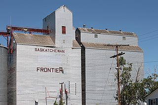
Frontier is a village in the Canadian province of Saskatchewan within the Rural Municipality of Frontier No. 19 and Census Division No. 4. Frontier is on Highway 18 and is served by the Frontier Airport located (3.7 km) south of the village.
Disley Aerodrome is located adjacent to Disley, Saskatchewan, Canada, and just west of Lumsden.

