Pell Lake, Wisconsin

Last updated

Pell Lake, Wisconsin
Former CDP
WIMap-doton-Pell Lake.png
Location of Pell Lake, Wisconsin
Coordinates: 42°32′16″N88°21′16″W / 42.53778°N 88.35444°W / 42.53778; -88.35444
Country United States
State Wisconsin
County Walworth
Area
  Total4.1 sq mi (10.6 km2)
  Land3.9 sq mi (10.2 km2)
  Water0.2 sq mi (0.4 km2)
Elevation
[1]
863 ft (263 m)
Population
 (2010)
  Total3,722
  Density910/sq mi (350/km2)
Time zone UTC-6 (Central (CST))
  Summer (DST) UTC-5 (CDT)
ZIP Code
53157
Area code 262
FIPS code 55-61725 [2]
GNIS feature ID1571158 [1]

Pell Lake is a neighborhood and former census-designated place (CDP) in Walworth County, Wisconsin, United States. The population was 3,722 at the 2010 census. [3] On December 20, 2011, Pell Lake became part of the newly incorporated village of Bloomfield. [4]

Contents

Geography

Pell Lake is located at 42°32′16″N88°21′16″W / 42.53778°N 88.35444°W / 42.53778; -88.35444 (42.537859, -88.354308). [5]

According to the United States Census Bureau, the CDP has a total area of 4.1 square miles (10.6 km2), of which, 3.9 square miles (10.2 km2) of it is land and 0.2 square miles (0.4 km2) of it (3.92%) is water.

Demographics

As of the census [2] of 2000, there were 2,988 people, 1,135 households, and 769 families residing in the CDP. The population density was 762.0 people per square mile (294.3/km2). There were 1,393 housing units at an average density of 355.3/sq mi (137.2/km2). The racial makeup of the CDP was 97.79% White, 0.47% African American, 0.17% Native American, 0.30% Asian, 0.37% from other races, and 0.90% from two or more races. Hispanic or Latino of any race were 2.14% of the population.

There were 1,135 households, out of which 37.3% had children under the age of 18 living with them, 52.6% were married couples living together, 10.0% had a female householder with no husband present, and 32.2% were non-families. 26.0% of all households were made up of individuals, and 10.6% had someone living alone who was 65 years of age or older. The average household size was 2.62 and the average family size was 3.16.

In the CDP, the population was spread out, with 29.1% under the age of 18, 6.0% from 18 to 24, 34.3% from 25 to 44, 19.3% from 45 to 64, and 11.3% who were 65 years of age or older. The median age was 35 years. For every 100 females, there were 101.5 males. For every 100 females age 18 and over, there were 100.4 males.

The median income for a household in the CDP was $41,442, and the median income for a family was $41,711. Males had a median income of $37,917 versus $22,500 for females. The per capita income for the CDP was $16,380. About 8.9% of families and 10.5% of the population were below the poverty line, including 12.1% of those under age 18 and 12.1% of those age 65 or over.

Related Research Articles

<span class="mw-page-title-main">Channel Lake, Illinois</span> Census-designated place in Illinois, United States

Channel Lake is an unincorporated community and census-designated place (CDP) in Antioch Township, Lake County, Illinois, United States. Per the 2020 census, the population was 1,581.

Forest Lake is an unincorporated community and census-designated place (CDP) in Ela Township of Lake County, Illinois, United States. It is about 35 miles (56 km) northwest of downtown Chicago. Per the 2020 census, the population was 1,784. The community was founded in 1935 as a vacation community for Chicago residents.

Fox Lake Hills is an unincorporated community and census-designated place (CDP) in Lake Villa Township, Lake County, Illinois, United States. Per the 2020 census, the population was 2,684.

Lake Catherine is an unincorporated community and census-designated place (CDP) in Lake County, Illinois, United States. Per the 2020 census, the population was 1,279.

Venetian Village is a census-designated place (CDP) in Lake County, Illinois, United States. Per the 2020 census, the population was 2,761.

Pistakee Highlands is a census-designated place (CDP) in McHenry County, Illinois, United States. It consists primarily of an unincorporated area of McHenry County adjoining Pistakee Bay, within the McHenry post office, and is located just northeast of Johnsburg. Per the 2020 census, the population was 3,237.

<span class="mw-page-title-main">Lake Summerset, Illinois</span> Census Designated Place in Illinois, United States

Lake Summerset is a census-designated place (CDP) in Stephenson and Winnebago counties in Illinois. The population was 2,048 at the 2010 census.

<span class="mw-page-title-main">Woodward, Pennsylvania</span> Census-designated place in Pennsylvania, United States

Woodward is an unincorporated community and census-designated place in Centre County, Pennsylvania, United States. It is part of the State College, Pennsylvania, Metropolitan Statistical Area. The population was 110 at the 2010 census.

<span class="mw-page-title-main">Lake Koshkonong, Wisconsin</span> Census-designated place in Wisconsin, United States

Lake Koshkonong is a census-designated place (CDP) in the towns of Koshkonong and Sumner, Jefferson County, Wisconsin, United States. The population was 1,239 at the 2020 census. Lake Koshkonong is in the area.

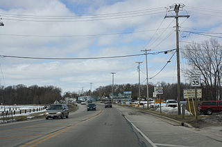
Rome is a census-designated place (CDP) in the town of Sullivan in Jefferson County, Wisconsin, United States, along the Bark River. The population was 752 at the 2020 census.

<span class="mw-page-title-main">Bohners Lake, Wisconsin</span> CDP in Wisconsin, United States

Bohners Lake is a census-designated place (CDP) in Racine County, Wisconsin, United States. Its first syllable is pronounced as in "bone". The population of the CDP was 2,374 at the 2020 census. It is politically part of the Town of Burlington, together with Browns Lake, Wisconsin. There has been discussion of incorporating Bohners Lake as a village to prevent annexation by the City of Burlington. It was named for Antony Bohner, a French immigrant who established a resort on the lake of the same name.

<span class="mw-page-title-main">Browns Lake, Wisconsin</span> CDP in Wisconsin, United States

Browns Lake is a census-designated place (CDP) in Racine County, Wisconsin around a lake of the same name. The population was 1,879 at the 2020 census. It is politically a part of the town of Burlington, along with Bohners Lake.

<span class="mw-page-title-main">Tichigan, Wisconsin</span> Census-designated place in Wisconsin, United States

Tichigan is a census-designated place (CDP) in Racine County, Wisconsin, United States. The population was 5,277 at the 2020 census.

<span class="mw-page-title-main">Wind Lake, Wisconsin</span> CDP in Wisconsin, United States

Wind Lake is a census-designated place (CDP) in Racine County, Wisconsin, United States. The population was 5,355 at the 2020 census. Wind Lake is in the town of Norway.

<span class="mw-page-title-main">Como, Wisconsin</span> CDP in Wisconsin, United States

Como is a census-designated place (CDP) in the town of Geneva, Walworth County, Wisconsin, United States. The population was 2,356 at the 2020 census.

<span class="mw-page-title-main">Delavan Lake, Wisconsin</span> CDP in Wisconsin, United States

Delavan Lake is a census-designated place (CDP) in the towns of Delavan and Walworth, Walworth County, Wisconsin, United States. The population was 2,803 at the 2020 census. It is located near the shore of Delavan Lake.

<span class="mw-page-title-main">Potter Lake, Wisconsin</span> CDP in Wisconsin, United States

Potter Lake is a census-designated place (CDP) in the town of East Troy, Walworth County, Wisconsin, United States. The population was 1,117 at the 2020 census.

<span class="mw-page-title-main">Ayer (CDP), Massachusetts</span> Census-designated place in Massachusetts, United States

Ayer is a census-designated place (CDP) and the primary settlement in the town of Ayer in Middlesex County, Massachusetts, United States. The population of the CDP was 2,986 at the 2020 census, out of 8,479 in the entire town.

<span class="mw-page-title-main">Tonawanda (CDP), New York</span> Census-designated place in New York, United States

Tonawanda is a census-designated place (CDP) in Erie County, New York, United States. The CDP comprises the town of Tonawanda minus its subsidiary village of Kenmore. As of the 2010 census, the CDP population was 58,144.

<span class="mw-page-title-main">Hebron (CDP), Wisconsin</span> Census-designated place in Wisconsin, United States

Hebron is a census-designated place (CDP) in the town of Hebron, Jefferson County, Wisconsin, United States. The population was 209 at the 2020 census. It is located on the Bark River.

References

  1. 1 2 "US Board on Geographic Names". United States Geological Survey. October 25, 2007. Retrieved January 31, 2008.
  2. 1 2 "U.S. Census website". United States Census Bureau . Retrieved January 31, 2008.
  3. "U.S. Census website". U.S. Census Bureau . Retrieved April 17, 2011.
  4. "Boundary Changes". Geographic Changes. Population Division, United States Census Bureau. January 1, 2012. Retrieved February 26, 2013.
  5. "US Gazetteer files: 2010, 2000, and 1990". United States Census Bureau. February 12, 2011. Retrieved April 23, 2011.