
Elk Township is a township in Gloucester County, New Jersey, United States. As of the 2010 United States Census, the township's population was 4,216, reflecting an increase of 702 (+20.0%) from the 3,514 counted in the 2000 Census, which had in turn declined by 292 (-7.7%) from the 3,806 counted in the 1990 Census.

West Freehold is an unincorporated community and census-designated place (CDP) within Freehold Township, in Monmouth County, New Jersey, United States. As of the 2010 United States Census, the CDP's population was 13,613. Due to the community's close proximity to the Battle of Monmouth, West Freehold is home to several important historical structures, which have been preserved in the 'West Freehold Village Historic District'. The historically preserved Monmouth Battlefield, along with the historic villages of Clarksburg, Englishtown, Smithburg and Tennent are a short distance away.
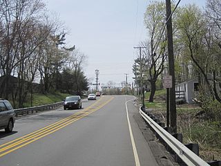
Route 77 is a state highway in the southern part of the U.S. state of New Jersey. It runs 22.55 mi (36.29 km) from an intersection with Route 49 in Bridgeton, Cumberland County north to a junction with Route 45 in Mullica Hill, Gloucester County. It is a mostly two-lane, undivided road traversing through farmland in Cumberland, Salem, and Gloucester Counties. Along the way, Route 77 intersects Route 56 in Upper Deerfield Township and U.S. Route 40 in Upper Pittsgrove Township.

Warwick is a town in the southwestern part of Orange County, New York, United States. Its population was 32,065 at the 2010 census. The town contains three villages and eight hamlets.

South Jersey comprises the southern portion of the U.S. state of New Jersey, between the lower Delaware River and the Atlantic Ocean. The designation of southern New Jersey with a distinct toponym is a colloquial one rather than an administrative one, reflecting not only geographical but also perceived cultural differences from the northern part of the state, with no official definition. Though definitions of South Jersey may vary, most of South Jersey is generally considered to be part of the Philadelphia Metropolitan Area.

Pine Brook is an unincorporated community located within Montville Township in Morris County, New Jersey, United States. The area is served as United States Postal Service ZIP Code 07058.

West Trenton is a section of Ewing Township in Mercer County, New Jersey, United States. It is a suburban area located adjacent to the northwestern portion of the city of Trenton, from which it derives its name. Located at the intersection of Bear Tavern Road/Grand Avenue and West Upper Ferry Road, it is one of the oldest settlements in Ewing Township.

Whitehouse is an unincorporated community located within Readington Township in Hunterdon County, New Jersey, United States. The community lies along the former Jersey Turnpike, just west of Mechanicsville.

Parkway Pines is an unincorporated community located along the border of Howell Township in Monmouth County and Brick Township in Ocean County, in New Jersey, United States. The Howell area of this community is called Ramtown.
The Elk Township School District is a community public school district that serves students in pre-kindergarten through sixth grade from Elk Township, in Gloucester County, New Jersey, United States.
Smithburg is an unincorporated community located where the municipal boundaries of Freehold, Manalapan and Millstone townships intersect in Monmouth County, New Jersey, United States. County Route 527 and Monmouth Road pass through the center of the quaint village of Smithburg.

Bear Tavern is an unincorporated community located within Hopewell Township in Mercer County, New Jersey, United States.

Carrs Tavern is an unincorporated community in Millstone Township in Monmouth County, New Jersey, United States. It is located at the intersection of County Route 526 and County Route 571.

Barbertown is an unincorporated community located within Kingwood Township in Hunterdon County, New Jersey, United States.

Fairfield is an unincorporated community located within Howell Township in Monmouth County, New Jersey, United States. The community is centered on the intersection of County Route 524 (CR 524) and Ketchum Road, where the Colonial Era Our House Tavern is located. The area includes several small businesses, township offices and schools. There are also small farms and residential developments in the area. Fairfield was a stop on the Freehold and Jamesburg Agricultural Railroad

Sooy Place is an unincorporated community located within Tabernacle Township in Burlington County, New Jersey, United States. The settlement is located in a rural part of the township centered on the intersection of Sooy Place Road and Powell Place Road. The area is a mix of forestland, some properties with single-family residences, and two horse farms. Per a historical marker present at the intersection, the settlement was also home to Pine Tavern, a travelers' stop for those traveling to Speedwell Furnace near Chatsworth.

Four Mile is an unincorporated community located within Woodland Township, in Burlington County, New Jersey, United States. The Four Mile Circle, where Route 70 and Route 72 intersect, is located in Four Mile, near the border of Pemberton and Southampton townships. Except for small businesses along Route 72, a small residential cluster southeast of the circle, and the New Lisbon Developmental Center located about one mile (1.6 km) from the circle, the area is composed of forest that makes up the New Jersey Pine Barrens.

Stone Tavern is an unincorporated community located on the border of Millstone and Upper Freehold townships in Monmouth County, New Jersey, United States.

The Cedar Bridge Tavern is a historic building located in the New Jersey Pine Barrens in Barnegat Township. It was built around 1740 and is believed to be the oldest intact bar in the United States. It is located at the site of the last skirmish of the American Revolutionary War. It is on the National Register of Historical Places.
Othello is an unincorporated community located within Greenwich Township, Cumberland County, New Jersey, United States. It is part of the Greenwich Historic District, which has been on the National Register of Historic Places since 1972.

