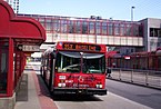
OC Transpo is the primary public transport agency for the city of Ottawa, Ontario, Canada, operating bus rapid transit, light rail, conventional bus routes, and door-to-door paratransit in the nation's capital region.

The Transitway is a bus rapid transit (BRT) network operated by OC Transpo in Ottawa, Ontario, Canada. It comprises a series of bus-only roadways and reserved lanes on city streets and highways. The dedicated busways ensure that buses and emergency vehicles on the Transitway rarely intersect directly with regular traffic, making it possible to run quickly and consistently, even during rush hour traffic. OC Transpo operates a network of rapid routes which use the Transitway to connect communities with the O-Train light rail system. Additional bus routes also use segments of the Transitway.

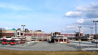
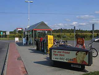
Billings Bridge is a station on the OC Transpo Transitway, adjacent to the Billings Bridge Plaza, Ottawa, Ontario, Canada. It is named for, not only the plaza, but after Billings Bridge itself which is both a nearby bridge and neighbourhood. The transitway station itself is a major stop on the southern transitway-line due to its location near Bank Street, Ottawa's major north–south road and the mall itself. The station is located just south of the Plaza near the intersection between Bank Street and Riverside Drive.
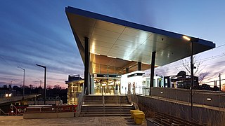
Bayview is an O-Train interchange station in Ottawa, Ontario, Canada, connecting the Confederation Line and Trillium Line.

Dominion is a station on the Transitway in Ottawa, Ontario. It is located north of the western edge of Westboro village, where the below-grade transitway segment joins the Kichi Zībī Mīkan. The station is named after nearby Dominion Avenue.

Lincoln Fields is a station on Ottawa's transitway located at Carling Avenue and the Kichi Zībī Mīkan. It is adjacent to the now-shuttered Lincoln Fields Shopping Centre. It is the main western hub of the transitway system and has a ticket sales and information office as well as a small convenience store. The transitway routes branch off in two directions: westward to Kanata and Stittsville, and southward to Barrhaven. The western branch of the transitway from this point is currently incomplete, forcing westbound routes to use existing streets such as Carling Avenue and the Queensway.

Iris station is one of the few grade-level stations on the Southwest Ottawa Transitway. It is located on Iris Street, a collector road in western Ottawa.

Walkley is an intermodal OC Transpo station in Ottawa, Ontario. It is located in on Walkley Road between Airport Parkway and Bank Street. There are plans for mixed-use development all around the station which is vacant.
Bayshore is a station on the transitway in Ottawa, Ontario, served by OC Transpo buses. It is located in the western transitway section at the Bayshore Shopping Centre in the neighbourhood of Bayshore.
Eagleson is a station on Ottawa, Ontario's transitway served by OC Transpo buses. It is located in the western transitway section at Eagleson Road and Highway 417. Eastbound buses enter the station; westbound buses remain on Eagleson and service is from an adjacent bus stop.

Terry Fox station is a bus stop on Ottawa, Ontario's transitway served by OC Transpo buses. It is located in the western transitway section and is the main western terminal of routes 61 and 62 for all trips not extended to/from Stittsville.

Place d'Orléans is a transitway station in the suburb of Orléans in the former city of Gloucester in Ottawa, Ontario, Canada. The station opened in 1994, just off Regional Road 174 and Champlain Street right next to Place d'Orléans Shopping Centre. It is the main transit hub between local routes in Orléans and route 39.

Trim is a transitway station and future O-Train terminus in the east end of Ottawa, Ontario, located near Trim Road and Regional Road 174. A Natrel factory is located near this station.
Teron is a curbside bus stop operated by OC Transpo in Ottawa, Ontario. The stop is located in the suburb of Kanata on Campeau Drive just east of the intersection with Teron Road from which it takes its name, which in turn was named after William Teron, who was responsible for developing Kanata. It is near the western off-ramp of Highway 417 at March Road and an overpass north of Eagleson station and Park and ride. Teron was officially included in the Transitway system in the 2007 fall schedules.

Marketplace is a Southwest Transitway station in the Barrhaven neighbourhood of Ottawa, Ontario, Canada. The station is located at the Chapman Mills Marketplace shopping centre, an extensive commercial zone which contains big-box stores and department stores.

Fallowfield station or Fallowfield Train Station is an inter-city passenger railway station and bus rapid transit station located at 3347 Fallowfield Road in the suburban neighbourhood of Barrhaven in Ottawa, Ontario, Canada.

Riverview is an OC Transpo transit station located in the Riverside South community in Ottawa, Ontario. The station is located south of Earl Armstrong Road east of River Road.
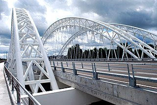
The Vimy Memorial Bridge is a bridge in Ottawa, Ontario, Canada. Completed in 2014, it crosses the Rideau River, connecting Strandherd Drive in Barrhaven and Earl Armstrong Road in Riverside South. The bridge was the 2015 winner of the Gustav Lindenthal Medal. It is named after the Battle of Vimy Ridge, as suggested by two Royal Canadian Legions in Ottawa.
Britannia Heights is a neighbourhood in Bay Ward in west end of Ottawa, Ontario, Canada. The neighbourhood is a sub-neighbourhood of Britannia area of the city, but is within the Queensway Terrace North Community Association boundaries. The neighbourhood is away from the Ottawa River on a steep hill. It is bounded to the North by Carling Avenue, east by OC Transpo Transitway, south by Henley Street, and west by Bayshore Drive. The population of the neighbourhood is approximately 1750.

Queensway Terrace North (QTN) is a neighbourhood in Bay Ward in the west end of Ottawa, Ontario, Canada. Its neighbourhood association is bounded to the north by Carling Avenue, to the west by Pinecrest Road, to the south by the Queensway, and to the east by the Transitway. These boundaries include the adjacent neighbourhood of Britannia Heights.