
Fowey is a port town and civil parish at the mouth of the River Fowey in south Cornwall, England, United Kingdom. The town has been in existence since well before the Norman invasion, with the local church first established some time in the 7th century; the estuary of the River Fowey forms a natural harbour which enabled the town to become an important trading centre. Privateers also made use of the sheltered harbourage. The Lostwithiel and Fowey Railway brought China clay here for export.

Charlestown is a village and port on the south coast of Cornwall, England, in the civil parish of St Austell Bay. It is situated approximately 2 miles (3 km) south east of St Austell town centre.

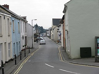
Mevagissey is a village, fishing port and civil parish in Cornwall, England, United Kingdom. The village is situated approximately five miles (8 km) south of St Austell. The parish population at the 2011 census was 2,015, whereas the ward population at the same census was 4,354.

Tywardreath is a small hilltop village on the south coast of Cornwall, England, United Kingdom, about 3 miles (5 km) north west of Fowey. It is located in a sheltered spot overlooking a silted up estuary opposite Par and near the beach of Par Sands. It is on the Saints' Way path.

Par is a village and fishing port with a harbour on the south coast of Cornwall, England, United Kingdom. The village is situated in the civil parish of Tywardreath and Par, although West Par and the docks lie in the parish of St Blaise.

Rashleigh is a surname of a prominent family from Cornwall and Devon in south western Britain, which originated in the 14th century or before at the estate of Rashleigh in the parish of Wembworthy, Devon. The principal branches were:

Par railway station serves the villages of Par, Tywardreath and St Blazey, Cornwall, England. The station is 281 miles 66 chains from the zero point at London Paddington measured via Box and Plymouth Millbay. It is the junction for the Atlantic Coast Line to Newquay.
St Blazey is a small town in Cornwall, England, United Kingdom.

Bodinnick is a riverside village in south-east Cornwall, in the United Kingdom. According to the Post Office the population of the 2011 Census was included in the civil parish of Lanteglos-by-Fowey. It is a fishing village situated on the east bank of the River Fowey opposite the town of Fowey, also on the banks of the Fowey River. The ferry crossing is from Fowey to Bodinnick and the "Old Ferry Inn" is located on its bank glorified as "in the heart of Du Maurier country". This ferry terminal is said to have existed since the 13th century.

Duporth was situated on Porthpean Road, just outside St Austell in south Cornwall, England, UK. For over 50 years, it was a holiday resort, until its closure in 2006. The site has now been sold to private developers and now contains new houses in the traditional Cornish cottage style.

Gribbin Head is a promontory on the south coast of Cornwall, England, UK, owned and managed by the National Trust. It separates St Austell Bay from the estuary of the River Fowey and is marked by a large tower used to aid navigation of ships approaching the local harbours. The nearest town is Fowey. The western point of the headland is called Little Gribbin.

Jonathan I Rashleigh, of Menabilly, near Fowey in Cornwall, was an English shipping-merchant, Member of Parliament for Fowey in 1614, 1621, 1625, April 1640 and November 1640, and 1661 and served as Sheriff of Cornwall in 1627. He supported the Royalist cause during the Civil War.
John Rashleigh II of Menabilly, near Fowey in Cornwall, was an English merchant and was MP for Fowey in 1588 and 1597, and was High Sheriff of Cornwall in 1608. He was the builder of the first mansion house on the family estate at Menabilly, near Fowey, Cornwall, thenceforth the seat of the family until the present day. Many generations later the Rashleigh family of Menabilly in the Return of Owners of Land, 1873 was listed as the largest landowner in Cornwall with an estate of 30,156 acres (122.04 km2) or 3.97% of the total area of Cornwall.

Polmear is a hamlet in Cornwall, England, UK. It is located on the A3082 road close to Par Sands and the village of Par. Part is in the civil parish of Fowey and part in Par and Tywardreath parish. The centre of Fowey is some 3 miles (4.8 km) distant, whilst Par railway station is less than 1 mile (1.6 km) away. Polmear used to be known as East Polmear and West Polmear is now known as Charlestown, and has been since Charles Rashleigh built the harbour there.

Fowey Lifeboat Station is the base for Royal National Lifeboat Institution (RNLI) search and rescue operations at Fowey on the south coast of Cornwall in the United Kingdom. The first lifeboat was stationed in the area in 1859 and the present station was opened in 1997. It operates a Trent Class all weather boat (AWB) and a D class (IB1) inshore lifeboat (ILB).
Jonathan Rashleigh was an English landowner, local politician, and collector and numismatist of some repute.
Jonathan Rashleigh of Menabilly, Cornwall, was a British landowner and Tory politician who sat in the House of Commons for 37 years from 1727 to 1764.
Presented below is an alphabetical index of articles related to Cornwall:

Tregaminion Church is a Church of England church in Tregaminion, Cornwall, England, UK. The church dates to the early 19th century and is a Grade II* listed building.


