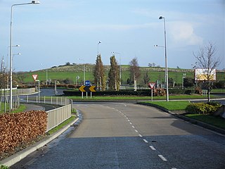
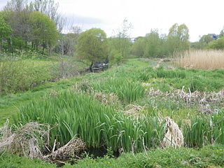
Poppintree (Irish: Crann Phapáin), is a neighbourhood of the large outer suburb of Ballymun, Dublin, Ireland. It is principally bordered by other parts of Ballymun, and Finglas, and to a modest extent by Ballygall. The area includes Poppintree Park. [1] the Poppintree Sports and Community Complex [2]
The name is derived from the townland [3] in the civil parish of Santry (Ballymun was established primarily on Santry lands). It borders a smaller townland of the same name to the west the parish of Finglas.
Poppintree is derived from Pappan's Tree, named in honour of the 6th century abbot, Saint Pappan, who built a small chapel in Santry. [4] The area was the site of a large tree under which was held an annual commemoration service to Saint Pappan on the last day of July. The services ceased by 1845. [5]
Buses serving the area are 4, 13, 88n, 140, 155, 220, N6.

Glasnevin is a neighbourhood of Dublin, Ireland, situated on the River Tolka. While primarily residential, Glasnevin is also home to the National Botanic Gardens, Glasnevin Cemetery, the National Meteorological Office, and a range of other state bodies, and Dublin City University has its main campus and other facilities in and near the area. Glasnevin is also a civil parish in the ancient barony of Coolock.

Finglas is a northwestern outer suburb of Dublin, Ireland. It lies close to Junction 5 of the M50 motorway, and the N2 road. Nearby suburbs include Glasnevin and Ballymun; Dublin Airport is seven km (4.3 mi) to the north. Finglas lies mainly in the postal district of Dublin 11.

Ballymun is an outer suburb of Dublin, Ireland, at the northern edge of the Northside, the green-field development of which began in the 1960s to accommodate a housing crisis in inner city areas of Dublin. While the newly built housing was state-of-the-art at the time, comprising high-rise tower blocks and flat complexes, residents were moved in years before shops, schools and other infrastructure were fully ready, and the area became well known for both a strong community spirit and considerable social challenges. Ballymun has several sub-districts such as Sillogue, Coultry, Shangan and Poppintree, and is close to both the Republic of Ireland's only IKEA store and to Dublin Airport. The area is the source of one Dublin river, and parts lie in the floodplain of another, and there are a number of parks.

Fingal is a county in Ireland. It is in the province of Leinster and is part of the Eastern and Midland Region. It is one of three successor counties to County Dublin, which was disestablished for administrative purposes in 1994. Its name is derived from the medieval territory of Scandinavian foreigners that settled in the area. Fingal County Council is the local authority for the county. In 2022 the population of the county was 330,506, making it the second most populated council in Dublin and the third most populous county in the state.

Coolock is a large suburban area, centred on a village, on Dublin city's Northside in Ireland. Coolock is crossed by the Santry River, a prominent feature in the middle of the district, with a linear park and ponds. The Coolock suburban area encompasses parts of three Dublin postal districts: Dublin 5, Dublin 13 and Dublin 17.

Raheny is a northern suburb of Dublin, Ireland, halfway from the city centre to Howth. It is centred on a historic settlement, first documented in 570 AD. The district shares Dublin's two largest municipal parks, Saint Anne's Park and Bull Island with its 4.5 km beach, with neighbouring Clontarf, and is crossed by several small watercourses.

Santry is a suburb on the northside of Dublin, Ireland, bordering Coolock, Glasnevin, Kilmore and Ballymun. It straddles the boundary of Dublin City Council and Fingal County Council jurisdictions.

Firhouse is an outer suburb of Dublin, in the county of South Dublin, in the south of the traditional County Dublin in Ireland. It developed from a rural village by the River Dodder, with a second settlement, Upper Fir-house, nearby. It is just outside the M50 orbital motorway, and in the postal district of Dublin 24. It is adjacent to Knocklyon, Ballycullen, and Tallaght. In the historic divisions of local administration, Firhouse is in the civil parish of Tallaght and the barony of Uppercross.
Beaumont is a northside suburb of Dublin city, Ireland, bordered by Donnycarney, Santry and Artane. It lies within the postal district of Dublin 9.

Ballygall is a small suburban area located between Glasnevin and Finglas, on the northside of the city of Dublin, Ireland. It is also a townland divided between the civil parish of Finglas and that of Glasnevin. It was settled by Vikings in the 11th century, and later by the Cambro-Normans.

Charlesland is a townland and residential development located on the southside of Greystones in County Wicklow, Ireland. It is about 25 kilometres from Dublin city centre. As of the 2011 census, the townland of Charlesland had a population of 3,130 people.
Edenmore is a locality and townland within Raheny on the Northside of Dublin, Ireland, with several housing developments and a mid-size municipal park. It lies within the Dublin 5 postal district.
The barony of Castleknock is one of the baronies of Ireland. Originally part of the Lordship of Meath, it was then constituted as part of County Dublin. Today, it is in the modern county of Fingal, Ireland. The barony was originally also a feudal title, which became one of the subsidiary titles of the Viscounts Gormanston.
Nethercross is a feudal title of one of the baronies of Ireland. Originally part of the Lordship of Meath, it was then constituted as part of the County Dublin. Today, is in the modern county of Fingal.

Brackenstown is a neighbourhood in the north Dublin suburb of Swords in Ireland. It developed in west Swords on the north side of the Ward River. It developed along the Brackenstown Road, which runs from Swords to the townland of Knocksedan. Brackenstown was initially part of the Finglas-Swords social housing expansion, where the estates of St.Cronans, Glasmore, and Brackenstown Village were constructed. It was estimated that over 5,000 people benefited from this, primarily being relocated from Gardiner Street. Following its construction, Brackenstown's address was Finglas, Dublin 11. This was due to a social divide between the native people of Swords Village, not wanting the association with the rise in antisocial behaviour in Brackenstown. Gangland feuds once ruled the area upon its construction and its ties to Finglas Village were stronger than to Swords. Following the Celtic tiger, and the large expansion of Swords. Brackenstown became surrounded by a new sprawling Dublin suburb, and modernly is a small area located in the major Dublin city suburb of Swords. Brackenstown has shops, including a supermarket and a pub, and is adjacent to the Ward River Valley Park. Brackenstown is also a parish in the Fingal North deanery of the Roman Catholic Archdiocese of Dublin.
Finglas is a civil parish mainly situated in the barony of Castleknock in the traditional county of Dublin, Ireland. It contains 34 townlands. Today, the parish is split between two local government areas: the modern county of Fingal and Dublin City Council.

Saint Margaret's is a civil parish and townland in the historical barony of Coolock in County Dublin, Ireland. Rivermeade, a housing estate of 175 homes which is treated as a separate census town, is located between Saint Margaret's and the Ward River. Dublin Airport is also nearby.

Tolka Valley Park is a public park on the River Tolka, spanning the suburbs of Ashtown, Finglas and Glasnevin, in Dublin, Ireland.
St. Pappan's Church, is a Church of Ireland church in Santry, a suburb of Dublin. Today it belongs to the Santry, Glasnevin and Finglas Grouping of Parishes. There is an old graveyard beside St. Pappan's and a parish hall.
St. Canice's Church, is a Church of Ireland church on the northern side of church street, in Finglas, Dublin. The building was built in 1843, and dedicated by Richard Whately, Archbishop of Dublin, to replace an earlier church at the site of St. Canices' early monastery. Following the building of the new church the old church was still used as a vestry for some years.