
The Northside in an informal but commonly used term to describe the part of the city of Dublin that lies to the north of the River Liffey, and extending into part of North County Dublin. The part outside the city is within the county of Fingal, a local government area established in 1994. While it is sometimes regarded as less wealthy than the city's Southside, the Northside was originally the home of the city's upper classes and the more privileged of the two. Today, some of the wealthiest areas in Ireland, such as Malahide, Howth, Clontarf, and Castleknock, lie north of the river.
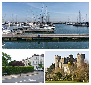
Malahide is an affluent coastal settlement in Fingal, County Dublin, Ireland, situated 14 kilometres north of Dublin city. It has a village centre surrounded by suburban housing estates, with a population of 18,608 as per the 2022 census.

Coolock is a large suburban area, centred on a village, on Dublin city's Northside in Ireland. Coolock is crossed by the Santry River, a prominent feature in the middle of the district, with a linear park and ponds. The Coolock suburban area encompasses parts of three Dublin postal districts: Dublin 5, Dublin 13 and Dublin 17.

Raheny is a northern suburb of Dublin, Ireland, halfway from the city centre to Howth. It is centred on a historic settlement, first documented in 570 AD. The district shares Dublin's two largest municipal parks, Saint Anne's Park and Bull Island with its 4.5 km beach, with neighbouring Clontarf, and is crossed by several small watercourses.

Artane, sometimes spelt Artaine, historically Tartaine is a northside suburb of Dublin city, Ireland.

Clontarf is an affluent coastal suburb on the Northside of Dublin in the city's Dublin 3 postal district. Historically, there were two centres of population, one on the coast towards the city, and the fishing village of Clontarf Sheds, further north on the coast at what is now Vernon Avenue. Clontarf has a range of retail businesses in several locations, mainly centred on Vernon Avenue. It adjoins Fairview, Marino, Killester and Raheny. Clontarf is in the jurisdiction of Dublin City Council.
Kilmore West is a locality within Dublin 5, situated on Dublin's Northside, Ireland. Located in the Dublin 5 district, it borders Santry, Beaumont, Artane, and Coolock. It is part of the larger Kilmore area.
Kilbarrack is a residential suburb of Dublin, Ireland, running inwards from the coast, about 8 km (5.0 mi) from the city's centre. It is also a civil parish in the ancient barony of Coolock. Modern-day Kilbarrack is within the jurisdiction of Dublin City Council, with part of its old lands now in Donaghmede, and part in Bayside under Fingal County Council jurisdiction.
Donaghmede is a mixed socio-economic residential suburb on the northern side of Dublin, Ireland, formed from parts of Baldoyle, Coolock and Raheny in the 1970s. It contains a mid-size shopping centre and a ruined chapel, and lies within the jurisdiction of Dublin City Council.

Harmonstown railway station, is a stop on the DART line serving the locality of Harmonstown and the nearer parts of Artane and Raheny in Dublin, Ireland.
Killester is a small residential suburb of Dublin, Ireland on the Northside of the city in the Dublin 3 and Dublin 5 postal districts. It was the site of a church and convent or monastery centuries ago, and later a small village developed. In 1922, a settlement for ex-servicemen and their families was established, and the area grew with suburban housing later. The local parish church has for many years hosted a relic of St Brigid.
Beaumont is a northside suburb of Dublin city, Ireland, bordered by Donnycarney, Santry and Artane. It lies within the postal district of Dublin 9.
Donnycarney is a Northside suburb in the city of Dublin, Ireland, in the jurisdiction of Dublin City Council. It is mostly residential, around 5 kilometres (3.1 mi) from the centre of Dublin. Dublin GAA's home stadium, Parnell Park, is located here.

The Naniken River is a minor river on the north side of Dublin city, Ireland, one of more than forty watercourses monitored by Dublin City Council. It is culverted for its upper course, visible in St Anne's Park for its entire lower course, and causes flooding somewhere along its line most years. The river flows entirely within the jurisdiction of Dublin City Council.

St. Assam's is the name of two historic churches in the village of Raheny, Dublin, one a ruin in the middle of the village, one the structurally sound but no longer primary church built for the local Roman Catholic community of the area after the revival of religious rights. Both buildings lie within the area of the ráth which gave the village and district its name, and which was perhaps 110 m across.
St Brendan's is a parish in Coolock, Dublin in Ireland that is served by the Church of St Brendan. The parish is in the Fingal South East deanery of the Roman Catholic Archdiocese of Dublin. The parish is based on the civil parish of Coolock. During penal times, it was one of the few functioning Catholic parishes in Dublin.
Founded in the early days of Irish Christian parish structures, the Parish of Clontarf assumed in 1829 the mantle of Union Parish for a large area of north Dublin, Ireland, a role previously filled by the Parish of Coolock, into which Clontarf had been subsumed in 1614 - refer to that article for history from 1618 to 1879. Clontarf itself is a large northside suburb of Dublin, and the parish was in the 20th century divided into the modern parishes which now serve that area.
The Parish of Raheny is the modern successor in the Roman Catholic Church to an early (1152) parish, in Raheny, a district of Dublin, Ireland, reputed to be a site of Christian settlement back to at least 570 A.D. Today's parish, within the Howth Deanery of the Roman Catholic Archdiocese of Dublin, comprises Raheny village and the central portion of the district, parts of which are also served by the parishes of Killester, Grange Park and Kilbarrack-Foxfield. The parish has a membership of around 10,000 Catholics. Similarly centred, and covering a greater land area but a much smaller membership, is the Church of Ireland parish of the same name.
Edenmore is a locality and townland within Raheny on the Northside of Dublin, Ireland, with several housing developments and a mid-size municipal park. It lies within the Dublin 5 postal district.
An election to all 45 seats on the council of Dublin Corporation took place on 7 June 1979 as part of the 1979 Irish local elections. The city of Dublin was divided into 11 borough electoral areas (BEAs) to elect councillors for a five-year term of office on the electoral system of proportional representation by means of the single transferable vote (PR-STV). The term was extended to 1985.

