The Back of the Pipes, Dublin

Last updated

The Back of the Pipes was the name of a lane and pipe route in Dublin 8, Ireland, located between Dolphin's Barn and James's Walk. The lane replaced a Grand Canal branch which ultimately fed the Dublin city basin (now replaced with Basin Lane / Basin Street) and the Grand Canal Harbour.

Contents

It ran along the remote end of the back gardens of the houses on Rubens Street from the Dolphin's Barn end across from the Leinster Cinema, down the back of Fatima Mansions, on past the back gardens of the houses between Mallin Ave and Lourdes Road, past the "stone sofa" and finally came out at James's Walk across from the old iron footbridge.

It took its name from an important part of the Dublin water supply originally erected in the years following 1245.

The City Watercourse

The main water supply for the city of Dublin prior to the arrival of the Hiberno-Normans in the twelfth century was the river Poddle. The Liffey was tidal up to Islandbridge and thus undrinkable. Due to increased growth and development after their arrival it became imperative for the authorities to provide a greatly increased water supply. The monks of the Abbey of St. Thomas in 1242 diverted part of the River Dodder at Balrothery near Firhouse via a man-made channel to the River Poddle at Kimmage. This canal passed through Templeogue and joined the River Tymon, forming the Poddle. The flow was separated at Mount Argus, near Mount Jerome Cemetery, by a construction known as the Tongue, one third of the flow being allocated to the city basin or cistern. This part of the flow left the Poddle proper and proceeded to St. James Terrace in Dolphin's Barn. It advanced on to James's Walk on the summit of an elevated rampart of earth and stone which became known as the "Back of the Pipes" or the "Ridges", to a cistern near the present Waterworks Headquarters at Marrowbone Lane. [1]

History

This watercourse supplied the city for over five hundred years. It also supplied the mills of the Abbey of St. Thomas at Thomas Court, and was a source of bitter contention between the citizens and the Abbot; the latter eventually agreeing to pay "yerly out of ther myllis without any contradiction, unto the Keper of the watyr of the cittie for the tyme beyng eyght busselis of corn, that ys to say four peckes of whet and four peckes of malt," for the use of the said water-course. [2] In 1555 the Mayor of Dublin was given authority to keep the whole course from the Dodder to Dolphin's Barn. However disputes arose between the city authorities and the Earl of Meath, who controlled the Liberty of St. Thomas, so that in the 18th century it was the joint property of the city and the Earls of Meath. [3]

The ancient records of Dublin city have numerous references concerning the upkeep of these water works. One of the earliest is a request from King Henry III in 1245 for a water supply for the King's Hall. The lead pipe which carried this supply was uncovered in Castle Street, next to Dublin Castle, in 1787, with an inscription from the 13th century. [4] The rebel followers of Silken Thomas in 1534, according to Hollinshed's Chronicles, "cut the pipes of the conduits whereby (the city) should be destitute of fresh water". [5]

In 1721 the Corporation reconstructed and raised the level of the City Basin at St James Gate, in the final development of the Poddle supply.

The lane was taken into the surrounding properties but the rampart remains at the end of the gardens backing onto its former location.

The locality

The locality contained the Old Leinster Cinema (later the Dublin Ice Rink, now modern apartments) near Reuben Street and Emerald Square. Fatima Mansions and Lourdes Road backed on to the "Pipes". This part of the Grand Canal has been filled in and the Luas now runs along it. The visitors' centre at Guinness's brewery is a few minutes walk away from the other end of the "Pipes".

The Back of the Pipes was a popular meeting place for courting couples in the 19th century and much later into the 20th century. A place nearby where they would stroll was called the "Stone Sofa", located at St. James Walk. [5]

In Dublin slang "at the back of the pipes" became a response to an enquiry regarding the unknown whereabouts of an object or person.

Related Research Articles

<span class="mw-page-title-main">River Liffey</span> River in Dublin in Ireland

The River Liffey is a river in eastern Ireland that ultimately flows through the centre of Dublin to its mouth within Dublin Bay. Its major tributaries include the River Dodder, the River Poddle and the River Camac. The river supplies much of Dublin's water and supports a range of recreational activities.

<span class="mw-page-title-main">Grand Canal (Ireland)</span> Canal in Ireland

The Grand Canal is the southernmost of a pair of canals that connect Dublin, in the east of Ireland, with the River Shannon in the west, via Tullamore and a number of other villages and towns, the two canals nearly encircling Dublin's inner city. Its sister canal on the Northside of Dublin is the Royal Canal. The last working cargo barge passed through the Grand Canal in 1960.

<span class="mw-page-title-main">Harold's Cross</span> Suburb of Dublin, Ireland

Harold's Cross is an affluent urban village and inner suburb on the south side of Dublin, Ireland in the postal district D6W. The River Poddle runs through it, though largely in an underground culvert, and it holds a major cemetery, Mount Jerome, and Our Lady's Hospice.

<span class="mw-page-title-main">Templeogue</span> Suburb of Dublin in Ireland

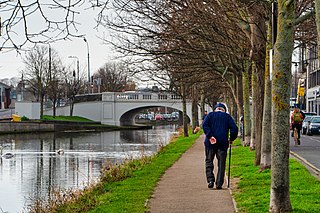
Templeogue is a southwestern suburb of Dublin in Ireland. It lies between the River Poddle and River Dodder, and is about halfway from Dublin's centre to the mountains to the south.

<span class="mw-page-title-main">Ringsend</span> Suburb of Dublin, Ireland

Ringsend is a southside inner suburb of Dublin, Ireland. It is located on the south bank of the River Liffey and east of the River Dodder, about two kilometres east of the city centre. It is the southern terminus of the East Link Toll Bridge. Areas included in Ringsend are the south side of the Dublin Docklands, and at the west end is the area of South Lotts and part of the Grand Canal Dock area. Neighbouring areas include Irishtown, Sandymount and the Beggars Bush part of Ballsbridge to the south, and the city centre to the west. A key feature of the area is the chimneys of Poolbeg power station.

<span class="mw-page-title-main">River Dodder</span> River in Dublin in Ireland

The River Dodder is one of the three main rivers in Dublin, Ireland, the others being the Liffey, of which the Dodder is the largest tributary, and the Tolka.

<span class="mw-page-title-main">The Liberties, Dublin</span> Historic area of central Dublin, Ireland

The Liberties is an area in central Dublin, Ireland, located in the southwest of the inner city. Formed from various areas of special manorial jurisdiction, separate from the main city government, it is one of Dublin's most historic working class neighbourhoods. The area was traditionally associated with the River Poddle, market traders and local family-owned businesses, as well as the Guinness brewery, whiskey distilling, and, historically, the textiles industry and tenement housing.

<span class="mw-page-title-main">Firhouse</span> Suburb of Dublin, Ireland

Firhouse is an outer suburb of Dublin, in the county of South Dublin, in the south of the traditional County Dublin in Ireland. It developed from a rural village by the River Dodder, with a second settlement, Upper Fir-house, nearby. It is just outside the M50 orbital motorway, and in the postal district of Dublin 24. It is adjacent to Knocklyon and Ballycullen, and close to Tallaght. In the historic divisions of local administration, Firhouse is in the civil parish of Tallaght and the barony of Uppercross.

<span class="mw-page-title-main">River Tolka</span> River of Counties Meath and Dublin, Ireland

The River Tolka, also once spelled Tolga, is one of Dublin's three main rivers, flowing from County Meath to Fingal within the old County Dublin, and through the north of Dublin city, Ireland. By flow of water, the Tolka is the second largest river in Dublin, following the Liffey, but runs more slowly than the Dodder.

<span class="mw-page-title-main">River Poddle</span> River in Dublin, Ireland

The River Poddle is a river in Dublin, Ireland, a pool which gave the city its English language name. Boosted by a channel made by the Abbey of St. Thomas à Becket, taking water from the far larger River Dodder, the Poddle was the main source of drinking water for the city for more than 500 years, from the 1240s. The Poddle, which flows wholly within the traditional County Dublin, is one of around a hundred members of the River Liffey system, and one of over 135 watercourses in the county; it has just one significant natural tributary, the Commons Water from Crumlin.

<span class="mw-page-title-main">Santry River</span> Small river on northside of Dublin, Ireland

Santry River is a small watercourse on the north side of Dublin city, one of the forty or so watercourses monitored by Dublin City Council. It runs, mostly unculverted, from Harristown and Dubber near Dublin Airport, through Santry and Coolock, reaching the sea at Raheny, in a lagoon area inshore of Bull Island.

<span class="mw-page-title-main">Rialto, Dublin</span> Inner suburb of Dublin, Ireland

Rialto is an inner suburb of Dublin, situated on the city's southside. The area takes its name from the Harcourt Bridge, which was commonly known as the Rialto Bridge due to its resemblance to the shape of the bridge of that name in Venice.

<span class="mw-page-title-main">R112 road (Ireland)</span> Suburban road between Chapelizod and Mount Merrion in Dublin, Ireland

The R112 road is a regional road in south Dublin, Ireland. It begins at the junction with the R148 road at Chapelizod and arcs southeastwards, then eastwards across the middle of south Dublin, ending at the Mount Merrion junction of the R138. The road is a single carriageway, with cycle lanes on some stretches. Improvements to the road have been made over the last 10 years, the most significant being at Dundrum Cross where the road was widened to make room for the new Luas bridge and Dundrum bypass.

<span class="mw-page-title-main">Neher water system</span>

Neher water system provided clean water for the people of Aurangabad and its suburbs. It was created by Malik Ambar who founded the town under the name Khadki and was later expanded by Aurangzeb to facilitate the military activity that became prevalent under Mughal rule during the 17th century.

<span class="mw-page-title-main">The Coombe, Dublin</span> Street in Dublin, Ireland

The Coombe is a historic street in the south inner city of Dublin, Ireland. It was originally a hollow or valley where a tributary of the River Poddle, the Coombe Stream or Commons Water, ran. The name is sometimes used for the broader area around, in which the Poddle and its related watercourses featured strongly.

<span class="mw-page-title-main">Fumbally Lane</span> Historic street in The Liberties, central Dublin

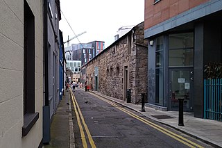
Fumbally Lane is a narrow and historic street in Dublin, Ireland, south of the city centre in The Liberties, 'In name and character perhaps the most evocative of all the Liberties' streets.' It connects Blackpitts to New Street and is close to St Patrick's Cathedral.

<span class="mw-page-title-main">Nicholas Queytrot</span> Mayor of Dublin, Ireland

Nicholas Queytrot (t) (c. 1475 – c. 1550), also called Nicholas Greytrot or Nicholas Coitrotte, was a wealthy merchant and citizen of Dublin city in the sixteenth century, who served one term as Mayor of Dublin in 1523-4.

<span class="mw-page-title-main">Fatima Luas stop</span> Tram stop in Dublin, Ireland

Fatima is a stop on the Luas light-rail tram system in Dublin, Ireland. It opened in 2004 as a stop on the Red Line. The stop is at the southern side of St. James's Hospital, adjacent to James's Walk. Fatima is named for its proximity to Fatima Mansions, a public housing complex. It provides access to the suburbs of Dolphin's Barn, The Coombe, and The Liberties. The stop has two edge platforms, and is of the same design as many Luas stops. After departing the stop, northbound trams turn left and traverse the grounds of the hospital on their way to Connolly or The Point. Southbound trams continue along an abandoned canal alignment, travelling towards Tallaght or Saggart.

<span class="mw-page-title-main">Crampton Court, Dublin</span> Passage way in central Dublin, Ireland

Crampton Court, also colloquially known as Love Lane since the mid-2010s, is a short lane or passageway located in Temple Bar in central Dublin, Ireland. A small open-air square exists at approximately the halfway point of the lane, measuring approximately 11.5 by 16.7 metres wide, from which narrow, semi-covered lanes lead to its northern and southern entrances.

References

  1. Clair L. Sweeney, The Rivers of Dublin. Dublin Corporation, 1991. ISBN   0-9505301-4-X.
  2. Dublin: A Historical and Topographical Account of the City. Samuel A. Ossory Fitzpatrick, Dublin, 1907. Chapter IX
  3. Donal Flood, Irish Times, 3 June 1972, p. 8
  4. Journal R.S.A.I. for 1890-91, vol. xx. P. 558
  5. 1 2 Quidnunc, An Irishman's Diary, Irish Times, 2 June 1942, p. 2