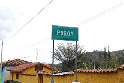
Poroy District

Last updated
Poroy
Poroy sign.JPG
Country Flag of Peru.svg  Peru
Region Cusco
Province Cusco
FoundedFebruary 20, 1941
Capital Poroy
Government
   Mayor Miguel Angel Sanchez Arteaga
Area
  Total14.96 km2 (5.78 sq mi)
Elevation
3,570 m (11,710 ft)
Population
  Total4,452
  Density300/km2 (770/sq mi)
Time zone UTC-5 (PET)
UBIGEO 080103

Poroy District is one of eight districts of the province Cusco in Peru. [1]

Districts of Peru third level administrative subdivision of Peru

The districts of Peru are the third-level country subdivisions of Peru. They are subdivisions of the provinces, which in turn are subdivisions of the larger regions or departments. There are 1,838 districts in total.

Cusco Province Province in Cusco, Peru

Cusco Province is the smallest of thirteen provinces in the Cusco Region in the southern highlands of Peru.

Peru republic in South America

Peru, officially the Republic of Peru, is a country in western South America. It is bordered in the north by Ecuador and Colombia, in the east by Brazil, in the southeast by Bolivia, in the south by Chile, and in the west by the Pacific Ocean. Peru is a megadiverse country with habitats ranging from the arid plains of the Pacific coastal region in the west to the peaks of the Andes mountains vertically extending from the north to the southeast of the country to the tropical Amazon Basin rainforest in the east with the Amazon river.

Related Research Articles

Muskoka River river in Canada

The Muskoka River is a river in the Muskoka District of Ontario, Canada.

Windsor Forest Colleges Group is a group of further education colleges located in Berkshire, England, with campuses in Langley and Windsor. It was formerly known as East Berkshire College.

Tamburco District District in Apurímac, Peru

Tamburco District is one of the nine districts of the province Abancay in Peru.

San Pedro de Cachora District is one of the nine districts of the province Abancay in Peru.

Coata District District in Puno, Peru

Coata District is one of fifteen districts of the province Puno in Peru.

Cachimayo District District in Cusco, Peru

Cachimayo District is one of nine districts of the province Anta in Peru.

Huarocondo District District in Cusco, Peru

Huarocondo District is one of nine districts of the province Anta in Peru.

Mollepata District is one of nine districts of the province Anta in Peru.

Pucyura District is one of nine districts of the province Anta in Peru.

Zurite District is one of nine districts of the province Anta in Peru.

Lares District District in Cusco, Peru

Lares District is one of eight districts of the province Calca in Peru.

Ccorca District is one of eight districts of the Cusco Province in Peru.

Huayopata District District in Cusco, Peru

Huayopata District is one of ten districts of the province La Convención in Peru.

Huanoquite District is one of nine districts of the province Paruro in Peru.

Huayllabamba District, Urubamba District in Cusco, Peru

Huayllabamba District is one of seven districts of the province Urubamba in Peru.

Maras District District in Cusco, Peru

Maras District is one of seven districts of the Urubamba Province in Peru.

Yucay District District in Cusco, Peru

Yucay District is one of seven districts of the province Urubamba in Peru.

Urubamba District District in Cusco, Peru

Urubamba District is one of seven districts of the province Urubamba in Peru.

Uraca District District in Arequipa, Peru

Uraca District is one of fourteen districts of the province Castilla in Peru.

Venustiano Carranza Municipality is a municipality in Puebla in south-eastern Mexico.

References

Coordinates: 13°30′19″S72°01′36″W / 13.5052°S 72.0267°W / -13.5052; -72.0267

Geographic coordinate system Coordinate system

A geographic coordinate system is a coordinate system that enables every location on Earth to be specified by a set of numbers, letters or symbols. The coordinates are often chosen such that one of the numbers represents a vertical position and two or three of the numbers represent a horizontal position; alternatively, a geographic position may be expressed in a combined three-dimensional Cartesian vector. A common choice of coordinates is latitude, longitude and elevation. To specify a location on a plane requires a map projection.