Lucre District, Quispicanchi

Last updated
Lucre
District

Rumicolca.jpg

Country Flag of Peru.svg  Peru
Region Cusco
Province Quispicanchi
Founded January 17, 1941
Capital Lucre
Area
  Total 118.78 km2 (45.86 sq mi)
Elevation 3,086 m (10,125 ft)
Population (2005 census)
  Total 4,040
  Density 34/km2 (88/sq mi)
Time zone PET (UTC-5)
UBIGEO 081208

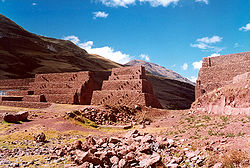
The Lucre District is one of the twelve districts in the Quispicanchi Province in Peru. Created by Law No. 9295 on January 17, 1941, its capital is the town of Lucre.

Districts of Peru third level administrative subdivision of Peru

The districts of Peru are the third-level country subdivisions of Peru. They are subdivisions of the provinces, which in turn are subdivisions of the larger regions or departments. There are 1,838 districts in total.

Quispicanchi Province Province in Cusco, Peru

Quispicanchi Province is one of thirteen provinces in the Cusco Region in the southern highlands of Peru.

Peru republic in South America

Peru, officially the Republic of Peru, is a country in western South America. It is bordered in the north by Ecuador and Colombia, in the east by Brazil, in the southeast by Bolivia, in the south by Chile, and in the west by the Pacific Ocean. Peru is a megadiverse country with habitats ranging from the arid plains of the Pacific coastal region in the west to the peaks of the Andes mountains vertically extending from the north to the southeast of the country to the tropical Amazon Basin rainforest in the east with the Amazon river.

Contents

Geography

One of the highest peaks of the district is Qusqu Qhawarina at 4,145 m (13,599 ft). Other mountains are listed below: [1]

Qusqu Qhawarina (Quispicanchi)

Qusqu Qhawarina is a 4,145-metre-high (13,599 ft) mountain in the Cusco Region in Peru. It is situated in the Quispicanchi Province, on the border of the districts of Andahuaylillas and Lucre. Qusqu Qhawarina lies on the left bank of the Willkanuta River, northeast of a mountain named Saywa.

Ethnic groups

The people in the district are mainly indigenous citizens of Quechua descent. Quechua is the language which the majority of the population (57.36%) learnt to speak in childhood, 42.31% of the residents started speaking using the Spanish language (2007 Peru Census). [2]

Indigenous peoples of the Americas Pre-Columbian inhabitants of North, Central and South America and their descendants

The indigenous peoples of the Americas are the Pre-Columbian peoples of North, Central and South America and their descendants.

Quechua people ethnic group

Quechua people or Quecha peoples, may refer to any or all speakers of the Quechua languages, which originated among the indigenous peoples of South America. Most Quechua speakers are native to Peru, although there are some significant populations living in Ecuador, Bolivia, Chile, Colombia and Argentina.

Spanish language Romance language

Spanish or Castilian is a Romance language that originated in the Castile region of Spain and today has hundreds of millions of native speakers in the Americas and Spain. It is a global language and the world's second-most spoken native language, after Mandarin Chinese.

See also

Related Research Articles

Acomayo Province Province in Cusco, Peru

Acomayo Province is one of thirteen provinces in the Cusco Region in the southern highlands of Peru.

Kunturkanki District District in Cusco, Peru

Kunturkanki District is one of eight districts in the Canas Province in Peru. Its seat is the village of El Descanso.

Quehue District District in Cusco, Peru

Quehue is one of eight districts in the Canas Province in Peru. Its seat is the village of Quehue.

Chilcayoc District District in Ayacucho, Peru

Chilcayoc or Ch'illkayuq is the smallest of 11 districts of the Sucre Province in the Ayacucho region in Peru.

Ocongate District District in Cusco, Peru

The Ocongate District is one of the twelve districts in the Quispicanchi Province in Peru. Created on January 2, 1857, its capital is the town of Ocongate.

The Cusipata District is one of the twelve districts in the Quispicanchi Province in Peru. Created by Law No. 9164 on September 5, 1940, its capital is the town of Cusipata.

The Marcapata District is one of the twelve districts in the Quispicanchi Province in Peru. Created on January 20, 1869, its capital is Marcapata.

Pichirhua District is one of the nine districts of the Abancay Province in Peru.

Rondocan District is one of seven districts of the province Acomayo in Peru.

Chinchaypujio is one of nine districts of the Anta Province in Peru.

Coya District District in Cusco, Peru

Coya District is one of eight districts of the Calca Province in the Cusco Region of Peru.

Taray District District in Cusco, Peru

Taray District is one of eight districts of the Calca Province in the Cusco Region in Peru. Its seat is Taray. The town lies near Pisac, southwest of it, at a stream called Pawayuq (Pahuayoc), an affluent of Willkanuta River.

Checacupe or Ch'iqa Kupi is one of eight districts of the Canchis Province in the Cusco Region in Peru.

Pitumarca District District in Cusco, Peru

Pitumarca District is one of eight districts of the province Canchis in Peru.

Colquemarca is one of eight districts of the Chumbivilcas Province in Peru.

Ccapi District is one of nine districts of the Paruro Province in Peru.

Omacha District is one of nine districts of the province Paruro in Peru.

Challabamba District is one of six districts of the Paucartambo Province in Peru.

Kosñipata District is one of six districts of the province Paucartambo in Peru.

References

  1. escale.minedu.gob.pe/ UGEL map Cusco Province (Cusco Region)
  2. inei.gob.pe Archived 2013-01-27 at the Wayback Machine . INEI, Peru, Censos Nacionales 2007, Frequencias: Preguntas de Población: Idioma o lengua con el que aprendió hablar (in Spanish)

Coordinates: 13°38′19″S71°44′27″W / 13.6386°S 71.7407°W / -13.6386; -71.7407

Geographic coordinate system Coordinate system

A geographic coordinate system is a coordinate system that enables every location on Earth to be specified by a set of numbers, letters or symbols. The coordinates are often chosen such that one of the numbers represents a vertical position and two or three of the numbers represent a horizontal position; alternatively, a geographic position may be expressed in a combined three-dimensional Cartesian vector. A common choice of coordinates is latitude, longitude and elevation. To specify a location on a plane requires a map projection.