Yauri Kiskachay | |
|---|---|
 | |
 | |
| Country | |
| Region | Cusco |
| Province | Espinar |
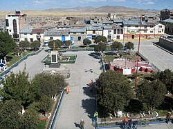
| Capital | Yauri |
| Government | |
| • Mayor | Lindley Alfredo Salinas Perez |
| Area | |
• Total | 747.78 km2 (288.72 sq mi) |
| Elevation | 3,915 m (12,844 ft) |
| Population | |
• Total | 32,471 |
| • Density | 43/km2 (110/sq mi) |
| Time zone | UTC-5 (PET) |
| UBIGEO | 080801 |
Yauri District, also known as Espinar or Kiskachay District, is one of eight districts of the Espinar Province in Peru. [1] Its seat is Yauri (Yawri).