The Quinpool District refers to a commercial district of Halifax, Nova Scotia, encompassing the eastern portion of Quinpool Road as well as the streets directly north and south of it. Prominent landmarks on Quinpool Road include the Atlantica Hotel, the Oxford Theatre, and an eclectic variety of local businesses, including many popular Chinese and Greek restaurants.

The Chebucto Peninsula is a Canadian peninsula located in central Nova Scotia entirely within the Halifax Regional Municipality on the Atlantic coast.
Richmond was a Canadian urban neighbourhood comprising part of the North End of the Halifax Peninsula in Nova Scotia's Halifax Regional Municipality.
Dollar Lake Provincial Park is a seasonal Provincial Park located in the Musquodoboit Valley area of the Halifax Regional Municipality in Nova Scotia, Canada in the community of Wyses Corner, Nova Scotia, 22 kilometres from the Halifax International Airport, on the Old Guysborough Road.
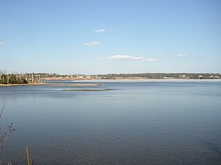
East Lawrencetown is a rural community within Halifax Regional Municipality in Nova Scotia, Canada on the Eastern Shore on Route 207 along the scenic route Marine Drive. The community is 22.4 kilometers from Halifax. Lawrencetown Beach Provincial Park is located in the community, at the southern end of Lawrencetown Lake, a natural ocean inlet. The beach is a year-round destination for surfing, attracting both locals and those from abroad. There are also places to park your vehicle, stroll along boardwalks, hike, mountain bike and swim. Available to the public in the summer is a canteen, showers, flush toilets and a section of beach that is supervised by the Nova Scotia Lifeguard Service.
Birch Cove is a subdivision and a cove in the community of Bedford area of the Halifax Regional Municipality, Nova Scotia, Canada, on the shore of Bedford Basin and along the Bedford Highway. The name is after the birch trees that hung over the cove by William Donaldson, who named his estate Birch Cove.

Montague Gold Mines is a rural community in the Halifax Regional Municipality of Nova Scotia, located on the Montague Road off of exit 14 of Highway 107 three kilometers from Dartmouth.
Dutch Settlement is a Canadian rural community`in Halifax Regional Municipality, Nova Scotia.
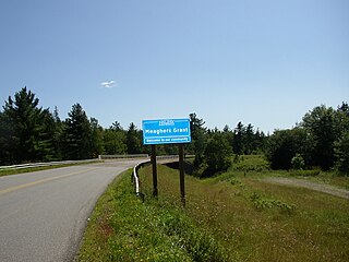
Elderbank is a farming community in the Musquodoboit Valley area of the Halifax Regional Municipality, Nova Scotia at the junction of Routes 357 and 212. Elderbank is located in the Southeast Branch Musquodoboit. Other communities in this branch include, Meaghers Grant, Nova Scotia.
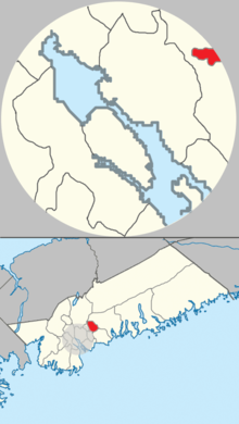
The Halifax Regional Municipality (HRM) in the Canadian province of Nova Scotia is composed of more than 200 communities and neighbourhoods.
Bayside is a small coastal rural community in the Halifax Regional Municipality Nova Scotia, Canada. It is about 19 kilometres (12 mi) from Halifax. Bayside is situated on the shore of Shad Bay on the Atlantic Ocean. The community is on the Prospect Road which runs on the Chebucto Peninsula.
Beechville is a rural community within the Halifax Regional Municipality of Nova Scotia, Canada, on the St. Margaret's Bay Road. The Beechville Lakeside Timberlea (BLT) trail starts here near Lovett Lake, following the line of the old Halifax and Southwestern Railway. Ridgecliff Middle School, located in Beechville Estates, serves the communities of Beechville, Lakeside and Timberlea.

The Capital District was an area in Nova Scotia's Halifax Regional Municipality designated as Nova Scotia's centre of business, government, events and attractions.
Greenwood in Nova Scotia can be
Pockwock is one of four Black Nova Scotian settlements in Upper Hammonds Plains. People in this area are mostly descendants of War of 1812 refugees. It is located in the Halifax Regional Municipality in the Canadian province of Nova Scotia. The Halifax Regional Water Commission uses Pockwock Lake as a source for water for the communities of Halifax, Bedford and Lower Sackville.

The Black Cultural Centre for Nova Scotia is located in Cherrybrook, Nova Scotia, in the Halifax Regional Municipality. The centre is a museum and a library resource centre that focuses on the history and culture of African Nova Scotian. The organization of the Black Cultural Society was incorporated as a charitable organization in 1977 and the centre opened its doors in 1983, with a goal to educate and inspire and to protect, preserve and promote Black culture in Nova Scotia. The centre is located on Trunk 7 at 1149 Main Street.
Upper Hammonds Plains is a Canadian suburban community located in Nova Scotia's Halifax Regional Municipality.