Rampside

Last updated

Rampside
Rampside.jpeg
Rampside on a summer's day
Location map United Kingdom Borough of Barrow-in-Furness.svg
Red pog.svg
Rampside
Location in the former Borough of Barrow-in-Furness
Location map United Kingdom Morecambe Bay.svg
Red pog.svg
Rampside
Location in Morecambe Bay
Cumbria UK location map.svg
Red pog.svg
Rampside
Location within Cumbria
OS grid reference NY236659
Unitary authority
Ceremonial county
Region
Country England
Sovereign state United Kingdom
Post town BARROW-IN-FURNESS
Postcode district LA13
Dialling code 01229
Police Cumbria
Fire Cumbria
Ambulance North West
UK Parliament
List of places
UK
England
Cumbria
54°04′59″N3°09′58″W / 54.083°N 3.166°W / 54.083; -3.166

Rampside is a village in Cumbria, England. Historically in Lancashire, it is located a few miles south-east of the town of Barrow-in-Furness, in the north-western corner of Morecambe Bay on the Furness peninsula.

Contents

History

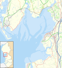
There is evidence that the village was inhabited as early as 1292, in the records of the monks of Furness Abbey, though Viking and Roman artefacts have been found in the village's church. As well as agriculture, the village acted as a small port, with shipping trade coming to Furness Abbey through Roa Island, which itself was defended by the fortified Piel Island, both around one mile south of Rampside. [1]

Thomas Lawson, a herbalist and botanist, was born at Rampside in 1630 and became minister at the village church. He invited George Fox to preach from the pulpit after one Sunday service, and subsequently became a Quaker himself in 1653. He published various religious works and died in 1691. [2]

Rampside Leading Light, also known as The Needle, was built in the 19th century. Piel Castle can be seen in the distance at left. Rampside, UK Lighthouse.jpg
Rampside Leading Light, also known as The Needle, was built in the 19th century. Piel Castle can be seen in the distance at left.

In the late 18th century, the village had a reputation as a bathing resort; at the time, it was larger than Barrow-in-Furness, which was still a small hamlet. The poet, William Wordsworth, is known to have frequented the village at this time. [1] His memory of his time at Rampside and his view towards Piel Castle led him to write the following in 1805: [3]

'I was thy neighbour once, thou rugged Pile!
Four summer weeks I dwelt in sight of thee:
I saw thee every day, and all the while,
Thy form was sleeping on a glassy sea'

In 1840, development began on a causeway to Roa Island, resulting in a rail ferry from Fleetwood to the island, the trains then passing through Rampside Station to get to Barrow and the southern Lake District. This service became obsolete with the railway barges linking Ulverston and Lancaster, and the causeway soon became a road. [1]

On 15 February 1865, a small shallow earthquake caused serious damage in Rampside. The intensity at Rampside has been estimated as VIII on the European macroseismic scale; the magnitude of the earthquake is uncertain, but probably not more than 3 ML . [4]

Present day

In recent years, Roa Island and Rampside have retained their close links to the sea, with sailing and windsurfing popular in the surrounding waters.

Rampside is also home to the Rampside Gas Terminal and Roosecote Power Station, where gas from the Morecambe Bay and Irish Sea gasfields comes onshore. This, and commuting into Barrow, are the main sources of modern-day employment in Rampside.

See also

Related Research Articles

<span class="mw-page-title-main">Barrow-in-Furness</span> Town in Cumbria, England

Barrow-in-Furness is a port town in Cumbria, England. Historically in Lancashire, it was incorporated as a municipal borough in 1867 and merged with Dalton-in-Furness Urban District in 1974 to form the Borough of Barrow-in-Furness. In 2023, the borough merged with Eden and South Lakeland districts to form a new unitary authority: Westmorland and Furness. At the tip of the Furness peninsula, close to the Lake District, it is bordered by Morecambe Bay, the Duddon Estuary and the Irish Sea. In 2011, Barrow's population was 56,745, making it the second largest urban area in Cumbria after Carlisle, and the largest in the Westmorland and Furness unitary authority.

<span class="mw-page-title-main">Morecambe Bay</span> Estuary in northwest England

Morecambe Bay is a large estuary in northwest England, just to the south of the Lake District National Park. It is the largest expanse of intertidal mudflats and sand in the United Kingdom, covering a total area of 120 sq mi (310 km2). In 1974, the second largest gas field in the UK was discovered 25 mi (40 km) west of Blackpool, with original reserves of over 7 trillion cubic feet (tcf). At its peak, 15% of Britain's gas supply came from the bay but production is now in decline. It is also one of the homes of the high brown fritillary butterfly.

<span class="mw-page-title-main">Furness Railway</span> English railway company

The Furness Railway (Furness) was a railway company operating in the Furness area of Lancashire in North West England.

<span class="mw-page-title-main">Furness</span>

Furness is a peninsula and region of Cumbria, England. Together with the Cartmel Peninsula it forms North Lonsdale, historically an exclave of Lancashire. On 1 April 2023 it became part of the new unitary authority of Westmorland and Furness.

<span class="mw-page-title-main">Piel Island</span> Tidal island in Cumbria, United Kingdom

Piel Island lies in Morecambe Bay, around 12 mile off the southern tip of the Furness peninsula in the administrative county of Cumbria, England. It is one of the Islands of Furness, three of which sit near to Piel at the mouth of Walney Channel. The island is the location of Piel Castle, built by the monks of Furness Abbey in the fourteenth century.

Roa Island lies just over half a mile (1 km) south of the village of Rampside at the southernmost point of the Furness Peninsula in Westmorland and Furness, though formerly in the county of Lancashire north of the sands. It is located at 54°5′N3°10′W. It is one of the Islands of Furness in northern England. It has an area of about three hectares.

<span class="mw-page-title-main">Furness Abbey</span> Ruined abbey in Cumbria, England

Furness Abbey, or St. Mary of Furness, is a former monastery located to the north of Barrow-in-Furness, Cumbria, England. The abbey dates back to 1123 and was once the second-wealthiest and most powerful Cistercian monastery in the country, behind Fountains Abbey, prior to its dissolution during the English Reformation. The abbey contains a number of individual Grade I Listed Buildings and is a Scheduled Monument.

<span class="mw-page-title-main">Walney Island</span> Island in the United Kingdom

Walney Island, also known as the Isle of Walney, is an island off the west coast of England, at the western end of Morecambe Bay in the Irish Sea. It is part of Barrow-in-Furness, separated from the mainland by Walney Channel, which is spanned by the Jubilee Bridge. Walney is the largest island of the Furness Islands group, both in population and size, as well as the largest English island in the Irish Sea. Its population at the 2011 UK Census was 10,651, distributed evenly across the island's two Wards of Walney North and Walney South.

Foulney Island is a low-lying grass and shingle area 1 mile (1.6 km) to the south-east of Roa Island, off the southern tip of the Furness Peninsula in Cumbria, England. Foulney Island is one of the Islands of Furness in Morecambe Bay, northern England. For local government purposes the island is in the borough of Barrow-in-Furness. It has an area of about 40 acres. In earlier times it was known as Fowle Island.

<span class="mw-page-title-main">Roose</span> Human settlement in England

Roose or Roosecote is a suburb and ward of Barrow-in-Furness, Cumbria, England. The word 'roose' is Celtic for "moor" or "heath" and the suffix 'cote' of Roosecote means "hut" or "huts". Before the building of Roose Cottages and the arrival of the Cornish miners Roose was pronounced with a hard S, as in goose; now it is locally pronounced 'Rooze', due to the Cornish accent. Roose is served by Roose railway station, one of the few remaining stations on the Furness Line in the Barrow area.

<span class="mw-page-title-main">Piel Castle</span> Grade I listed building in Cumbria, UK

Piel Castle, also known as Fouldry Castle or the Pile of Fouldray, is a castle situated on the south-eastern point of Piel Island, off the coast of the Furness Peninsula in north-west England. Built in the early-14th century by John Cockerham, the Abbot of neighbouring Furness Abbey, it was intended to oversee the trade through the local harbour and to protect against Scottish raids. The castle was built using stones from the local beach, and featured a large keep with surrounding inner and outer baileys. It was used as a base by the Yorkist pretender Lambert Simnel in 1487, but by 1534 it had fallen into ruin and passed into the hands of the Crown.

<span class="mw-page-title-main">Muchland</span> Manor in Low Furness, Cumbria, England

Muchland is a medieval manor in Low Furness in the county of Cumbria in northern England. The manor was the seat of the Lords of Aldingham, and included at its peak the villages of Bardsea, Urswick, Scales, Stainton, Sunbrick, Baycliff, Gleaston, Aldingham, Dendron, Leece and Newbiggin. The area also features the historic remains of Gleaston Castle, Aldingham Castle, Gleaston Water Mill, the Druids' Temple at Birkrigg, plus many prehistoric remains around Urswick and Scales.

<span class="mw-page-title-main">Rampside Gas Terminal</span> Gas terminal in Rampside Road , Barrow-in-Furness

Rampside Gas Terminal is a gas terminal situated in Barrow-in-Furness, Cumbria on the Irish Sea coast. It connects to gas fields in Morecambe Bay. It is situated adjacent to the former Roosecote Power Station.

<span class="mw-page-title-main">Eric Gill works at the Midland Hotel, Morecambe</span>

Eric Gill works at the Midland Hotel, Morecambe include a sculpture, reliefs and a medallion.

<span class="mw-page-title-main">Port of Barrow</span> Port in United Kingdom

The Port of Barrow refers to the enclosed dock system within the town of Barrow-in-Furness, England. Morecambe Bay is to the east of the port and the Irish Sea surrounds it to the south and west. The port is currently owned and operated by Associated British Ports Holdings, but some land is shared with BAE Systems Submarine Solutions. Currently consisting of four large docks, the Port of Barrow is one of North West England's most important ports. The docks are as follows: Buccleuch Dock, Cavendish Dock, Devonshire Dock and Ramsden Dock. The port of Barrow is the only deep water port between the Mersey and the Clyde.

<span class="mw-page-title-main">Rampside Hall</span> Historic site in Barrow-in-Furness, Cumbria

Rampside Hall is a Grade I listed building in the Rampside area of Barrow-in-Furness, Cumbria, England. It is one of only three Grade I listed buildings in the Borough outside of the Furness Abbey complex and dates back to the 17th century. Built for the Knype family, it is most noted for its dozen chimneys which have given the building the nickname 'the twelve apostles'. Rampside Hall retains the majority of its original features, with the only major alteration taking place in 1810 when the building was re-roofed. The building was heavily damaged on 15 February 1865 when a 2.2ML earthquake shook the area, toppling three of its famed chimneys, cracking walls and displacing some of them by eight inches.

The following is a timeline of the history of Barrow-in-Furness, England, United Kingdom.

Rampside railway station was located on the Piel Branch of the Furness Railway in the Rampside area of Barrow-in-Furness, England.

<span class="mw-page-title-main">Piel railway station</span> Disused railway station in Cumbria, England

Piel railway station was the terminus of the Furness Railway's Piel Branch in Barrow-in-Furness, England that operated between 1846 and 1936. Located on Roa Island it was built to serve the passenger steamers at Piel Pier. The Roa Island causeway was specifically constructed for the railway, in turn making the island part of the British mainland. The station and the Piel Branch line have both been demolished, however the Roa Island Hotel which was built adjoining the station survives to this day as a Grade II listed building.

<span class="mw-page-title-main">Bay Cycle Way</span> Cycle route around Morecambe Bay in NW England

The Bay Cycle Way is an 80-mile (130 km) cycling route around Morecambe Bay in Lancashire and Cumbria in north west England. Most of it forms National Cycle Route 700, while other sections are waymarked as NCN 6, NCN 69 and NCN 70.

References

  1. 1 2 3 Barrow and District by Fred Barnes, Barrow-in-Furness Corporation, Barrow-in-Furness (Lancs) 1968
  2. The Parish of Dalton in A History of the County of Lancaster, Volume 8, pp304-319 (1914).
  3. Suggested by a Picture of Peele Castle, in a Storm, Painted by Sir George Beaumont in The Complete Poetical Works by William Wordsworth, Macmillan, London 1888.
  4. The Barrow-in-Furness Earthquake of 15 February 1865: Liquefaction from a Very Small Magnitude Event by R.M.W. Musson, Pure and Applied Geophysics, 152(4): 733-745, 1998

Commons-logo.svg Media related to Rampside at Wikimedia Commons