Randolph, Illinois | |
|---|---|
 Randolph  Randolph | |
| Coordinates: 40°22′34″N88°58′49″W / 40.37611°N 88.98028°W | |
| Country | United States |
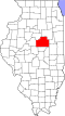
| State | Illinois |
| County | McLean |
| Elevation | 781 ft (238 m) |
| Time zone | UTC-6 (Central (CST)) |
| • Summer (DST) | UTC-5 (CDT) |
| Area code | 309 |
| GNIS feature ID | 423100 [1] |
Randolph is an unincorporated community in McLean County, in the U.S. state of Illinois. [1]