Fairbank is a ghost town in Cochise County, Arizona, next to the San Pedro River. First settled in 1881, Fairbank was the closest rail stop to nearby Tombstone, which made it an important location in the development of southeastern Arizona. The town was named for Chicago investor Nathaniel Kellogg Fairbank who partially financed the railroad, and was the founder of the Grand Central Mining Company, which had an interest in the silver mines in Tombstone. Today Fairbank is located within the San Pedro Riparian National Conservation Area.

Arivaca is an unincorporated community in Pima County, Arizona, United States. It is located 11 miles (18 km) north of the Mexican border and 35 miles (56 km) northwest of the port of entry at Nogales. The European-American history of the area dates back at least to 1695, although the community was not founded until 1878. Arivaca has the ZIP code 85601. The 85601 ZIP Code Tabulation Area had a population of 909 at the 2000 census.

Gleeson is a ghost town situated in southeastern Cochise County, Arizona, United States. It has an estimated elevation of 4,924 feet (1,501 m) above sea level. The town was first settled as Turquoise in the 1870s in what was then the Arizona Territory, then later re-established as Gleeson in 1900.

Charleston is a ghost town in Cochise County in the southeastern part of the U.S. state of Arizona. It was occupied from the late-1870s through the late-1880s, and was located in what was then known as the Arizona Territory. Located on the west bank of the San Pedro River, Charleston's economy was based on milling silver ore mined from nearby Tombstone in the community of Millville, located directly across the river.

Tiger is a former populated place in Pinal County in the U.S. state of Arizona. The town was settled as Schultzcirca 1881 in what was then the Arizona Territory, then later reestablished as Tiger after World War I.
James DeNoon Reymert was an American newspaper editor, mine operator, lawyer and politician. He was a pioneer settler in Wisconsin Territory, early elected official in the state of Wisconsin and founded the first Norwegian language newspaper to be published in the United States.

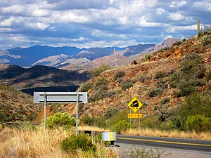
Cherry is a mining ghost town in central Yavapai County, Arizona, United States, between Dewey and Camp Verde, located at an elevation of 5,143 feet.

Sasco is a ghost town located in Pinal County, Arizona, west of Red Rock. Sasco, which is an acronym for the Southern Arizona Smelter Company, was a company town with a large smelter that served several mines. Once an impressive and little-known ghost town, today Sasco is a common sporting destination with shotgun shells, airsoft bb's, paintball splatter, and litter in the area.
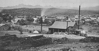
Pinal or Pinal City is a ghost town in Pinal County in the U.S. state of Arizona. The town was populated from the 1870s into the 1890s, in what was then the Arizona Territory.

The Castle Dome Mountains are a mountain range in Yuma County, Arizona, within the Kofa National Wildlife Refuge. Castle Dome Peak, the high point of the range, is a prominent butte and distinctive landmark. The peak is 3,780 feet (1,152 m) high, and is located at 33°05′04″N 114°08′36″W. Castle Dome was named by American soldiers at old Fort Yuma in the 1880s. Early Spanish explorers called the same peak Cabeza de Gigante, "Giant's Head."

Pearce, Arizona, and Sunsites, Arizona, are adjacent unincorporated communities in the Sulphur Springs Valley of Cochise County, Arizona, United States. The two communities are often referred to as Pearce–Sunsites, Pearce/Sunsites, or Pearce Sunsites.

Harshaw is a ghost town in Santa Cruz County in the southeastern part of the U.S. state of Arizona. The town was settled in the 1870s, in what was then Arizona Territory. Founded as a mining community, Harshaw is named after the cattleman-turned-prospector David Tecumseh Harshaw, who first successfully located silver in the area. At the town's peak near the end of the 19th century, Harshaw's mines were among Arizona's highest producers of ore, with the largest mine, the Hermosa, yielding approximately $365,455 in bullion over a four-month period in 1880.
McMillenville, also known as McMillianville or McMillanville, is a populated place in Gila County, Arizona. Silver ore was discovered by chance in 1876 by Theodore H. Harris and Charles McMillen, and the town formed around the ore deposits.

The Silver King Mine is an inactive silver mine located near Superior, Arizona in the United States. The richest silver mine in Arizona, it produced an estimated US$42 million worth of silver ore between 1875 and 1900.

The Mineral Park mine is a large open pit copper mine located in the Cerbat Mountains 14 miles northwest of Kingman, Arizona, in the southwestern United States. A 2013 report said that Mineral Park has an estimated reserves of 389 million tonnes of ore grading 0.14% copper and 31 million oz of silver.
Denoon was a village established by James DeNoon Reymert in 1852, straddling the county line between Waukesha and Racine counties in Wisconsin, 15 miles southeast of Waukesha, in range 20 E. of the towns of Muskego and Norway, on the shore of Lake Denoon. It was on the plank road between Milwaukee and Rochester, which Reymert is generally credited with getting built.
DeNoon is a ghost town located 13 miles (21 km) southwest of Superior in Pinal County, Arizona, United States. The town served as a milling town for the Reymert Mine, which was 2 miles (3.2 km) away. James DeNoon Reymert founded and named the town in 1889. The town grew quickly, and its own post office opened on March 19, 1890; however, the post office closed the following year, and the town disappeared soon afterwards.

The Historic Pinal Cemetery, first known simply as "Pinal Cemetery", is a cemetery located on a hill in what once within the jurisdiction of the now ghost town of Pinal City, Arizona. The Pioneers' Cemetery Association (PCA) defines a "historic cemetery" as one which has been in existence for more than fifty years. In 2009, the Tonto National Forest made it its goal to develop and manage the cemetery as an interpretive site while preserving its historic context and integrity as an archaeological resource. Among those who are buried in the cemetery is Celia Ann “Mattie” Blaylock Earp who was Wyatt Earp's common law wife. The role of Mattie Earp was played by actress Dana Wheeler-Nicholson in the 1993 American Western film Tombstone.