
Coke is a grey, hard, and porous coal-based fuel with a high carbon content. It is made by heating coal or oil in the absence of air. Coke is an important industrial product, used mainly in iron ore smelting, but also as a fuel in stoves and forges.
West Blocton is a town in Bibb County, Alabama, United States. At the 2020 census, the population was 1,217. The current mayor is Daniel Sims.

Apache Junction is a city in Pinal and Maricopa County, Arizona, United States. As of the 2020 census, the population was 38,499, most of whom lived in Pinal County. It is named for the junction of the Apache Trail and Old West Highway. The area where Apache Junction is located used to be known as Youngberg. Superstition Mountain, the westernmost peak of the Superstition Mountains, is to the east.

Swansea is a ghost town in La Paz County in the U.S. state of Arizona. It was settled circa 1909 in what was then the Arizona Territory. It served as a mining town as well as a location for processing and smelting the copper ore taken from the nearby mines.

A beehive oven is a type of oven in use since the Middle Ages in Europe. It gets its name from its domed shape, which resembles that of a skep, an old-fashioned type of beehive.
Coketon is an unincorporated community and coal town in Tucker County, West Virginia, United States. Coketon lies at the confluence of Snyder Run and the North Fork Blackwater River, south of the town of Thomas.

Charleston is a ghost town in Cochise County in the southeastern part of the U.S. state of Arizona. It was occupied from the late-1870s through the late-1880s, and was located in what was then known as the Arizona Territory. Located on the west bank of the San Pedro River, Charleston's economy was based on milling silver ore mined from nearby Tombstone in the community of Millville, located directly across the river.

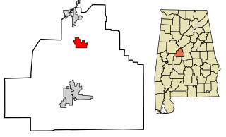
Tiger is a former populated place in Pinal County in the U.S. state of Arizona. The town was settled as Schultzcirca 1881 in what was then the Arizona Territory, then later reestablished as Tiger after World War I.

The Castle Dome Mountains are a mountain range in Yuma County, Arizona, within the Kofa National Wildlife Refuge. Castle Dome Peak, the high point of the range, is a prominent butte and distinctive landmark. The peak is 3,780 feet (1,152 m) high, and is located at 33°05′04″N 114°08′36″W. Castle Dome was named by American soldiers at old Fort Yuma in the 1880s. Early Spanish explorers called the same peak Cabeza de Gigante, "Giant's Head."

Castle Dome Landing, Arizona is a ghost town in the Castle Dome Mountains of Yuma County in the U.S. state of Arizona. It was first settled as a transport depot and mining camp around 1863 in what was then the Arizona Territory.

Kay Moor, also known as Kaymoor, is the site of an abandoned coal mine, coal-processing plant, and coal town near Fayetteville, West Virginia. The town site is located in the New River Gorge at Kaymoor Bottom (38°03′00″N81°03′17″W). It is linked to the mine portal 560 feet (170 m) above on Sewell Bench (38°02′52″N81°03′58″W) in the wall of the Gorge by conveyors.
Sewell is an unincorporated community in Fayette County, West Virginia, United States. Sewell is located on the New River, 6 miles (9.7 km) southeast of Fayetteville. Sewell was the sight of a major coking operation with 193 beehive coke ovens operating in the late nineteenth century and early to mid twentieth century. The operation was serviced by the Mann's Creek Railroad between 1886 and 1955.

The Silver King Mine is an inactive silver mine located near Superior, Arizona in the United States. The richest silver mine in Arizona, it produced an estimated US$42 million worth of silver ore between 1875 and 1900.
Christmas is an uninhabited mining community in Gila County, Arizona, United States. The mine which led to creation of the town was staked on Christmas Day 1902, prompting the name. During the three decades in which the town's post office operated it was a popular destination for holiday mail seeking a "Christmas" postmark. The mine is also the location where the minerals apachite, junitoite, and ruizite were first discovered.

Twin Buttes is a populated place on the east flank of the Sierrita Mountains approximately twenty miles south of Tucson, in Pima County, Arizona, United States. Named after a prominent hill located next to the town, Twin Buttes was founded as a small mining town circa 1903 and abandoned around 1930. Much of the actual town site is now buried underneath mine tailings, and all that remains is the Twin Buttes Cemetery.
DeNoon is a ghost town located 13 miles (21 km) southwest of Superior in Pinal County, Arizona, United States. The town served as a milling town for the Reymert Mine, which was 2 miles (3.2 km) away. James DeNoon Reymert founded and named the town in 1889. The town grew quickly, and its own post office opened on March 19, 1890; however, the post office closed the following year, and the town disappeared soon afterwards.
Clip, or Clip Landing, was a steamboat landing and mill settlement in Yuma County, Arizona Territory. The site in the present day is owned and maintained by the Laccinole Family Living Trust, on the east bank of the Colorado River in La Paz County, Arizona. The settlement was located 70 miles up river from Yuma. It lies at an elevation of 223 feet, just south of Clip Wash, and the road to the Clip Mine at the top of the wash, 8 miles southeast of the mill.

Coke Oven Hollow is a ghost town in Penn Township, Parke County, in the U.S. state of Indiana.

Monckton Coke Works was a coking plant near Royston in South Yorkshire, England. The plant opened in 1884 and was closed 130 years later in 2014, being one of the last remnants of the coal industry in Yorkshire. In the 21st century, it was known as being the last independent coke works in the United Kingdom. For many years it was known for its high-quality coking coal, even being exported to coal-rich South Africa for use in steelmaking. However, in 2013/2014, the market was swamped with cheap imports from the Far East, spelling the demise of Monckton due to it being uneconomical.


