
Eau Claire County is a county located in the U.S. state of Wisconsin. As of the 2010 census, the population was 98,736. Its county seat is Eau Claire. The county took its name from the Eau Claire River.
Maxville is a town in Buffalo County in the U.S. state of Wisconsin. The population was 309 at the 2010 census. The unincorporated community of Maxville is located in the town. The ghost town of Savoy was located in the town.

Chippewa Falls is a city located on the Chippewa River in Chippewa County in the U.S. state of Wisconsin. The most recent census from 2010 shows that the population is 13,661. Incorporated as a city in 1869, it is the county seat of Chippewa County.

Cornell is a city in Chippewa County in the U.S. state of Wisconsin. The population was 1,467 at the 2010 census. It is located on the Chippewa River, upstream from Lake Wissota and Chippewa Falls.

Stanley is a city in Chippewa and Clark counties in the U.S. state of Wisconsin. The population was 3,608 at the 2010 census. Of this, 3,602 were in Chippewa County, and 6 in Clark County.

Eau Claire is a city in Chippewa and Eau Claire counties in the west-central part of the U.S. state of Wisconsin. Located almost entirely in Eau Claire County, for which it is the county seat, the city had a population of 65,883 at the 2010 census, making it the state's ninth-largest city. Eau Claire is the principal city of the Eau Claire, Wisconsin Metropolitan Statistical Area, which is a part of the Eau Claire-Menomonie Combined Statistical Area.

Lake Hallie is a village in Chippewa County, Wisconsin, United States. It was incorporated from part of the Town of Hallie on February 18, 2003. The 2010 census put the village's population at 6,448.

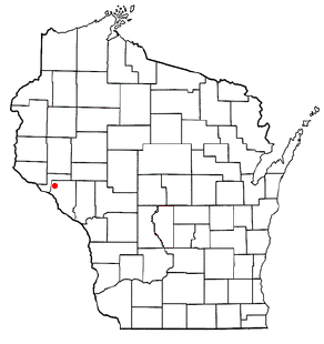
Chippewa Valley Regional Airport is a public use airport in Chippewa County, Wisconsin, United States. The airport is owned by Eau Claire county and is located three nautical miles (6 km) north of the central business district of the city of Eau Claire, Wisconsin.

Caryville is an unincorporated community in the town of Rock Creek, in Dunn County, Wisconsin, United States. The community is on the south shore of the Chippewa River, along State Highway 85, near where Dunn County Highway H crosses the river.

Wisconsin's 7th congressional district is a congressional district of the United States House of Representatives in northwestern and central Wisconsin; it is the largest congressional district in the state geographically, covering 20 counties, for a total of 18,787 sq mi. The district contains the following counties: Ashland, Barron, Bayfield, Burnett, St. Croix, Chippewa (partial), Clark, Douglas, Florence, Forest, Iron, Jackson (partial), Juneau (partial), Langlade, Lincoln, Marathon, Monroe (partial) Oneida, Polk, Price, Rusk, Sawyer, Taylor, Vilas, Washburn and Wood (partial).

Jim Falls is an unincorporated census-designated place located in Chippewa County, Wisconsin, United States. Jim Falls is located on the Chippewa River northeast of Chippewa Falls, in the town of Anson. Jim Falls has a post office with ZIP code 54748. As of the 2010 census, its population was 237.

Ojibwa is an unincorporated community located in the town of Ojibwa, Sawyer County, Wisconsin, United States. Ojibwa is located on the Chippewa River at the junction of Wisconsin Highway 27 and Wisconsin Highway 70, 5.5 miles (8.9 km) east of Radisson and 5.5 miles (8.9 km) west-southwest of Winter. Ojibwa had a post office, which closed on June 13, 1986.
Eagleton is an unincorporated community located in the town of Eagle Point, Chippewa County, Wisconsin, United States. Eagleton is located on Wisconsin Highway 124, 8.5 miles (13.7 km) north of Chippewa Falls.
Arnold is an unincorporated community located in the town of Ruby, Chippewa County, Wisconsin, United States.
Gaslyn is an unincorporated community in the town of Rusk, Burnett County, Wisconsin, United States. Gaslyn is located along County Highway H to the south of Gaslyn Lake. The community is part of the reservation of the St. Croix Chippewa Indians of Wisconsin. The community was named for David C. Gaslin, a logger during the 1860s. A post office operated in the community from 1902 to 1919.
Eagle Point is an unincorporated community located in the town of Eagle Point, Chippewa County, Wisconsin, United States. Eagle Point is located along the Union Pacific Railroad near Wisconsin Highway 124, 6.5 miles (10.5 km) north of Chippewa Falls.
Cobban is an unincorporated community located in the town of Arthur, Chippewa County, Wisconsin, United States. Cobban is located on the east bank of the Chippewa River at the junction of County Highways K and TT, 5.2 miles (8.4 km) south-southwest of Cornell.
Shanagolden is an unincorporated community located in the town of Shanagolden, Ashland County, Wisconsin, United States. Shanagolden is located on the East Fork Chippewa River 10 miles (16 km) northwest of Butternut.


