
The Krishna River or Kistna River is a river in the Deccan plateau, and the third-longest river of India, after the Ganges and Godavari, and the fourth-largest in terms of water inflows and river basin area in India, after the Ganges, Indus and Godavari. The river, also called Krishnaveni, it is 1,400 kilometres (870 mi) long and its length in Maharashtra is 242 kilometres. It is a major source of irrigation in the Indian states of Maharashtra, Karnataka, Telangana and Andhra Pradesh.
Sangli is a city and the district headquarters of Sangli District in the state of Maharashtra, in western India. It is known as the Turmeric City of Maharashtra due to its production and trade of the spice. Sangli is situated on the banks of river Krishna and houses many sugar factories. Sangli is a major city in Western India 390 km from Mumbai, 240 km from Pune, 50 km from Kolhapur, and 653 km from Bangalore. Sangli is known for its turmeric trade, grapes and the largest number of sugar factories in India. The only district has more than 30 sugar factories. Sangli Miraj Kupwad, along with its Urban Agglomeration together known as Sangli Miraj Kupwad Metropolitan Region (SMKMR).
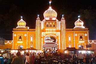
Kirloskarwadi is an industrial township that developed around the Kirloskar Brothers Ltd factory in the Sangli district, in Maharashtra state, India. It is the second oldest industrial township in India. On 10 March 2010, Kirloskarwadi celebrated 100 years of its establishment. Kirloskarwadi is a rapidly growing satellite suburb of Sangli city. The famous holy place of God Datta Maharaj Audumbar is just 10 km away. While Sagareshwar picnic spot is around 8–10 km away. Another famous holy place Audumbar of the god Datta Maharaj is just about 11 km from this place. The town has centric connectivity between Vita–Isalmapur–Palus–Tasgaon talukas.

Ganpatipule (Gaṇpatīpuḷē) is a small town located 25 km north of the city of Ratnagiri in Ratnagiri district on the Konkan coast of Maharashtra, in the sub-continent of India. The town of Chiplun is located to its north.

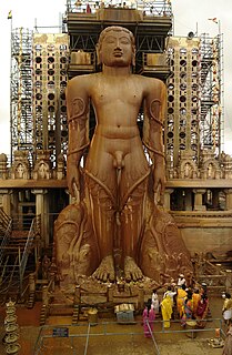
Kumbhoj is the name of an ancient town located in Kolhapur district in Maharashtra. The town is about eight kilometers from Hatkanangale, about twenty seven kilometers from Kolhapur and currently, also is the Taluka or Tehsil Headquarters. The famous Jain Tirtha known as Bahubali, is just two kilometers away from the Kumbhoj city.

Sangli district is a district of Maharashtra state in India. Sangli city is the district headquarters. It is bordered by Satara district, Solapur district to the North, Karnataka state to South-East, by Kolhapur district to South-West and by narrow portion in East side to Ratnagiri district. It is present on the southern tip of Maharashtra.
Jaysingpur is a city and municipal council in the Kolhapur district of the Indian state of Maharashtra. The city derives its name from Raja Jaysing, the father of Shrimant Chhatrapati Shahu Maharaj of Kolhapur, who planned and developed the architecture of the city. Shahu Maharaj laid out Jaysingpur as one of the few "chess board cities" in Maharashtra where roads meet at 90-degree angles. Jaysingpur has emerged as a satellite of Sangli city and is growing at rapid pace.

Karad is a city in Satara district of Indian state of Maharashtra and it is 320 km (180.19 miles) from Mumbai and 159 km from Pune. It lies at the confluence of Koyna River and the Krishna River known as the "Priti sangam". The two rivers originate at Mahabaleshwar, which is around 100 km from Karad. They diverge at their origin, and travel for about the same distance to meet again in Karad. The rivers meet exactly head on, thus forming letter "T" which is the only head on confluence in the world. Hence Krishna and Koyna river's confluence is called Preeti Sangam, meaning Confluence of Love. Karad is well known for sugar production and is known as the sugar bowl of Maharashtra owing to the presence of many sugar factories in and around Karad. It is considered as an important educational hub in Western Maharashtra due to the presence of many prestigious educational institutes. This place is also known for resting place or (Samadhi) of the first chief minister of Maharashtra Shri. Yashwantrao Chavan situated at the confluence of Krishna and Koyana river.
Tasgaonpronunciation (help·info) is a city and a municipal council in Sangli district in the Indian state of Maharashtra. Tasgaon has rapidly merged with Sangli city as a satellite suburb and will soon become part of Sangali Urban Agglomeration. Tasgaon was given as Jahagir to Parshuram Bhau Tasgaonkar by Narayanrao Ballal Peshwa in 1774. Tasgaon Sansthan was lapsed by British during ruling of Shrimant Ganapatrao Tasgaonkar.
Karnataka, the sixth largest state in India, has been ranked as the third most popular state in the country for tourism in 2014. It is home to 507 of the 3600 centrally protected monuments in India, the largest number after Uttar Pradesh. The State Directorate of Archaeology and Museums protects an additional 752 monuments and another 25,000 monuments are yet to receive protection. Tourism centres on the ancient sculptured temples, modern cities, the hill ranges, forests and beaches. Broadly, tourism in Karnataka can be divided into four geographical regions: North Karnataka, the Hill Stations, Coastal Karnataka and South Karnataka.

The word Maharashtra, the land of the mainly Marathi-speaking people, appears to be derived from Maharashtri, an old form of Prakrit. Some believe that the word indicates that it was the land of the Mahars and the Rattas, while others consider it to be a corruption of the term 'Maha Kantara', a synonym for 'Dandakaranya'. Maharashtra is the third largest state in India after Rajasthan and Madhya Pradesh. It covers an area of 307,713 km2 and is bordered by the states of Madhya Pradesh to the north, Chhattisgarh to the east, Telangana to the southeast, Karnataka to the south and Goa to the southwest. The state of Gujarat lies to the northwest, with the Union territory of Dadra and Nagar Haveli sandwiched between the borders. Maharashtra moosd,omadomcopm kooc has coastline of 720 km.The Arabian Sea makes up Maharashtra's west coast. Maharashtra consists of two major relief divisions. The plateau is a part of the Deccan tableland and the Konkan coastal strip abutting on the Arabian Sea.
Shirol is a historic place also. It was named "Shirol", because there is story behind it. The story is:"there was great war between Shivaji Maharaj & Mughal’s. In that war, the Mughals were defeated & the heads of Mughal soldiers were hanged to main gate of city. So the name Shirol: Shir(heads) + ol(row).
Palus is a tehsil in Sangli, in the Indian state of Maharashtra.

Amboli is a hill station in south Maharashtra, India. At an altitude of 690 m (2,260 ft) it is the last hill station before the coastal highlands of Goa.
Arjunwad is a village in Belagavi district in the Northern state of Karnataka, India.
Bhilawadi is a town (Neighbourhood) of Sangli City which is 27 km away from the heart of City Sangli in Sangli district, Maharashtra state, located on the bank of Krishna River. This town is one of the prominent producers of Grapes and Sugar Cane in Sangli district. Bhilawadi town has won the Nirmal Gram Purskar in Sant Gadage Baba Gram Swachhata Abhiyan.

Rameshwar also known as Rameshwar Wadi is a small town located on the coast of Sindhudurg District of Maharashtra on the west coast of India. A very old Shri Dev Rameshwar Temple is located in this town which is dedicated to the Hindu deity Shiva.
Kundal is a town in Palus Taluka within the Sangli District of southwestern Maharashtra, It has a population of 18,287 people - 9,432 males and 8,855 females according to the 2011 census. Kundal is located 40 kilometres north of the district capital, Sangli. Kundal is surrounded by Valva-Islampur Taluka to the west, Kadegaon Taluka to the north, Tasgaon Taluka to the east, and Karad Taluka to the west.
Malkapur is a town in Satara district in the southern part of Indian state of Maharashtra. It lies beside the city of Karad and along the NH4 highway. It had one of the highest revenue-generating Gram Panchayats in Maharashtra. Later on due to increasing population and urbanization it was given the status of a town having Municipal Council. The town is well known even in other countries for its 24×7 water supply to each and every house and at very cheap cost. It is also implementing Solar City Project in which municipal gives subsidiary on purchasing any solar-powered equipment and reducing power dependency on MSEB. The Malkapur town is divided into 17 wards for which elections are held every 5 years.
Karawadi is a village panchayat located in the Karad taluka of Satara district in the southern part of Indian state of Maharashtra. It belongs to Western Maharashtra region. It has a population of 3,588 according to 2011 census. The nearby villages include Ogalewadi, Viravade, Wagheri, vadoli Nileshwar. Prominent family surnames include Pisal, Dubal, Patil, Chavan, Bhosale, More, Bansode. It is in the Pune Division. It is located 57 km towards South from District headquarters Satara and 278 km from State capital Mumbai.
