Saint-Hilaire | |
---|---|
Coordinates: 47°18′45″N68°26′24″W / 47.3125°N 68.44°W | |
Country | Canada |
Province | New Brunswick |
County | Madawaska |
Erected | 1877 |
Area | |
• Land | 41.90 km2 (16.18 sq mi) |
Population (2016) [1] | |
• Total | 478 |
• Density | 11.4/km2 (30/sq mi) |
• Change 2011-2016 | 2.4% |
• Dwellings | 196 |
Time zone | UTC-4 (AST) |
• Summer (DST) | UTC-3 (ADT) |
Figures do not include portion within village of St. Hilaire No census data available after 2016 |
Saint-Hilaire is a geographic parish in Madawaska County, New Brunswick, Canada. [2]
For governance purposes it is part of the incorporated rural community of Haut-Madawaska, [3] which is a member of the Northwest Regional Service Commission (NWRSC). [4]
The parish takes its name from the local Roman Catholic church. [5]
Saint-Hilaire was erected as Saint Hilaire in 1877 from Madawaska and Saint-François Parishes. [6]
In 1930 Baker Brook Parish was erected from the western part of Saint-Hilaire. [7]
In 1946 Saint-Hilaire was affected by the major reorganisation of Madawaska County parish boundaries. [8]
In 1973 the hyphen was finally added to the legal name. [9]
Saint-Hilaire Parish is bounded: [2] [10] [11] [12]
Communities at least partly within the parish; [10] [11] [12]
Bodies of water [lower-alpha 1] at least partly in the parish: [10] [11] [12]
Islands in the parish: [10] [11] [12]
Parish population total does not include former incorporated village of St. Hilaire
2016 | 2011 | |
---|---|---|
Population | 478 (-2.4% from 2011) | 490 (-7.7% from 2006) |
Land area | 41.90 km2 (16.18 sq mi) | 41.55 km2 (16.04 sq mi) |
Population density | 11.4/km2 (30/sq mi) | 11.8/km2 (31/sq mi) |
Median age | 45.15 (M: 44.7, F: 45.5) | 45.5 (M: 43.0, F: 46.7) |
Private dwellings | 196 (total) | 196 (total) |
Median household income | $75,008 |
|
|
| |||||||||||||||||||||||||||
[17] [18] [1] |
Canada Census Mother Tongue - Saint-Hilaire Parish, New Brunswick 2011 language data for this area has been suppressed for data quality or confidentiality reasons. [17] | ||||||||||||||||||
---|---|---|---|---|---|---|---|---|---|---|---|---|---|---|---|---|---|---|
Census | Total | French | English | French & English | Other | |||||||||||||
Year | Responses | Count | Trend | Pop % | Count | Trend | Pop % | Count | Trend | Pop % | Count | Trend | Pop % | |||||
2011 | n/a | n/a | 0.0% | 0.00% | n/a | 0.0% | 0.00% | n/a | 0.0% | 0.00% | n/a | 0.0% | 0.00% | |||||
2006 | 525 | 525 | 7.6% | 100.00% | 0 | 100.0% | 0.00% | 0 | 0.0% | 0.00% | 0 | 100.0% | 0.00% | |||||
2001 | 525 | 485 | 10.2% | 92.38% | 30 | 14.3% | 5.71% | 0 | 100.0% | 0.00% | 10 | n/a% | 1.90% | |||||
1996 | 585 | 540 | n/a | 92.31% | 35 | n/a | 5.98% | 10 | n/a | 1.71% | 0 | n/a | 0.00% |
Paquetville is a geographic parish in Gloucester County, New Brunswick, Canada.
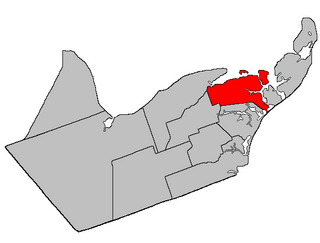
Caraquet is a geographic parish in Gloucester County, New Brunswick, Canada.
Saint-François is a geographic parish in Madawaska County, New Brunswick, Canada.
Lac Baker is a geographic parish in Madawaska County, New Brunswick, Canada.
Clair is a geographic parish in Madawaska County, New Brunswick, Canada.
Baker Brook is a geographic parish in Madawaska County, New Brunswick, Canada.
Madawaska is a geographic parish in Madawaska County, New Brunswick, Canada.
Saint-Jacques is a geographic parish in Madawaska County, New Brunswick, Canada. The parish consists of two discontiguous portions separated by Saint-Joseph Parish.
Saint-Joseph is a geographic parish in Madawaska County, New Brunswick, Canada.
Saint-Basile is a geographic parish in Madawaska County, New Brunswick, Canada.
Rivière-Verte is a geographic parish in Madawaska County, New Brunswick, Canada.
Sainte-Anne is a geographic parish in Madawaska County, New Brunswick, Canada.
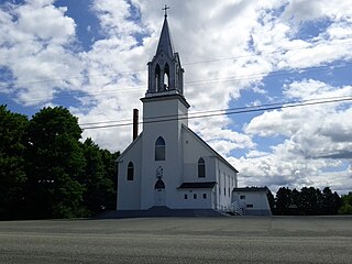
Notre-Dame-de-Lourdes is a geographic parish in Madawaska County, New Brunswick, Canada.
Saint-Léonard is a geographic parish in Madawaska County, New Brunswick, Canada.
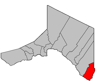
Saint-André is a geographic parish in Madawaska County, New Brunswick, Canada.
Drummond is a geographic parish in Victoria County, New Brunswick, Canada.
Saint-Marie, is a geographic parish in Kent County, New Brunswick, Canada.
Kent is a geographic parish in the northeastern corner of Carleton County, New Brunswick, Canada.
Saint Croix is a geographic parish in Charlotte County, New Brunswick, Canada, straddling Route 1 to the north of the original town of Saint Andrews.
Saint David is a geographic parish in Charlotte County, New Brunswick, Canada, located northeast of St. Stephen and northwest of Saint Andrews.