Sakhalin Railway

Last updated
Sakhalin Railway Division
Map Sakhalinskaia zheleznaia doroga 2020-08-01.svg
Sakhalin railway network
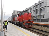
RZD 2M62-1066 2022-08 Kholmsk 2.jpg
Sakhalin Railway in Kholmsk
Overview
Native nameСахалинская железная дорога
Owner Government of Russia
Area served Sakhalin Island
Locale Sakhalin Oblast, Russia
Transit type Heavy rail
Number of stations84
Headquarters Yuzhno-Sakhalinsk
Operation
Began operation1945
Operator(s) Russian Railways
Infrastructure manager(s) Far Eastern Railway
Technical
System length804.9 km (500.1 mi)
No. of tracks1
Track gauge 1,520 mm (4 ft 11+2732 in) Russian gauge
Old gauge1,067 mm (3 ft 6 in)

Sakhalin Railway ( ‹See Tfd› Russian : Сахалинская железная дорога) is a division of the Far Eastern Railway that primarily serves Sakhalin Island. Due to its island location, the railway is the second[ clarification needed ] isolated 1520mm gauge network in Russia, like the Norilsk railway. The only main connection to the mainland is the Vanino–Kholmsk train ferry. The management is located at Yuzhno-Sakhalinsk.

History

A Japanese D51 steam locomotive outside the Yuzhno-Sakhalinsk railway station Japanese SL D51-22.jpg
A Japanese D51 steam locomotive outside the Yuzhno-Sakhalinsk railway station
Japanese Government Railways map of Hokkaido, Chosen, Karahuto, and Manchukuo Japanese Government Railways Wartime Route Map.jpg
Japanese Government Railways map of Hokkaido, Chosen, Karahuto, and Manchukuo

The Treaty of Portsmouth following the Russo-Japanese War of 1904-05 placed the northern half of Sakhalin under the control of the Russian Empire, whilst the southern half (Karafuto) was under control of Japan.

On the Japanese half of the island, a 42.5-kilometre-long (26.4 mi) railway was built from Korsakov (大泊 (Ōtomari)) to Yuzhno-Sakhalinsk (豊原 (Toyohara)), with a gauge of 600 mm (1 ft 11+58 in). This section was later converted to the normal Japanese railway gauge of 1,067 mm (3 ft 6 in).

In 1911, a 64 km (40 mi) branch was built from Yuzhno-Sakhalinsk to Starodubskoye (Sakaehama). Between 1918 and 1921, the towns of Nevelsk (本斗 (Honto)), Kholmsk (真岡 (Maoka)), Chekhov (野田 (Noda)) and Tomari (泊居 (Tomarioru)) were also connected to the network. The Japanese railway network consisted of the Western Karafuto Railway from Naihoro (Gornozavodsk) to Tomarioru, and the Eastern Karafuto Railways from Otomari to Koton (Pobedino) until 1944. Its total length was over 1,225 km (761 mi).

After the Second World War, control of the whole of the island passed to the Soviet Union, including the island's complete rail network and rolling stock. Wagons from the Soviet railways were re-gauged for use on the island. The locomotive factory in Lyudinovo produced diesel locomotives of the models TG16 and TG21 specifically for use on the island's narrow gauge network. Additionally, trains were imported from Japan, such as the purpose-made A1 sets made by Hitachi Rail and Teikoku Sharyo (1958-1960), followed by the D2 sets made by Fuji Heavy Industries (1986) and ex-JNR KiHa 58 railcars, purchased second hand in the early 1990s.

The Soviet era saw the network extend into the north of the island, with a total extent in 1992 of 2,500 km (1,600 mi). By 2006, little-used sections such as DachnoyeAniva and DolinskStarodubskoye had been closed, but the network still had a total length of 2,025 km (1,258 mi).

In 1992, the Sakhalin Railway was split from the Far Eastern Railway and made its own administrative entity. It reverted to being part of the Far Eastern Railway in 2010. [1]

The new track 1,067 mm (3 ft 6 in) / 1,520 mm (
4 ft 11+27/32 in) GaugeWidening.jpg
The new track 1,067 mm (3 ft 6 in) / 1,520 mm (4 ft 11+2732 in)
Contemporary era of railway after re-gauge, DMU RA3-026 in Korsakov (2022) RZD RA3-026 Korsakov-Pristan 2022-08.jpg
Contemporary era of railway after re-gauge, DMU RA3-026 in Korsakov (2022)

In order to allow regular Russian trains to run on the island, the island's rail network underwent conversion to Russian broad gauge [2] starting from 2003. Russian Railways formally completed the regauging work in August 2019. [3] Last scheduled train on 1067mm line Holmsk-77km pk9 was run at 30 September 2020. [4]

Future prospects

Potential connection to the mainland

Chronology of railways in Sakhalin Sakhalin railway map chronology.svg
Chronology of railways in Sakhalin

The Soviet Union under Joseph Stalin planned to construct a tunnel between Sakhalin and the Russian mainland, which would have linked Sakhalin to the rest of the Soviet rail network. The project was begun using forced labor between 1950 and 1953 but was canceled after Stalin's death.

Since 1973, a train ferry has connected Vanino (on the mainland near Sovetskaya Gavan) with the town of Kholmsk on Sakhalin.

There have been some calls from politicians to revive the concept of building a bridge or tunnel between Sakhalin and the mainland, although there have been concerns that the costs of the project would outweigh the benefits. [5] However, Russian President Dimitry Medvedev announced his support for the project in November 2008, suggesting the link could be completed by 2030, with bridge rather than a tunnel, and far more northerly route. [6] In February 2013, the Russian government announced plans to build the link, including it in the 2012–2015 federal transport plan. It would connect the Sakhalin Railway to the Baikal–Amur Mainline at Komsomolsk-on-Amur. The link, estimated at 21 billion rubles, would require about 925 km (575 mi) of new construction on the mainland, a 16 km (9.9 mi) bridge across the northernmost part of the Strait of Nevelskoy, and an additional 320 km (200 mi) of new track to connect the line to the existing network. [7]

Potential connection to Hokkaido

There have also been proposals to connect the southern tip of Sakhalin to the Japanese island of Hokkaido via a 40-kilometre-long (25 mi) bridge or tunnel. This link would allow a direct land transport link for container traffic from Japan to the Asian mainland and Europe. [8] [9]

Rolling stock

See also

Related Research Articles

<span class="mw-page-title-main">Sakhalin</span> Island in the Sea of Okhotsk

Sakhalin is an island in Northeast Asia. Its north coast lies 6.5 km (4.0 mi) off the southeastern coast of Khabarovsk Krai in Russia, while its southern tip lies 40 kilometres (25 mi) north of Japan's Hokkaido. An island of the West Pacific, Sakhalin divides the Sea of Okhotsk to its east from the Sea of Japan to its southwest. It is administered as part of Sakhalin Oblast and is the largest island of Russia, with an area of 72,492 square kilometres (27,989 sq mi). The island has a population of roughly 500,000, the majority of whom are Russians. The indigenous peoples of the island are the Ainu, Oroks, and Nivkhs, who are now present in very small numbers.

<span class="mw-page-title-main">Strait of Tartary</span> Strait dividing Sakhalin from mainland Asia

Strait of Tartary or Gulf of Tartary is a strait in the Pacific Ocean dividing the Russian island of Sakhalin from mainland Asia, connecting the Sea of Okhotsk on the north with the Sea of Japan on the south. It is 632 km (393 mi) long, 7–23 km (4.3–14.3 mi) wide, and only 4 m (13 ft) deep at its shallowest point.

<span class="mw-page-title-main">Okha, Russia</span> Town in Sakhalin Oblast, Russia

Okha is a town and the administrative center of Okhinsky District of Sakhalin Oblast, Russia. Population: 23,008 (2010 Census); 27,963 (2002 Census); 36,104 (1989 Soviet census).

<span class="mw-page-title-main">Sakhalin Oblast</span> First-level administrative division of Russia

Sakhalin Oblast is a federal subject of Russia comprising the island of Sakhalin and the Kuril Islands in the Russian Far East. The oblast has an area of 87,100 square kilometers (33,600 sq mi). Its administrative center and largest city is Yuzhno-Sakhalinsk. As of the 2021 Census, the oblast has a population of 466,609.

<span class="mw-page-title-main">Yuzhno-Sakhalinsk</span> City in Sakhalin Oblast, Russia

Yuzhno-Sakhalinsk is a city and the administrative center of Sakhalin Oblast, Russia. It is located on Sakhalin Island in the Russian Far East, north of Japan. Gas and oil extraction as well as processing are amongst the main industries on the island. It was called Vladimirovka (Влади́мировка) from 1882 to 1905, then Toyohara during its period of Imperial Japanese control from 1905 to 1946. As of the 2010 Census, its population was 181,728.

<span class="mw-page-title-main">Karafuto Prefecture</span> Part of the Empire of Japan

Karafuto Agency, from 1943 Karafuto Prefecture, commonly known as South Sakhalin, was a part of the Empire of Japan on Sakhalin. It was part of the gaichi from 1907 to 1943 and later a prefecture as part of the naichi until 1945.

<span class="mw-page-title-main">Kholmsk</span> Town in Sakhalin Oblast, Russia

Kholmsk, known until 1946 as Maoka, is a port town and the administrative center of Kholmsky District of Sakhalin Oblast, Russia. It is located on the southwest coast of the Sakhalin Island, on coast of the gulf of Nevelsky in the Strait of Tartary of the Sea of Japan, 83 kilometers (52 mi) west of Yuzhno-Sakhalinsk. Population: 30,937 (2010 Census); 35,141 (2002 Census); 51,381 (1989 Soviet census).

<span class="mw-page-title-main">Korsakov (town)</span> Town in Sakhalin Oblast, Russia

Korsakov is a town and the administrative center of Korsakovsky District of Sakhalin Oblast, Russia. It is located 42 kilometers (26 mi) south from Yuzhno-Sakhalinsk, at the southern end of Sakhalin Island, on the coast of the Salmon Cove in the Aniva Bay. The town has a population of 33,526 as of the 2010 census.

Between 1905 and 1945, the Japanese Empire administered the southern half of Sakhalin, using the name Karafuto (樺太). The area was designated a chō (廳), the same term given to Hokkaidō at the time. It is commonly referred to as Karafuto Prefecture in English. The prefecture was divided into 4 subprefectures, which in turn were subdivided into 11 districts, in turn divided into 41 municipalities

<span class="mw-page-title-main">5 ft and 1520 mm gauge railways</span> Railway track gauge

Railways with a railway track gauge of 5 ft first appeared in the United Kingdom and the United States. This gauge became commonly known as "Russian gauge", because the government of the Russian Empire chose it in 1843. Former areas and states of the Empire have inherited this standard. However in 1970, Soviet Railways re-defined the gauge as 1,520 mm.
<span class="mw-page-title-main">Poronaysk</span> Town in Sakhalin Oblast, Russia

Poronaysk is a town and the administrative center of Poronaysky District of Sakhalin Oblast, Russia, located on the Poronay River 288 kilometers (179 mi) north of Yuzhno-Sakhalinsk. Population: 16,120 (2010 Census); 17,954 (2002 Census); 25,971 (1989 Soviet census).

Sakhalin Koreans are Russian citizens and residents of Korean descent living on Sakhalin Island, who can trace their roots to the immigrants from the Gyeongsang and Jeolla provinces of Korea during the late 1930s and early 1940s, the latter half of the Japanese ruling era.

<span class="mw-page-title-main">Sakhalin Tunnel</span>

The Sakhalin Tunnel is an incomplete and currently indefinitely postponed construction project, which after completion would have connected the island of Sakhalin with mainland Russia via a tunnel of approximately 10 kilometres (6 mi) under the Nevelskoy Strait.

<span class="mw-page-title-main">Sakhalin–Hokkaido Tunnel</span> Proposed tunnel between Russia and Japan

The Sakhalin–Hokkaido Tunnel is a proposed connection to link the Russian island of Sakhalin with the Japanese island of Hokkaido. Cost estimates by Russia in the year 2000 put the project at $50 billion. When the project is complete, it will span across the Soya strait for 45-kilometre (28-mile), making it the longest bridge in the world.

Pogibi is a rural locality in Sakhalin Oblast, Russia. It is located at Cape Pogibi, the closest point on the island of Sakhalin to the Russian mainland, only 7.5 km across the Strait of Nevelskoy at this point.
<span class="mw-page-title-main">Far Eastern Railway</span> Railway in Russia

Far Eastern Railway is a railway in Russia that crosses Primorsky Krai, Khabarovsk Krai, Amur Oblast, Jewish Autonomous Oblast, and Yakutia.

<span class="mw-page-title-main">Tymovskoye</span> Urban-type settlement in Sakhalin Oblast, Russia

Tymovskoye is an urban locality and the administrative center of Tymovsky District of Sakhalin Oblast, Russia, located in the central part of the Sakhalin Island on the right bank of the Tym River, about 450 kilometers (280 mi) north of Yuzhno-Sakhalinsk. Population: 7,855 (2010 Census); 8,532 (2002 Census); 10,869 (1989 Soviet census).

<span class="mw-page-title-main">Soviet invasion of South Sakhalin</span> 1945 Soviet invasion of the Japanese portion of Sakhalin Island

The Soviet invasion of South Sakhalin, also known as the Battle of Sakhalin, was the Soviet invasion of the Japanese portion of Sakhalin Island known as Karafuto Prefecture. The invasion was part of the Soviet–Japanese War, a minor campaign in the Asian Theatre during Second World War.
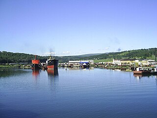
<span class="mw-page-title-main">Vanino–Kholmsk train ferry</span>

The Vanino–Kholmsk train ferry is the ferry connection across the Strait of Tartary in Russia that connects Vanino in Khabarovsk Krai and Kholmsk in Sakhalin Oblast. This ferry connects Sakhalin Island with mainland Russia and its distance is 260 km. It is operated by Sakhalin Shipping Company.

<span class="mw-page-title-main">Yuzhno-Sakhalinsk railway station</span> Railway station in Russia

Yuzhno-Sakhalinsk railway station is railway station of Sakhalin Railway in Yuzhno-Sakhalinsk, Sakhalin Oblast, Russia. The station belongs to the Far Eastern Railway.

References

  1. "Сахалинская железная дорога войдет в состав ДВЖД" [Sakhalin Railway will be part of the Far Eastern Railway]. // Sakhalin.info. Archived from the original on 2020-03-28. Retrieved 2020-03-28.
  2. "Railway a Gauge of Sakhalin's Future". The Moscow Times. 7 July 2008. Archived from the original on 9 September 2012.
  3. "Российская колея по всему Сахалину: движение открыто". Archived from the original on 2019-09-01. Retrieved 2019-08-30.
  4. 共同通信 (2020-09-30). "サハリン、日本の鉄路に幕 宮沢賢治「銀河鉄道」にも | 共同通信". 共同通信 (in Japanese). Retrieved 2021-03-16.
  5. "Sakhalin rail link too expensive.(World Report)". International Railway Journal. 1 December 2003. Archived from the original on 29 May 2007. Retrieved 2 August 2018.
  6. "Russian President wants to connect Sakhalin with the Mainland (Russian)". Prima Media. 19 November 2008. Archived from the original on 21 July 2011. Retrieved 5 January 2012.
  7. Vorotnikov, Vladislav (2013-02-18). "Russia plans rail link to Sakhalin island". railjournal.com. Archived from the original on 2018-08-03. Retrieved 2 August 2018.
  8. "Plan for Tunnel to Sakhalin Unveiled". St Petersburg Times. 28 November 2000. Archived from the original on 5 June 2011. Retrieved 5 January 2012.
  9. "Sakhalin-Hokkaido Tunnel Project Discussed in Sakhalin". Interfax. 29 September 2005. Archived from the original on 27 May 2012. Retrieved 5 January 2012.

46°37′10″N142°46′03″E / 46.61950°N 142.76757°E / 46.61950; 142.76757