Okha is a town and the administrative center of Okhinsky District of Sakhalin Oblast, Russia. Population: 23,008 (2010 Census); 27,963 (2002 Census); 36,104 (1989 Census).
Shakhtyorsk is a town in Uglegorsky District of Sakhalin Oblast, Russia, located on the western coast of the Sakhalin Island, 376 kilometers (234 mi) northwest of Yuzhno-Sakhalinsk, the administrative center of the oblast. Population: 8,382 (2010 Census); 10,643 (2002 Census); 12,945 (1989 Census).

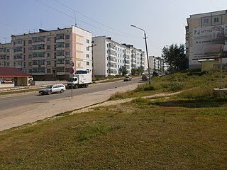
Nevelsk is a port town and the administrative center of Nevelsky District of Sakhalin Oblast, Russia, located on the southwest coast of the Sakhalin Island, 123 kilometers (76 mi) from Yuzhno-Sakhalinsk, the administrative center of the oblast. Population: 11,682 (2010 Census); 18,639 (2002 Census); 24,236 (1989 Census).
Makarov is a coastal town and the administrative center of Makarovsky District of Sakhalin Oblast, Russia, located on the eastern coast of the Sakhalin Island, 235 kilometers (146 mi) north of Yuzhno-Sakhalinsk. Population: 6,705 (2010 Census); 7,271 (2002 Census); 11,351 (1989 Census).

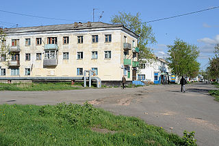
Smirnykh is an urban locality and the administrative center of Smirnykhovsky District of Sakhalin Oblast, Russia, located in the central part of the Sakhalin Island. Population: 7,399 (2010 Census); 7,561 (2002 Census); 9,693 (1989 Census).

Anivsky District is an administrative district (raion) of Sakhalin Oblast, Russia; one of the seventeen in the oblast. Municipally, it is incorporated as Anivsky Urban Okrug. It is located in the south of the oblast. The area of the district is 2,684.8 square kilometers (1,036.6 sq mi). Its administrative center is the town of Aniva. Population: 17,533 (2010 Census); 15,272 (2002 Census); 36,740 (1989 Census). The population of Aniva accounts for 52.0% of the district's total population.

Dolinsky District is an administrative district (raion) of Sakhalin Oblast, Russia; one of the seventeen in the oblast. Municipally, it is incorporated as Dolinsky Urban Okrug. It is located in the southeast of the oblast. The area of the district is 2,441.6 square kilometers (942.7 sq mi). Its administrative center is the town of Dolinsk. Population : 13,699 (2010 Census); 15,649 (2002 Census); 22,484 (1989 Census).

Kholmsky District is an administrative district (raion) of Sakhalin Oblast, Russia; one of the seventeen in the oblast. Municipally, it is incorporated as Kholmsky Urban Okrug. It is located in the southwest of the oblast. The area of the district is 2,279 square kilometers (880 sq mi). Its administrative center is the town of Kholmsk. Population : 10,988 (2010 Census); 14,672 (2002 Census); 20,498 (1989 Census).

Korsakovsky District is an administrative district (raion) of Sakhalin Oblast, Russia; one of the seventeen in the oblast. Municipally, it is incorporated as Korsakovsky Urban Okrug. It is located in the southeast of the oblast. The area of the district is 2,623.6 square kilometers (1,013.0 sq mi). Its administrative center is the town of Korsakov. Population : 7,885 (2010 Census); 8,684 (2002 Census); 10,501 (1989 Census).

See also: Kurilsky (disambiguation)

Makarovsky District is an administrative district (raion) of Sakhalin Oblast, Russia; one of the seventeen in the oblast. Municipally, it is incorporated as Makarovsky Urban Okrug. It is located in the southeast of the Island of Sakhalin. The area of the district is 2,148.4 square kilometers (829.5 sq mi). Its administrative center is the town of Makarov. Population: 8,579 (2010 Census); 9,774 (2002 Census); 14,993 (1989 Census). The population of Makarov accounts for 78.2% of the district's total population.

Nevelsky District is an administrative district (raion) of Sakhalin Oblast, Russia; one of the seventeen in the oblast. Municipally, it is incorporated as Nevelsky Urban Okrug. It is located in the southwest of the oblast and includes Moneron Island to the west, located in the south of the Tartary Strait. The area of the district is 1,445.4 square kilometers (558.1 sq mi). Its administrative center is the town of Nevelsk. Population : 5,876 (2010 Census); 8,225 (2002 Census); 13,972 (1989 Census).

Nogliksky District is an administrative district (raion) of Sakhalin Oblast, Russia; one of the seventeen in the oblast. Municipally, it is incorporated as Nogliksky Urban Okrug. It is located in the northeast of the Island of Sakhalin. The area of the district is 11,294.8 square kilometers (4,360.9 sq mi). Its administrative center is the urban locality of Nogliki. Population: 12,124 (2010 Census); 13,576 (2002 Census); 16,786 (1989 Census). The population of Nogliki accounts for 84.4% of the district's total population.
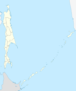
Okhinsky District is an administrative district (raion) of Sakhalin Oblast, Russia; one of the seventeen in the oblast. Municipally, it is incorporated as Okhinsky Urban Okrug. It is located in the north of the Island of Sakhalin. The area of the district is 14,815.87 square kilometers (5,720.44 sq mi). Its administrative center is the town of Okha. Population : 22,847 (2010 Census); 25,526 (2002 Census); 18,612 (1989 Census).

Poronaysky District is an administrative district (raion) of Sakhalin Oblast, Russia; one of the seventeen in the oblast. As a municipal division, it is incorporated as Poronaysky Urban Okrug. It is located in the eastern central part of the Island of Sakhalin. The area of the district is 7,280.2 square kilometers (2,810.9 sq mi). Its administrative center is the town of Poronaysk. Population : 21,686 (2010 Census); 10,857 (2002 Census); 17,977 (1989 Census).

Smirnykhovsky District is an administrative district (raion) of Sakhalin Oblast, Russia; one of the seventeen in the oblast. Municipally, it is incorporated as Smirnykhovsky Urban Okrug. It is located in the central part of the Island of Sakhalin. The area of the district is 10,457.43 square kilometers (4,037.64 sq mi). Its administrative center is the urban locality of Smirnykh. As of the 2010 Census, the total population of the district was 13,142, with the population of Smirnykh accounting for 56.3% of that number.

Tomarinsky District is an administrative district (raion) of Sakhalin Oblast, Russia; one of the seventeen in the oblast. Municipally, it is incorporated as Tomarinsky Urban Okrug. It is located in the southwest of the Island of Sakhalin. The area of the district is 3,169.3 square kilometers (1,223.7 sq mi). Its administrative center is the town of Tomari. Population: 9,457 (2010 Census); 11,678 (2002 Census); 17,823 (1989 Census). The population of Tomari accounts for 48.0% of the district's total population.

Tymovsky District is an administrative district (raion) of Sakhalin Oblast, Russia; one of the seventeen in the oblast. Municipally, it is incorporated as Tymovsky Urban Okrug. It is located in the center of the Island of Sakhalin. The area of the district is 6,312.7 square kilometers (2,437.3 sq mi). Its administrative center is the urban locality of Tymovskoye. Population: 16,212 (2010 Census); 19,099 (2002 Census); 25,774 (1989 Census). The population of Tymovskoye accounts for 48.5% of the district's total population.
Uglegorsky District is an administrative district (raion) of Sakhalin Oblast, Russia; one of the seventeen in the oblast. Municipally, it is incorporated as Uglegorsky Municipal District. It is located in the western central part of the Island of Sakhalin. The area of the district is 3,965.6 square kilometers (1,531.1 sq mi). Its administrative center is the town of Uglegorsk. Population: 12,156 (2010 Census); 16,804 (2002 Census); 28,022 (1989 Census).
Tymovskoye is an urban locality and the administrative center of Tymovsky District of Sakhalin Oblast, Russia, located in the central part of the Sakhalin Island on the right bank of the Tym River, about 450 kilometers (280 mi) north of Yuzhno-Sakhalinsk. Population: 7,855 (2010 Census); 8,532 (2002 Census); 10,869 (1989 Census).