San Luis, Batangas Last updated October 04, 2025 Municipality in Batangas, Philippines
Municipality in Calabarzon, Philippines
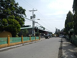
San Luis , officially the Municipality of San Luis (Tagalog : Bayan ng San Luis municipality in the province of Batangas , Philippines . According to the 2020 census, it has a population of 36,172 people. [ 5]
Etymology No reliable information could be gathered as to why the town is called San Luis. However, some people believe that it was named as such because it was established during the feast of Saint Louis . [ 6] [ 7]
History San Luis was historically part of Taal . It was established as an independent town on August 25, 1861. However, in 1903, [ 8] due to small income, the town was made a part of Taal once again, with all the barrios in existence retaining their names, while the town center (poblacion ) was reverted to its Spanish-era name Balibago. On February 2, 1918, San Luis was re-established. [ 9]
In 1961, the barrios of Pacifico and Sampa were separated from San Luis and annexed to the new municipality of Santa Teresita . [ 10]
Geography According to the Philippine Statistics Authority , the municipality has a land area of 42.56 square kilometers (16.43 sq mi) [ 11] , constituting 1.36% of the 3,119.75-square-kilometer (1,204.54 sq mi) total area of Batangas.
Barangays San Luis is politically subdivided into 26 barangays , as shown in the matrix below. [ 12] Each barangay consists of puroks and some have sitios .
PSGC Barangay Population ±% p.a. 2024 [ 13] 2010 [ 14] 041024001 Abiacao 3.1% 1,146 1,052 ▴ 0.59% 041024002 Bagong Tubig 4.9% 1,818 1,778 ▴ 0.15% 041024003 Balagtasin 1.5% 561 534 ▴ 0.34% 041024004 Balite 2.7% 997 942 ▴ 0.39% 041024005 Banoyo 6.2% 2,294 2,066 ▴ 0.73% 041024006 Boboy 4.1% 1,502 1,480 ▴ 0.10% 041024007 Bonliw 3.1% 1,145 1,002 ▴ 0.93% 041024008 Calumpang West 3.2% 1,186 1,081 ▴ 0.64% 041024009 Calumpang East 4.0% 1,464 1,430 ▴ 0.16% 041024010 Dulangan 7.8% 2,868 2,818 ▴ 0.12% 041024011 Durungao 1.8% 665 621 ▴ 0.48% 041024012 Locloc 1.2% 458 534 ▾ −1.06% 041024013 Luya 3.3% 1,229 1,063 ▴ 1.01% 041024014 Mahabang Parang 2.0% 734 602 ▴ 1.38% 041024015 Manggahan 2.7% 986 924 ▴ 0.45% 041024016 Muzon 5.7% 2,097 2,015 ▴ 0.28% 041024019 San Antonio 1.8% 656 624 ▴ 0.35% 041024020 San Isidro 5.2% 1,898 1,671 ▴ 0.89% 041024021 San Jose 1.9% 698 594 ▴ 1.12% 041024022 San Martin 1.7% 613 542 ▴ 0.86% 041024023 Santa Monica 3.2% 1,193 1,042 ▴ 0.94% 041024024 Taliba 4.5% 1,657 1,484 ▴ 0.77% 041024025 Talon 3.4% 1,238 1,124 ▴ 0.67% 041024026 Tejero 3.4% 1,258 1,068 ▴ 1.14% 041024027 Tungal 1.5% 558 487 ▴ 0.95% 041024028 Poblacion 6.1% 2,230 2,123 ▴ 0.34% Total 36,841 30,701 ▴ 1.27%
Climate Climate data for San Luis, Batangas Month Jan Feb Mar Apr May Jun Jul Aug Sep Oct Nov Dec Year Mean daily maximum °C (°F) 29 30 31 33 32 30 29 29 29 29 29 29 30 Mean daily minimum °C (°F) 20 20 21 22 24 24 24 24 24 23 22 21 22 Average precipitation mm (inches) 11 13 14 32 101 142 208 187 175 131 68 39 1,121 Average rainy days 5.2 5.0 7.4 11.5 19.8 23.5 27.0 25.9 25.2 23.2 15.5 8.3 197.5 Source: Meteoblue [ 15]
Demographics Population census of San Luis Year ±% p.a. 1903 5,316 — 1918 6,728 +1.58% 1939 8,464 +1.10% 1948 9,330 +1.09% 1960 12,290 +2.32% 1970 15,133 +2.10% 1975 16,884 +2.22% 1980 17,991 +1.28% 1990 22,143 +2.10% 1995 26,423 +3.37% 2000 26,924 +0.40% 2007 29,645 +1.34% 2010 30,701 +1.28% 2015 33,149 +1.47% 2020 36,172 +1.85% 2024 36,841 +0.44% Source: Philippine Statistics Authority [ 16] [ 17] [ 14] [ 18] [ 19]
In the 2020 census, San Luis had a population of 36,172. [ 20] The population density was 850 inhabitants per square kilometre (2,200/sq mi) .
Economy Poverty incidence of San Luis
Education The San Luis Schools District Office governs all educational institutions within the municipality. It oversees the management and operations of all private and public, from primary to secondary schools. [ 29]
Primary and elementary schools Abiacao Elementary School Balite Primary School Banoyo Elementary School Boboy Elementary School Bonliw Elementary School Calumpang East Primary School Calumpang Elementary School Durungao Primary School Locloc Elementary School Mahabang Parang Primary School Muzon Elementary School San Antonio Elementary School San Isidro Elementary School San Luis Academy San Luis Central School St. Blaise Community Academy Sta. Monica Elementary School Taliba Elementary School Talon Elementary School Tungal Elementary School Whiz Creative and Interactive Academy Secondary schools Banoyo National High School Luya Integrated School San Luis Senior High School Sta. Monica National High School References ↑ Municipality of San Luis | (DILG) ↑ "2015 Census of Population, Report No. 3 – Population, Land Area, and Population Density" (PDF) . Philippine Statistics Authority . Quezon City, Philippines. August 2016. ISSN 0117-1453 . Archived (PDF) from the original on May 25, 2021. Retrieved July 16, 2021 . ↑ "2024 Census of Population (POPCEN) Population Counts Declared Official by the President" . Philippine Statistics Authority. 17 July 2025. Retrieved 18 July 2025 . ↑ "PSA Releases the 2021 City and Municipal Level Poverty Estimates" . Philippine Statistics Authority. 2 April 2024. Retrieved 28 April 2024 . ↑ "2024 Census of Population (POPCEN) Population Counts Declared Official by the President" . Philippine Statistics Authority. 17 July 2025. Retrieved 18 July 2025 . ↑ "San Luis, Batangas: Historical Data" . Batangas History . January 4, 2018. Retrieved March 1, 2022 . ↑ Transcribed from “History and Cultural Life of the Town of San Luis, Batangas,” 1953, online at the National Library of the Philippines Digital Collections. ↑ Act No. 708 (March 28, 1903), An Act Reducing Thirteen of the Municipalities in the Province of Batangas to Five , retrieved July 5, 2023 [ permanent dead link ] ↑ "History" . San Luis Batangas. Archived from the original on August 9, 2021. Retrieved August 9, 2021 . ↑ Executive Order No. 454, s. 1961 (December 28, 1961), "Creating the municipality of Sta. Teresita in the Province of Batangas" , Official Gazette of the Republic of the Philippines , retrieved February 14, 2023 ↑ "Province:" . PSGC Interactive . Quezon City, Philippines: Philippine Statistics Authority . Retrieved 25 August 2025 . ↑ "Municipal: San Luis, Batangas" . PSGC Interactive . Quezon City, Philippines: Philippine Statistics Authority . Retrieved 8 January 2016 . ↑ Census of Population (2020). "Region IV-A (Calabarzon)" . Total Population by Province, City, Municipality and Barangay . Philippine Statistics Authority . Retrieved 8 July 2021 . 1 2 Census of Population and Housing (2010). "Region IV-A (Calabarzon)" (PDF) . Total Population by Province, City, Municipality and Barangay . National Statistics Office . Retrieved 29 June 2016 . ↑ "San Luis: Average Temperatures and Rainfall" . Meteoblue. Retrieved 5 May 2020 . ↑ "2024 Census of Population (POPCEN) Population Counts Declared Official by the President" . Philippine Statistics Authority. 17 July 2025. Retrieved 18 July 2025 . ↑ Census of Population (2015). "Region IV-A (Calabarzon)" . Total Population by Province, City, Municipality and Barangay . Philippine Statistics Authority . Retrieved 20 June 2016 . ↑ Censuses of Population (1903–2007). "Region IV-A (Calabarzon)" . Table 1. Population Enumerated in Various Censuses by Province/Highly Urbanized City: 1903 to 2007 National Statistics Office . ↑ "Province of" . Municipality Population Data . Local Water Utilities Administration Research Division. Retrieved 17 December 2016 . ↑ "2024 Census of Population (POPCEN) Population Counts Declared Official by the President" . Philippine Statistics Authority. 17 July 2025. Retrieved 18 July 2025 . ↑ "Poverty incidence (PI):" . Philippine Statistics Authority. Retrieved December 28, 2020 . ↑ "Estimation of Local Poverty in the Philippines" (PDF) . Philippine Statistics Authority. 29 November 2005. ↑ "2003 City and Municipal Level Poverty Estimates" (PDF) . Philippine Statistics Authority. 23 March 2009. ↑ "City and Municipal Level Poverty Estimates; 2006 and 2009" (PDF) . Philippine Statistics Authority. 3 August 2012. ↑ "2012 Municipal and City Level Poverty Estimates" (PDF) . Philippine Statistics Authority. 31 May 2016. ↑ "Municipal and City Level Small Area Poverty Estimates; 2009, 2012 and 2015" . Philippine Statistics Authority. 10 July 2019. ↑ "PSA Releases the 2018 Municipal and City Level Poverty Estimates" . Philippine Statistics Authority. 15 December 2021. Retrieved 22 January 2022 . ↑ "PSA Releases the 2021 City and Municipal Level Poverty Estimates" . Philippine Statistics Authority. 2 April 2024. Retrieved 28 April 2024 . ↑ "Masterlist of Schools" (PDF) . Department of Education . January 15, 2021. Retrieved October 3, 2025 . External links
Places adjacent to San Luis, Batangas
This page is based on this
Wikipedia article Text is available under the
CC BY-SA 4.0 license; additional terms may apply.
Images, videos and audio are available under their respective licenses.