Malvar

Last updated
Malvar
Municipality of Malvar
President J.P. Laurel Hway, Malvar, Batangas, Apr 2024.jpg
President J.P. Laurel Highway in Malvar
Malvar Batangas.png
Ph locator batangas malvar.svg
Map of Batangas with Malvar highlighted
OpenStreetMap
Malvar
Philippines location map (square).svg
Red pog.svg
Malvar
Location within the Philippines
Coordinates: 14°02′30″N121°09′30″E / 14.0417°N 121.1583°E / 14.0417; 121.1583
Country Philippines
Region Calabarzon
Province Batangas
District 3rd district
Founded January 10, 1919
Named for Miguel Malvar
Barangays 15 (see Barangays)
Government
[1]
  Type Sangguniang Bayan
   Mayor Cristeta C. Reyes
   Vice Mayor Alberto C. Lat
   Representative Ma. Theresa V. Collantes
   Municipal Council
Members
   Electorate 38,118 voters (2022)
Area
[2]
  Total33.00 km2 (12.74 sq mi)
Elevation
213 m (699 ft)
Highest elevation
354 m (1,161 ft)
Lowest elevation
24 m (79 ft)
Population
 (2020 census) [3]
  Total64,379
  Density2,000/km2 (5,100/sq mi)
   Households
17,064
Economy
   Income class 2nd municipal income class
   Poverty incidence
9.40
% (2018) [4]
   Revenue 388.1 million (2020)
   Assets 1,259 million (2020)
   Expenditure 204.1 million (2020)
   Liabilities 159.9 million (2020)
Service provider
  ElectricityBatangas 2 Electric Cooperative (BATELEC 2)
Time zone UTC+8 (PST)
ZIP code
4233
PSGC
IDD : area code +63(0)43
Native languages Tagalog
Website www.malvarbatangas.gov.ph

Malvar, officially the Municipality of Malvar (Tagalog : Bayan ng Malvar), is a 2nd class municipality in the province of Batangas, Philippines.

Contents

Located 37 kilometers (23 mi) from Batangas City and 68 kilometers (42 mi) south of Manila and accessible by the STAR Tollway, Malvar is surrounded by Tanauan City to the north, Santo Tomas City to the east, Lipa City to the south and Balete to the west. With the expansion of Metro Manila, Malvar is now part of the Manila conurbation (which reaches Lipa City).

Etymology

The municipality was named after General Miguel Malvar, a native of Santo Tomas, Batangas and one of the last Filipino generals to surrender to the Americans during the Philippine-American War in 1902.

Its previous name before it became a municipality is Luta, derived from the name of Dayangdayang Luta, the youngest daughter of Datu Banga (a descendant of Datu Puti), who ruled the area. She was the most beautiful lady in the place who was loved and cherished by the inhabitants. She fell in love with a Chinese named Ling and was about to be married when her elder sister Kampupot took interest in him. However, out of the treachery and jealousy of her sister, she was executed and died in the arms of her Chinese lover. From then on, the place was named Luta in her honor. [5]

History

Aerial view of Malvar, circa 1930s Philippine Island - Luzon Island - NARA - 68156885.jpg
Aerial view of Malvar, circa 1930s

Malvar traces its origin to Luta, which was once a barrio of Lipa. According to Ferdinand Blumentritt who wrote many articles about Philippine history which were published in Boletin de la Sociedad Geografica in Madrid, Spain in 1866, Malvar's history dates back to the 13th century when Datu Puti, one of the ten legendary datus who escaped from Sultan Makatunao of Borneo, settled in what is now the province of Batangas. His descendants inhabited present-day Laguna, Cavite, Bicol, and Luta.

Luta's march toward becoming a municipality could never be ignored. For this is where the seeds and the sentiments of becoming one were sown. This is where the Samahang Mag-aararo, the acknowledged pioneers of this movement was organized. They were Mariano R. Lat, Gregorio Leviste, Miguel L. Aranda, Simeon Esleigue, Constancio Manalo, Pedro Lat-Torres, Nicasio Gutierrez, Gregorio Villapando, Estanislaw Lat, Pelagio Wagan, Sebastian Trinidad and Julian Lantin. Through its dynamic organizers and members, the first steps to make the locality a municipality were made. It was in Luta where the seat of the Municipal Government was situated. [5]

With their (The Samahang Mag-aararo) devotion, patience, and perseverance and with the help of the Interior Secretary Teodoro Kalaw, Malvar was finally created a municipality by an executive order issued by acting Governor-General Charles Yeater on December 16, 1918. The proclamation took effect on January 10, 1919, the day the municipality was inaugurated. [6] It initially included the adjoining barrios of Payapa, Kalikangan (Caligañgan), San Gallo (San Galo), and Bilukaw. As time went by, these original barrios were divided and were given other names. Payapa was divided and became San Fernando, Santiago, and Bagong Pook. Kalikakan became the barrios of San Andres and San Juan. San Gallo became the barrios of San Pioquinto, San Pedro (including Sitio Calejon) and Bilucaw became San Isidro and Bilucao. These names given to each barrio were based on the names of the locality's most powerful or honored man.
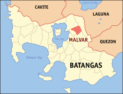
Geography

Malvar is located at 14°02′30″N121°09′30″E / 14.0417°N 121.1583°E / 14.0417; 121.1583 .

According to the Philippine Statistics Authority, the municipality has a land area of 33.00 square kilometers (12.74 sq mi) [7] constituting

Barangays

Malvar is politically subdivided into 15 barangays. [8] Each barangay consists of puroks and some have sitios.

PSGC Barangay Population ±% p.a.
2020 [3] 2010 [9]
041017001 Bagong Pook 3.2% 2,049 1,932 0.59%
041017002 Bilucao (San Isidro Western) 2.9% 1,842 1,587 1.50%
041017003 Bulihan 3.6% 2,311 1,472 4.61%
041017004 San Gregorio 2.1% 1,336 1,138 1.62%
041017005 Luta del Norte 6.2% 3,989 3,053 2.71%
041017006 Luta del Sur 7.2% 4,661 3,685 2.38%
041017008 Poblacion 11.9% 7,632 7,049 0.80%
041017012 San Andres 4.8% 3,074 2,869 0.69%
041017013 San Fernando 8.5% 5,446 4,349 2.27%
041017015 San Isidro East 2.5% 1,603 1,524 0.51%
041017016 San Juan 4.8% 3,069 2,907 0.54%
041017017 San Pedro II (Western) 3.1% 1,988 1,499 2.86%
041017018 San Pedro I (Eastern) 3.8% 2,448 1,681 3.83%
041017019 San Pioquinto 11.0% 7,068 5,227 3.06%
041017020 Santiago 12.0% 7,754 5,980 2.63%
Total64,37945,9523.43%

Climate

Climate data for Malvar
MonthJanFebMarAprMayJunJulAugSepOctNovDecYear
Mean daily maximum °C (°F)27
(81)
29
(84)
30
(86)
32
(90)
30
(86)
29
(84)
28
(82)
27
(81)
27
(81)
28
(82)
28
(82)
27
(81)
29
(83)
Mean daily minimum °C (°F)19
(66)
19
(66)
19
(66)
21
(70)
23
(73)
23
(73)
23
(73)
23
(73)
23
(73)
22
(72)
20
(68)
19
(66)
21
(70)
Average precipitation mm (inches)11
(0.4)
13
(0.5)
14
(0.6)
32
(1.3)
101
(4.0)
142
(5.6)
208
(8.2)
187
(7.4)
175
(6.9)
131
(5.2)
68
(2.7)
39
(1.5)
1,121
(44.3)
Average rainy days5.25.07.411.519.823.527.025.925.223.215.58.3197.5
Source: Meteoblue [10]

Demographics

Population census of Malvar
YearPop.±% p.a.
1939 6,637    
1948 7,787+1.79%
1960 10,313+2.37%
1970 14,169+3.22%
1975 15,584+1.93%
1980 18,028+2.96%
1990 24,253+3.01%
1995 27,771+2.57%
2000 32,691+3.56%
2007 41,730+3.42%
2010 45,952+3.57%
2015 56,270+3.93%
2020 64,379+2.68%
Source: Philippine Statistics Authority [11] [9] [12] [13]

In the 2020 census, Malvar had a population of 64,379. [3] The population density was 2,000 inhabitants per square kilometer (5,200/sq mi).

Economy

Government

Local government

Municipal hall Malvar Municipal Hall, Batangas, Apr 2024.jpg
Municipal hall

List of chief executive

  1. Gregorio Leviste: 1919-1922
  2. Simeon Esleigue: 1922-1924
  3. Julio Leviste: 1924-1930
  4. Benito Leviste: 1930–1939, 1945-1950
  5. Trinidad Leviste: 1939-1941
  6. Angel Leviste: 1941-1942
  7. Fidel Leviste: 1942-1944
  8. Eustacio Endaya: 1944–1945,1968-1980
  9. Benito Leviste: 1930–1939, 1945-1950
  10. Pedro Lat: 1951-1955
  11. Pedro Montecer: 1955-1959
  12. Isabelo Navarro: 1959 [21] -1967
  13. Eustacio Endaya: 1944–1945,1968-1980
  14. Fermin Malabanan: 1980
  15. Maximo Reyes: 1980-1986
  16. Patricio Villegas: 1986-1998
  17. Teodora Villegas: 1998-2001
  18. Cristeta C. Reyes: 2001-2010
  19. Carlito D. Reyes, MD: 2010-2016
  20. Cristeta C. Reyes: 2016-2018
  21. Alberto C. Lat: 2018-2019
  22. Cristeta C. Reyes: 2019–present

Education

Malvar National High School BSUJPLPCjf7877 05.JPG
Malvar National High School

Health

Apart from the primary Rural Health Unit under DOH-Batangas, Mayor Carlito Reyes founded the Malvar Maternity Clinic a month after taking office[ when? ]. The clinic accepts emergency deliveries and is open 24 hours daily for obstetric and other immediate health services. The clinic has doctors on duty from 7 am to 11 pm on weekdays and around the clock on weekends. RHU personnel serve during the day. Nurses are on duty 24 hours daily, and a midwife is on duty on weeknights. An ambulance is available for patient transfers, and all services are free of charge.

Tourism

Immaculate Conception Parish Church Immaculate Conception Church, Malvar, Batangas, Apr 2024.jpg
Immaculate Conception Parish Church
Miguel Malvar Monument Miguel Malvar Monument, Malvar, Batangas, Apr 2024 (1).jpg
Miguel Malvar Monument

Calejon Falls, in Barangay San Gregorio (formerly known as Calejon), consists of two large waterfalls and two smaller ones. One of the larger falls is about 10 feet (3.0 m) high, with clear water falling into a shallow pool. One of the smaller falls is shower-like, while the other forms a series of small cascades. All the falls are in an area of about 300 square meters (360 sq yd).

The falls are located at the STAR Tollway Bulihan exit. From Manila, buses to Batangas City or Lipa City stop at Malvar. Jeepneys and tricycle service are also available from the town. The 5-kilometer (3.1 mi) stretch of road is smoothly paved. There are 300 concrete steps down the river at the falls.

The San Juan River, the longest river in Batangas, connects Lipa, and Tanauan and Santo Tomas and is a water source for vegetable and fish farms.

A recently emerged local attraction in the area is a mango farm known as Sa Manggahan. [22] [ non-primary source needed ] Forty-five minutes away from Alabang, it is near the C-Joist Concrete Ventures Group plant. The country's third Thoroughbred race track (Metro Manila Turf Club Race Track) is in the municipality, as are the Immaculate Conception Parish Church of Malvar and the Miguel Malvar Monument at the Municipal Hall Grounds. The fiesta is celebrated every January 10.

Malvar is slowly establishing its reputation as a conference center in Batangas. In February 2013, the Lima Park Pavilion opened to the public with a concert by the Madrigal Singers. With a capacity of 1,000 the Lima Park Pavilion and Lima Park Hotel are located in Malvar's industrial park, the Lima Technology Center.

Landmarks

MMTCIjf8235 14.JPG
Metro Manila Turf Club Race Track panorama

Notable personalities

See also

Related Research Articles

<span class="mw-page-title-main">Candelaria, Quezon</span> Municipality in Quezon, Philippines

Candelaria, officially the Municipality of Candelaria, is a 1st class municipality in the province of Quezon, Philippines. According to the 2020 census, it has a population of 137,881 people.

<span class="mw-page-title-main">Batangas City</span> Capital of Batangas, Philippines

Batangas City, officially the City of Batangas, is a 1st class component city and capital of the province of Batangas, Philippines. According to the 2020 census, it has a population of 351,437 people.

<span class="mw-page-title-main">Lipa, Batangas</span> Component city in Batangas, Philippines

Lipa, officially the City of Lipa, is a 1st class component city in the province of Batangas, Philippines. According to the 2020 census, it has a population of 372,931 people.

<span class="mw-page-title-main">Alaminos, Laguna</span> Municipality in Laguna, Philippines

Alaminos, officially the Municipality of Alaminos, is a 3rd class municipality in the province of Laguna, Philippines. According to the 2020 census, it has a population of 51,619 people.

<span class="mw-page-title-main">Talisay, Batangas</span> Municipality in Batangas, Philippines

Talisay, officially the Municipality of Talisay, is a 3rd class municipality in the province of Batangas, Philippines. According to the 2020 census, it has a population of 46,238 people.

<span class="mw-page-title-main">Silang, Cavite</span> Municipality in Cavite, Philippines

Silang, officially the Municipality of Silang, formerly known as Silan during the Spanish colonial era, is a 1st class urban municipality in the province of Cavite, Philippines. According to the 2020 census, it has a population of 295,644 people.

<span class="mw-page-title-main">Tanauan, Batangas</span> Component city in Batangas, Philippines

Tanauan, officially the City of Tanauan, is a 1st class component city in the province of Batangas, Philippines. According to the 2020 census, it has a population of 193,936 people.

<span class="mw-page-title-main">Agoncillo, Batangas</span> Municipality in Batangas, Philippines

Agoncillo, officially the Municipality of Agoncillo, is a 4th class municipality in the province of Batangas, Philippines. According to the 2020 census, it has a population of 39,101 people.

<span class="mw-page-title-main">Balete, Batangas</span> Municipality in Batangas, Philippines

Balete, officially the Municipality of Balete, is a 5th class municipality in the province of Batangas, Philippines. According to the 2020 census, it has a population of 24,055 people. The people from Balete is called Baleteños.

<span class="mw-page-title-main">Ibaan</span> Municipality in Batangas, Philippines

Ibaan, officially the Municipality of Ibaan, is a 2nd class municipality in the province of Batangas, Philippines. According to the 2020 census, it has a population of 58,507 people.

<span class="mw-page-title-main">Laurel, Batangas</span> Municipality in Batangas, Philippines

Laurel, officially the Municipality of Laurel, is a 3rd class municipality in the province of Batangas, Philippines. According to the 2020 census, it has a population of 43,210 people.

<span class="mw-page-title-main">Lemery, Batangas</span> Municipality in Batangas, Philippines

Lemery, officially the Municipality of Lemery, is a 1st class municipality in the province of Batangas, Philippines. According to the 2020 census, it has a population of 93,186 people.

<span class="mw-page-title-main">Lian, Batangas</span> Municipality in Batangas, Philippines

Lian, officially the Municipality of Lian, is a 3rd class municipality in the province of Batangas, Philippines. According to the 2020 census, it has a population of 56,280 people.

<span class="mw-page-title-main">Rosario, Batangas</span> Municipality in Batangas, Philippines

Rosario, officially the Municipality of Rosario, is a 1st class municipality in the province of Batangas, Philippines. According to the 2020 census, it has a population of 128,352 people.

<span class="mw-page-title-main">San Juan, Batangas</span> Municipality in Batangas, Philippines

San Juan, officially the Municipality of San Juan, is a 1st class municipality in the province of Batangas, Philippines. According to the 2020 census, it has a population of 114,068 people.

<span class="mw-page-title-main">Santo Tomas, Batangas</span> Component city in Batangas, Philippines

Santo Tomas, officially the City of Santo Tomas, is a 1st class component city in the province of Batangas, Philippines. According to the 2020 census, it has a population of 218,500 people.

<span class="mw-page-title-main">Lucban</span> Municipality in Quezon, Philippines

Lucban, officially the Municipality of Lucban, is a 2nd class municipality in the province of Quezon, Philippines. According to the 2020 census, it has a population of 53,091 people.

<span class="mw-page-title-main">San Antonio, Quezon</span> Municipality in Quezon, Philippines

San Antonio, officially the Municipality of San Antonio, is a 4th class municipality in the province of Quezon, Philippines. According to the 2020 census, it has a population of 35,891 people.

<span class="mw-page-title-main">Tiaong</span> Municipality in Quezon, Philippines

Tiaong, officially the Municipality of Tiaong, is a first-class municipality in the province of Quezon, Philippines. According to the 2020 census, it has a population of 106,265 people.

<span class="mw-page-title-main">Unisan, Quezon</span> Municipality in Quezon, Philippines

Unisan, officially the Municipality of Unisan, is a 4th class municipality in the province of Quezon, Philippines. According to the 2020 census, it has a population of 25,448 people.

References

  1. Municipality of Malvar | (DILG)
  2. "2015 Census of Population, Report No. 3 – Population, Land Area, and Population Density" (PDF). Philippine Statistics Authority. Quezon City, Philippines. August 2016. ISSN   0117-1453. Archived (PDF) from the original on May 25, 2021. Retrieved July 16, 2021.
  3. 1 2 3 Census of Population (2020). "Region IV-A (Calabarzon)". Total Population by Province, City, Municipality and Barangay. Philippine Statistics Authority . Retrieved 8 July 2021.
  4. "PSA Releases the 2018 Municipal and City Level Poverty Estimates". Philippine Statistics Authority. 15 December 2021. Retrieved 22 January 2022.
  5. 1 2 "History | Municipality of Malvar, Batangas" . Retrieved 2021-02-24.
  6. Executive Order No. 56 (16 December 1918), Creating the Municipality of Malvar , retrieved July 7, 2023
  7. "Province: Batangas". PSGC Interactive. Quezon City, Philippines: Philippine Statistics Authority . Retrieved 12 November 2016.
  8. "Municipal: Malvar". PSGC Interactive. Quezon City, Philippines: Philippine Statistics Authority . Retrieved 8 January 2016.
  9. 1 2 Census of Population and Housing (2010). "Region IV-A (Calabarzon)" (PDF). Total Population by Province, City, Municipality and Barangay. National Statistics Office . Retrieved 29 June 2016.
  10. "Malvar: Average Temperatures and Rainfall". Meteoblue. Retrieved May 5, 2020.
  11. Census of Population (2015). "Region IV-A (Calabarzon)". Total Population by Province, City, Municipality and Barangay. Philippine Statistics Authority . Retrieved 20 June 2016.
  12. Censuses of Population (1903–2007). "Region IV-A (Calabarzon)". Table 1. Population Enumerated in Various Censuses by Province/Highly Urbanized City: 1903 to 2007. National Statistics Office.{{cite encyclopedia}}: CS1 maint: numeric names: authors list (link)
  13. "Province of Batangas". Municipality Population Data. Local Water Utilities Administration Research Division. Retrieved 17 December 2016.
  14. "Poverty incidence (PI):". Philippine Statistics Authority. Retrieved December 28, 2020.
  15. "Estimation of Local Poverty in the Philippines" (PDF). Philippine Statistics Authority. 29 November 2005.
  16. "2003 City and Municipal Level Poverty Estimates" (PDF). Philippine Statistics Authority. 23 March 2009.
  17. "City and Municipal Level Poverty Estimates; 2006 and 2009" (PDF). Philippine Statistics Authority. 3 August 2012.
  18. "2012 Municipal and City Level Poverty Estimates" (PDF). Philippine Statistics Authority. 31 May 2016.
  19. "Municipal and City Level Small Area Poverty Estimates; 2009, 2012 and 2015". Philippine Statistics Authority. 10 July 2019.
  20. "PSA Releases the 2018 Municipal and City Level Poverty Estimates". Philippine Statistics Authority. 15 December 2021. Retrieved 22 January 2022.
  21. Philippine News Agency (November 14, 1959). "Liberals win 5 more seats". The Manila Times . The Manila Times Publishing Company, Inc. Isabelo Navarro, Nacionalista, wrested the local mayoralty seat from incumbent mayor Pedro Montecer.
  22. "Sa Manggahan Leisure Farms, Barangay San Pioquinto, Malvar, Batangas". Samanggahan.com. Archived from the original on April 5, 2012. Retrieved 2011-09-27.