Santa Teresita, officially the Municipality of Santa Teresita (Tagalog: Bayan ng Santa Teresita), is a municipality in the province of Batangas, Philippines. According to the 2020 census, it has a population of 21,559 people.[7]
On December 28, 1961, the barrios of Sambat, Sinipian, Bihis, Calayaan, Irukan and Cutang Cawayan from the municipality of Taal; Calumala, Tambo, Saimsim and Burol from the municipality of San Nicolas; and Pacifico and Sampa from the municipality of San Luis were separated and constituted into a new and separate municipality known as Santa Teresita, by virtue of Executive Order No. 454 signed by President Carlos P. Garcia.[1]
Ireneo Aquino was appointed as its first municipal mayor, serving until June 1962. In 1971, barangay Antipolo was established as a separate barangay out of barangay Sinipian, as well as barangay Cuta East, which was separated from barangay Cutang Cawayan.[9]
According to the Philippine Statistics Authority, the municipality has a land area of 16.30 square kilometers (6.29sqmi)[10] constituting 0.52% of the 3,119.75-square-kilometer (1,204.54sqmi) total area of Batangas.
Santa Teresita is 17 kilometers (11mi) from Batangas City and 122 kilometers (76mi) from Manila.
Barangays
Santa Teresita is politically subdivided into 17 barangays, as shown in the matrix below.[11] Each barangay consists of puroks and some have sitios.
Currently, there are 3 barangays which are classified as urban.
The Santa Teresita Schools District Office governs all educational institutions within the municipality. It oversees the management and operations of all private and public, from primary to secondary schools.[28]
Primary and elementary schools
Burol Elementary School
Calumala Elementary School
Jorge M. Atienza Elementary School
Irukan-Kalayaan Elementary School
Mohon Elementary School
Saimsim Elementary School
Sta. Teresita Central School
Tambo Elementary School
Secondary schools
Sampa-Pacifico Integrated School
St. Therese Catholic School Batangas
Sta. Teresita National High School
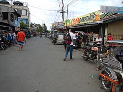
Gallery
Welcome arch
Old municipal hall
Downtown
ArchdiocesanShrine of SaintTherese of the ChildJesus and of the HolyFace
This page is based on this Wikipedia article Text is available under the CC BY-SA 4.0 license; additional terms may apply. Images, videos and audio are available under their respective licenses.