San Sebastián District, Cusco

Last updated
San Sebastián District
District
Country Flag of Peru.svg  Peru
Region Cusco
Province Cusco
Capital San Sebastián
Government
   Mayor Jorge Isaacs Acurio Tito
Area
  Total 89.44 km2 (34.53 sq mi)
Elevation 3,244 m (10,643 ft)
Population (2005 census)
  Total 85,472
  Density 960/km2 (2,500/sq mi)
Time zone PET (UTC-5)
UBIGEO 080105
Website munisansebastian.gob.pe

San Sebastián District is one of eight districts of the Cusco Province in Peru. [1] [2]

Districts of Peru third level administrative subdivision of Peru

The districts of Peru are the third-level country subdivisions of Peru. They are subdivisions of the provinces, which in turn are subdivisions of the larger regions or departments. There are 1,838 districts in total.

Cusco Province Province in Cusco, Peru

Cusco Province is the smallest of thirteen provinces in the Cusco Region in the southern highlands of Peru.

Peru republic in South America

Peru, officially the Republic of Peru, is a country in western South America. It is bordered in the north by Ecuador and Colombia, in the east by Brazil, in the southeast by Bolivia, in the south by Chile, and in the west by the Pacific Ocean. Peru is a megadiverse country with habitats ranging from the arid plains of the Pacific coastal region in the west to the peaks of the Andes mountains vertically extending from the north to the southeast of the country to the tropical Amazon Basin rainforest in the east with the Amazon river.

Contents

Geography

One of the highest peaks of the district is Anawarkhi at 4,050 m (13,290 ft). Other mountains are listed below: [3]


Archaeology

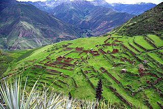
Some of the most important archaeological sites of the district are Chuqik'iraw Pukyu, Inkill Tampu, Pumamarka, Puqin Kancha, Qullqapampa, Rumiwasi and Wayna Tawqaray.

Pumamarka (Aymara and Quechua puma cougar, puma, marka village, "puma village", is an archaeological park in Peru. It is located in the Cusco Region, Cusco Province, San Sebastián District, on the left side of the river Pumamarka. The site was declared a National Cultural Heritage of Peru by the National Institute of Culture.

Puqin Kancha is an archaeological site near Cusco in Peru. It is situated in the Cusco Region, Cusco Province, San Sebastián District. The site consists of a wall on the mountain Puqin (Puquin). Puqin Kancha is protected by the Peruvian state by General Law No. 28296.

Qullqapampa is an archaeological site in Peru. It is situated in the Cusco Region, Cusco Province, San Sebastián District.

Related Research Articles

The Ccatca District is one of the twelve districts in the Quispicanchi Province in Peru. Its capital is the town of Ccatca.

Cusco District District in Cusco, Peru

Cusco is a district in the northern Cusco Province within the Cusco Region of Peru. It is bordered by districts of Ccorca and Poroy on the west, the provinces of Anta, the Calca, and Urubamba on the north, the San Jerónimo District on the east, and the districts of Santiago and San Sebastián to the south.

Coya District District in Cusco, Peru

Coya District is one of eight districts of the Calca Province in the Cusco Region of Peru.
Lamay District District in Cusco, Peru

Lamay District is one of eight districts of the province Calca in Peru.

San Salvador District District in Cusco, Peru

San Salvador District is one of eight districts of the province Calca in Peru.

Taray District District in Cusco, Peru

Taray District is one of eight districts of the Calca Province in the Cusco Region in Peru. Its seat is Taray. The town lies near Pisac, southwest of it, at a stream called Pawayuq (Pahuayoc), an affluent of Willkanuta River.

San Pedro District is one of eight districts of the province Canchis in Peru.

San Jerónimo District is one of eight districts of the Cusco Province in Peru. It is home to the Universidad Andina del Cusco. According to the 2007 census, there are 31,687 residents in the district. A large part of the population communicates in Quechua.

Santiago District is one of eight districts of the Cusco Province in Peru.

Wanchaq District is one of eight districts of the province Cusco in Peru. It includes Avenida de la Cultura, and Avenida de los Incas. It is home to 2 hospitals, and borders the district of San Sebastian.

Accha District is one of nine districts of the province Paruro in Peru.

Caicay District is one of six districts of the province Paucartambo in Peru.

Rumiwasi or Phaqchayuq is an archaeological site in Peru. It is located in the Cusco Region, Cusco Province, San Sebastián District, north of the central square of San Sebastián.

Inkilltambo

Inkilltambo,Inquilltambo,Inquiltambo or Inkill Tampu is an archaeological site in Peru. It is situated in the Cusco Region, Cusco Province, San Sebastián District.
Colcampata

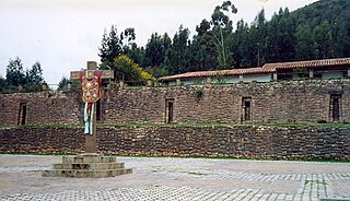
Colcampata is an archaeological site in Peru. It is situated in the Cusco Region, Cusco Province, Cusco District.

Wanakawri (Cusco) mountain in Peru

Wanakawri is an archaeological site and a legendary mountain in Peru. It is situated in the Cusco Region, Cusco Province, in the districts San Jerónimo and San Sebastián, and in the Paruro Province, Yaurisque District. The mountain with the archaeological remains is 4,089 metres (13,415 ft) high and one of the highest elevations near Cusco.

Choquequirao Puquio

Choquequirao Puquio is an archaeological site in Peru. It is situated in the Cusco Region, Cusco Province, San Sebastián District, north of San Sebastián.

Intiyuq K'uchu is an archaeological site in Peru with rock paintings. It is located in the Cusco Region, Calca Province, Lamay District. Intiyuq K'uchu is situated at a height of about 3,800 metres (12,467 ft).

Wayna Tawqaray

Wayna Tawqaray is an archaeological site in Peru. It is located in the Cusco Region, Cusco Province, San Sebastián District, about 5 km southeast of the center of Cusco. Wayna Tawqaray is situated at a height of about 3,600 metres (11,811 ft) on the slope of the mountain Tawqaray (Taucaray). The mountain with the archaeological remains lies southeast of the mountain Araway Qhata and the hill Muyu Urqu, above the river Watanay.

References

  1. (in Spanish) Instituto Nacional de Estadística e Informática. Banco de Información Distrital Archived 2008-04-23 at the Wayback Machine .. Retrieved April 11, 2008.
  2. Neil Edward Schlecht - Frommer's Peru Day by Day -2012 - Page 217 San Sebastián
  3. escale.minedu.gob.pe/ UGEL map Cusco Province (Cusco Region)

Coordinates: 13°32′10″S71°55′34″W / 13.5362°S 71.9261°W / -13.5362; -71.9261

Geographic coordinate system Coordinate system

A geographic coordinate system is a coordinate system that enables every location on Earth to be specified by a set of numbers, letters or symbols. The coordinates are often chosen such that one of the numbers represents a vertical position and two or three of the numbers represent a horizontal position; alternatively, a geographic position may be expressed in a combined three-dimensional Cartesian vector. A common choice of coordinates is latitude, longitude and elevation. To specify a location on a plane requires a map projection.