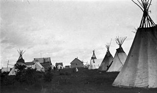
The Cree are a North American Indigenous people. They live primarily in Canada, where they form one of the country's largest First Nations.

Pierre Gaultier de Varennes, sieur de La Vérendrye was a French Canadian military officer, fur trader, and explorer. In the 1730s, he and his four sons explored the area west of Lake Superior and established trading posts there. They were part of a process that added Western Canada to the original New France territory that was centred along the Saint Lawrence basin.

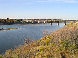
The Saskatchewan River is a major river in Canada. It stretches about 550 kilometres (340 mi) from where it is formed by the joining together of the North Saskatchewan River and South Saskatchewan River just east of Prince Albert, Saskatchewan, to Lake Winnipeg. It flows roughly eastward across Saskatchewan and Manitoba to empty into Lake Winnipeg. Through its tributaries the North Saskatchewan and South Saskatchewan, its watershed encompasses much of the prairie regions of Canada, stretching westward to the Rocky Mountains in Alberta and north-western Montana in the United States.
Anthony Henday was one of the first Europeans to explore the interior of what would eventually become western Canada. He ventured farther westward than any white man had before him. As an employee of the Hudson's Bay Company, he travelled across the prairies in the 1750s, journeyed into what is now central Alberta, and possibly arrived at the present site of Red Deer. He camped along the North Saskatchewan River, perhaps on the present site of Rocky Mountain House or Edmonton, and is said to have been the first European to see the Rocky Mountains, if only from a distance.

Louis-Joseph Gaultier de La Vérendrye was a French Canadian fur trader and explorer. He, his three brothers, and his father Pierre La Vérendrye pushed trade and exploration west from the Great Lakes. He, his brother, and two colleagues are thought to be the first Europeans to have crossed the northern Great Plains and seen the Rocky Mountains in Wyoming.
Fort La Jonquière was a French fort built along the Saskatchewan River in the spring of 1751. It was purported to have been the furthest west outpost of New France. The fort was named after the Governor General of New France at the time, Jacques-Pierre de Taffanel de la Jonquière, Marquis de la Jonquière, by Jacques Legardeur de Saint-Pierre, western commander of the French (1750-1753). There is no surviving record of its exact location, nor physical evidence, but it was most likely located near Nipawin, Saskatchewan.

Fort de la Corne was one of the two French forts established on the Saskatchewan River in the 20 years between the end of La Vérendrye's push west from Lake Superior in 1731–1743 and the fall of New France in 1763.

Fort Carlton was a Hudson's Bay Company fur trading post from 1795 until 1885. It was located along the North Saskatchewan River not far from Duck Lake, in what is now the Canadian province of Saskatchewan. The fort was rebuilt by the government of Saskatchewan as a feature of a provincial historic park and can be visited today. It is about 65 kilometres (40 mi) north of Saskatoon.

The North Saskatchewan River is a glacier-fed river that flows from the Canadian Rockies continental divide east to central Saskatchewan, where it joins with the South Saskatchewan River to make up the Saskatchewan River. Its water flows eventually into the Hudson Bay.

La Loche is a village in northwest Saskatchewan. It is located at the end of Highway 155 on the eastern shore of Lac La Loche in Canada's boreal forest. La Loche had a population of 2,827 in 2016 and is within the Northern Saskatchewan Administration District.

Beaver River is a large river in east-central Alberta and central Saskatchewan, Canada. It flows east through Alberta and Saskatchewan and then turns sharply north to flow into Lac Île-à-la-Crosse on the Churchill River which flows into Hudson Bay.
Highway 3 is a major provincial highway in the Canadian province of Saskatchewan. It runs from the Alberta border, where it continues west as Alberta Highway 45, to the Manitoba border, and then continues east as Highway 77. Highway 3 is about 615 km (382 mi.) long. The CanAm Highway comprises Saskatchewan Highways 35, 39, 6, 3, as well as 2. 59.7 miles (96.1 km) of Saskatchewan Highway 3 contribute to the CanAm Highway between Melfort and Prince Albert.

Highway 35 is a paved undivided provincial highway in the Canadian province of Saskatchewan.. It runs from the US Border near Port of Oungre to a dead end near the north shore of Tobin Lake. Saskatchewan Highway 35 (SK Hwy 35) is about 569 kilometres (354 mi) long. The CanAm Highway comprises Saskatchewan Highways 35, SK Hwy 39, SK Hwy 6, SK Hwy 3, SK Hwy 2 and U.S. Route 85. 74.6 kilometres (46.4 mi) of SK Hwy 35 contribute to the CanAm Highway between Port of Oungre on the Canada – United States border and Weyburn. Mudslides, and spring flooding were huge road building and maintenance problems around Nipawin as well as along the southern portion of the route named the Greater Yellow Grass Marsh. Over 20 early dams were built until the problem was addressed with the Rafferty-Alameda Project on the Souris River and the construction of the Qu'Appelle River Dam which have helped to eliminate washed out roads and flooded communities. The highway through the homesteading community followed the Dominion Land Survey on the square until reaching the Saskatchewan River at Nipawin. The completion of the combined railway and traffic bridge over the Saskatchewan River at Nipawin in the late 1920s retired the ferry and basket crossing for traffic north of Nipawin. The E.B. Campbell Dam built in 1963 northeast of Nipawin created Tobin Lake, and Codette Lake was formed with the construction of the Francois-Finlay Hydroelectric dam at Nipawin. The railway/traffic bridge that formed part of Highway 35 was the only crossing utilized at Nipawin until a new traffic bridge was constructed in 1974. The new bridge then became part of the combined Highway 35 and 55 until the highway parts just east of White Fox. Highway 35 then continued north along the west side of Tobin Lake. The railway/traffic bridge continues to be utilized for one lane vehicle traffic controlled by traffic lights, and continues as the "old highway 35" on the west side of the river until it joins with the current Highway 35/55.

Carrot River is a river in Western Canada in the north-eastern part Saskatchewan and the north-western part of Manitoba. The outlet of Wakaw Lake in Saskatchewan marks the beginning of the Carrot River and, from there, it flows north-east past several communities and Indian reserves until it joins the Saskatchewan River in the Cumberland Delta in Manitoba. The river's mouth is west and upstream of the Pasquia River and The Pas on the Saskatchewan River.
Touchwood Hills Post Provincial Park is the location of a former Hudson's Bay Company (HBC) fur trading post that existed from 1879 to 1909 in the Touchwood Uplands of the Canadian province of Saskatchewan. In 1986, the site was designated a provincial park. It is located along Highway 15 in the RM of Kellross No. 247, about 10 kilometres (6.2 mi) west of Lestock and 16 kilometres (9.9 mi) east of Punnichy.

Revillon Frères was a French fur and luxury goods company, founded in Paris in 1723. Then called la Maison Givelet, it was purchased by Louis-Victor Revillon in 1839 and soon, as Revillon Frères, became the largest fur company in France. Branches were opened in London in 1869 and in New York in 1878. At the end of the 19th century, Revillon had stores in Paris, London, New York City, and Montreal.
Fort Sturgeon (1776–1780) was the first trading post on the North Saskatchewan River. It was located about 4 miles west of Prince Albert, Saskatchewan. It and was also called Peter Pond Fort, Fort Pond, Fort la Prairie, Fort des Prairies, Lower Settlement and Fort Sturgeon River.

Saskatchewan River fur trade The Saskatchewan River was one of the two main axes of Canadian expansion west of Lake Winnipeg. The other and more important one was northwest to the Athabasca Country. For background see Canadian canoe routes (early). The main trade route followed the North Saskatchewan River and Saskatchewan River, which were just south of the forested beaver country. The South Saskatchewan River was a prairie river with few furs.
Fur trading on the Assiniboine River and the general area west of Lake Winnipeg, in what is now Manitoba, Canada, began as early as 1731.
Hudson Bay Regional Park is a regional park in the Canadian province of Saskatchewan. It is located on the south side of the town of Hudson Bay in the RM of Hudson Bay No. 394 along the shores of the Red Deer River. The park is the site of a North West Company fur trading fort called Fort Red Deer River that was built in 1790. About 14 kilometres (8.7 mi) downstream, near Erwood, was a Hudson's Bay Company trading post that was built in 1757.


