
Manhattan is the most densely populated and geographically smallest of the five boroughs of New York City. The borough is coextensive with New York County, the smallest county by geographical area in the U.S. state of New York. Located almost entirely on Manhattan Island near the southern tip of the state, Manhattan constitutes the geographical and demographic center of the Northeast megalopolis and the urban core of the New York metropolitan area. Manhattan serves as New York City's economic and administrative center and has been described as the cultural, financial, media, and entertainment capital of the world.

Staten Island is the southernmost borough of New York City, coextensive with Richmond County and situated at the southern most point of New York. The borough is separated from the adjacent state of New Jersey by the Arthur Kill and the Kill Van Kull and from the rest of New York by New York Bay. With a population of 495,747 in the 2020 Census, Staten Island is the least populated New York City borough but the third largest in land area at 58.5 sq mi (152 km2); it is also the least densely populated and most suburban borough in the city.

Tottenville is a neighborhood on the South Shore of Staten Island, New York City. It is the southernmost neighborhood and settlement in both New York City and New York State, as well as the westernmost neighborhood in New York City. Tottenville is bounded on three sides by water: the south side abuts the New York Bight while the west and north sides are bordered by the Arthur Kill. Nassau Place, Bethel Avenue and Page Avenue form the neighborhood's eastern border.
St. George is a neighborhood on the northeastern tip of Staten Island in New York City, along the waterfront where the Kill Van Kull enters Upper New York Bay. It is the most densely developed neighborhood on Staten Island, and the location of the administrative center for the borough and for the coterminous Richmond County. The St. George Terminal, serving the Staten Island Ferry and the Staten Island Railway, is also located here. St. George is bordered on the south by the neighborhood of Tompkinsville and on the west by the neighborhood of New Brighton.

Stapleton is a neighborhood in northeastern Staten Island in New York City, United States. It is located along the waterfront of Upper New York Bay, roughly bounded on the north by Tompkinsville at Grant Street, on the south by Clifton at Vanderbilt Avenue, and on the west by St. Paul's Avenue and Van Duzer Street, which form the border with the community of Grymes Hill.

New Brighton is a neighborhood located on the North Shore of Staten Island in New York City. The neighborhood comprises an older industrial and residential harbor front area along the Kill Van Kull west of St. George. New Brighton is bounded by Kill Van Kull on the north, Jersey Street on the east, Brighton and Castleton Avenues to the south, and Lafayette Avenue and Snug Harbor Cultural Center to the west. It is adjacent to St. George to the east, Tompkinsville to the south, and West New Brighton to the west.

Charleston is a neighborhood, or section, of New York City's borough of Staten Island. It is located on the island's South Shore, with Tottenville to the south, Pleasant Plains to the East, Rossville to the north, and the Arthur Kill to the west. The neighborhood is represented in the New York City Council by Joe Borelli and in the New York State Senate by Andrew Lanza.

Pleasant Plains is a neighborhood located on Staten Island, New York City, New York. It is bordered by Woodrow to the north, the Lower New York Bay to the south, Richmond Valley to the west, and Prince's Bay to the east. The neighborhood is represented in the New York City Council by Joe Borelli.

Woodrow is a neighborhood located on the South Shore of Staten Island, New York, United States. The neighborhood is represented in the New York State Senate by Andrew Lanza, in the New York State Assembly by Michael Reilly, and in the New York City Council by Joe Borelli.

Concord is a neighborhood located in the borough of Staten Island in New York City, New York, United States.
Grymes Hill is a 374 feet (114 m) tall hill formed of serpentine rock on Staten Island, New York. It is the second highest natural point on the island and in the five boroughs of New York City. The neighborhood of the same name encompasses an area of 0.894 square miles (2.32 km2) and has a population of 8,263 people. The hill also includes parts of the Silver Lake neighborhood. The area includes part of ZIP Codes 10301 and 10304.
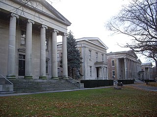
Sailors' Snug Harbor, also known as Sailors Snug Harbor and informally as Snug Harbor, is a collection of architecturally significant 19th-century buildings on Staten Island, New York City. The buildings are set in an 83-acre (34 ha) park along the Kill Van Kull in New Brighton, on the North Shore of Staten Island. Some of the buildings and the grounds are used by arts organizations under the umbrella of the Snug Harbor Cultural Center and Botanical Garden.

The geography of New York City is characterized by its coastal position at the meeting of the Hudson River and the Atlantic Ocean in a naturally sheltered harbor. The city's geography, with its scarce availability of land, is a contributing factor in making New York the most densely populated major city in the United States. Environmental issues are chiefly concerned with managing this density, which also explains why New York is among the most energy-efficient and least automobile-dependent cities in the United States. The city's climate is temperate.

Education in New York City is provided by a vast number of public and private institutions. New York City has the largest educational system of any city in the world. The city’s educational infrastructure spans primary education, secondary education, higher education, and research. New York City is home to some of the most important libraries, universities, and research centers in the world. In 2006, New York had the most post-graduate life sciences degrees awarded annually in the United States, 40,000 licensed physicians, and 127 Nobel laureates with roots in local institutions. The city receives the second-highest amount of annual funding from the National Institutes of Health among all U.S. cities. It also struggles with disparity in its public school system, with some of the best-performing public schools in the United States as well as some of the worst-performing. Under Mayor Michael Bloomberg, the city embarked on a major school reform effort.
The specialized high schools of New York City are nine selective public high schools, established and run by the New York City Department of Education to serve the needs of academically and artistically gifted students. The Specialized High Schools Admissions Test (SHSAT) examination is required for admission to all the schools except LaGuardia, which requires an audition or portfolio for admission.

St. James' Roman Catholic Church is located at 32 James Street between St. James Place and Madison Street in the Two Bridges neighborhood of Lower Manhattan, New York City. It is the second oldest Roman Catholic building in the city, built in 1835–1837 of fieldstone, with a pair of Doric columns flanking the entrance. While the neo-classical church is modeled on the published designs by Minard Lefever, and is sometimes attributed to him, there is no hard evidence of this being true. The building was once topped by a domed cupola.

Conference House Park is a park in Tottenville, Staten Island, New York City. The park is located along the Arthur Kill coast where the kill opens into Raritan Bay. It contains clay bluffs, part of the terminal moraine, formed when the Wisconsin Glacier receded 10,000 years ago. Ward's Point, the southernmost point in New York state, is in the park.

The Church of Saint Clare, located in the Great Kills neighborhood of Staten Island, New York City, is the largest-membership parish under the authority of the Roman Catholic Archdiocese of New York. It is dedicated to Clare of Assisi, and it includes a co-educational PreK–8 Catholic school and Religious Education program. It became an independent parish in 1925 and has six principal buildings dating from 1921 to 1979: the church, school, converted convent, parish center, chapel, and rectory. St. Clare's has received national attention for its architecture, its educational programs, its heavy casualties from the September 11 attacks, and its two priests lost to the COVID-19 pandemic.

The Church of Our Lady Help of Christians is a parish church under the authority of the Roman Catholic Archdiocese of New York, located in Tottenville, Staten Island, New York City. The church was established in 1890 as a mission of St. Joseph's Church (Rossville) and became an independent parish in 1898. Its first church building was constructed later that year. It burned down in 1985 and was rebuilt in 1990.

The Whitehall Terminal is a ferry terminal in the South Ferry section of Lower Manhattan, New York City, at the corner of South Street and Whitehall Street. It is used by the Staten Island Ferry, which connects the island boroughs of Manhattan and Staten Island. The Whitehall Terminal is one of the ferry's two terminals, the other being St. George Terminal on Staten Island.


