Shadybrook, Texas | |
---|---|
Coordinates: 32°6′38″N95°25′19″W / 32.11056°N 95.42194°W | |
Country | United States |
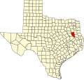
State | Texas |
County | Cherokee |
Area | |
• Total | 9.3 sq mi (24.0 km2) |
• Land | 7.7 sq mi (20.0 km2) |
• Water | 1.5 sq mi (4.0 km2) |
Elevation | 380 ft (120 m) |
Population (2010) | |
• Total | 1,967 |
• Density | 255/sq mi (98.4/km2) |
Time zone | UTC-6 (Central (CST)) |
• Summer (DST) | UTC-5 (CDT) |
ZIP code | 75757 [1] |
Area code(s) | 430, 903 |
FIPS code | 48-67010 [2] |
GNIS feature ID | 2586988 [3] |
Shadybrook is a census-designated place (CDP) in Cherokee County, Texas, United States. The population was 1,967 at the 2010 census. [2]
The CDP is located in the northwestern corner of the county adjacent to Lake Palestine, and takes its name from a gated community located on either side of Farm to Market Road 346. [4] It is 16 miles (26 km) northwest of Jacksonville and 21 miles (34 km) southwest of Tyler. The CDP includes the namesake development along with other developments and individually owned houses in the area. A map of the CDP is shown here. [5]
According to the United States Census Bureau, the CDP has a total area of 9.3 square miles (24.0 km2), of which 7.7 square miles (20.0 km2) is land and 1.5 square miles (4.0 km2), or 16.68%, is water, consisting of part of Lake Palestine.
Census | Pop. | Note | %± |
---|---|---|---|
2010 | 1,967 | — | |
U.S. Decennial Census [6] 1850–1900 [7] 1910 [8] 1920 [9] 1930 [10] 1940 [11] 1950 [12] 1960 [13] 1970 [14] 1980 [15] 1990 [16] 2000 [17] 2010 [18] |
Olmito is a census-designated place (CDP) in Cameron County, Texas, United States. Olmito is Spanish for "little elm". The population was 1,021 at the 2020 census. It is part of the Brownsville–Harlingen Metropolitan Statistical Area. Olmito is the self-described "mesquite capital of the world."
West Livingston is a census-designated place (CDP) in western Polk County, Texas, United States, located along the eastern shore of Lake Livingston 6 miles (9.7 km) west of central Livingston. The population was 8,156 at the 2020 census.
Redford is a census-designated place (CDP) in Presidio County, Texas, United States. The population was 43 at the 2020 census.
Hudson Bend is a census-designated place (CDP) in Travis County, Texas, United States. The population was 4,005 at the 2020 census.
Laredo Ranchettes is a census-designated place (CDP) in Webb County, Texas, United States. The population was 22 at the 2010 census.
Ranchitos Las Lomas is a census-designated place (CDP) in Webb County, Texas, United States. The population was 167 at the 2020 census. Las Lomas means "the hills" in Spanish.
Ranchos Penitas West is a census-designated place (CDP) in Webb County, Texas, United States. The population was 466 at the 2020 census.
Briar is a census-designated place (CDP) in Parker, Tarrant and Wise counties in the U.S. state of Texas, near the west side of Eagle Mountain Lake.The population was 7,035 in 2020.
Hilltop Lakes is a census-designated place and unincorporated community in Leon County, Texas, United States. As of the 2010 census, the population was 1,101.
Abram is an unincorporated community and census-designated place in Hidalgo County, Texas, United States. Its population was 2,067 as of the 2010 census. The community was named after Texas Ranger Abram Dillard, who was a resident of the area.
Lake Bryan is a census-designated place (CDP) in Brazos County, Texas, United States, situated around a reservoir of the same name managed by Bryan Texas Utilities. The population was 2,060 at the 2020 census. It is part of the Bryan–College Station metropolitan area.
Arroyo Gardens is a census-designated place (CDP) in Cameron County, in the U.S. state of Texas. The population was 456 at the 2010 census. Prior to the 2010 census, the community was part of the Arroyo Gardens-La Tina Ranch CDP. It is part of the Brownsville–Harlingen Metropolitan Statistical Area.
Las Palmas II is a census-designated place (CDP) in Cameron County, in the U.S. state of Texas. The population was 1,605 at the 2010 census. Prior to the 2010 census, the community was part of the Las Palmas-Juarez CDP. It is part of the Brownsville–Harlingen Metropolitan Statistical Area.
Lake Dunlap is a census-designated place in Guadalupe County, Texas, United States. The population was 1,934 at the 2010 census. It is part of the San Antonio–New Braunfels metropolitan area.
Western Lake is a census-designated place in Parker County, Texas, United States. This was a new CDP for the 2010 census with a population of 1,525.
Big Thicket Lake Estates is a census-designated place (CDP) in Polk and Liberty counties, Texas, United States. This was a new CDP for the 2010 census, with a population of 742, decreasing to 514 at the 2020 census.
Las Haciendas is a census-designated place (CDP) in Webb County, Texas, United States. This was a new CDP, formed from parts of the Ranchitos Las Lomas CDP prior to the 2010 census, with a population of 7.
Valle Verde is an unincorporated community and census-designated place (CDP) in Webb County, Texas, United States. This was a new CDP formed from parts of the Ranchitos Las Lomas CDP prior to the 2010 census. The population was listed as zero in both the 2010 and 2020 U.S. censuses.
Pueblo Nuevo is a census-designated place (CDP) in Webb County, Texas, United States.This was a new CDP formed from parts of the Laredo Ranchettes CDP and additional area prior to the 2010 census, with a population of 521.
Canyon Creek is an unincorporated community and census-designated place (CDP) in Hood County, Texas, United States. The population was 916 at the 2010 census. It is part of the Granbury micropolitan area as well as the Dallas–Fort Worth metroplex.