Shakertowne, Missouri

Last updated

Shakertowne, Missouri
USA Missouri location map.svg
Red pog.svg
Shakertowne
Usa edcp location map.svg
Red pog.svg
Shakertowne
Coordinates: 37°41′38″N89°52′03″W / 37.69389°N 89.86750°W / 37.69389; -89.86750
CountryUnited States
State Missouri
County Perry
Townships Central
Cinque Hommes
Area
[1]
  Total1.32 sq mi (3.42 km2)
  Land1.32 sq mi (3.42 km2)
  Water0.00 sq mi (0.00 km2)
Elevation
[2]
600 ft (200 m)
Population
 (2020)
  Total625
  Density473.48/sq mi (182.76/km2)
Time zone UTC-6 (Central (CST))
  Summer (DST) UTC-5 (CDT)
ZIP Code
63775 (Perryville)
Area code 573
FIPS code 29-66935
GNIS feature ID2806418 [2]

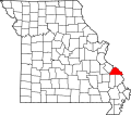
Shakertowne is an unincorporated community and census-designated place (CDP) in Perry County, Missouri, United States. It is in the central part of the county and is bordered to the north by Perryville, the county seat. Interstate 55 forms the western edge of the CDP; the closest access is from Exit 129 (Missouri Route 51) in Perryville. Via I-55 St. Louis is 84 miles (135 km) to the north and Cape Girardeau is 34 miles (55 km) to the south.

Shakertowne was first listed as a CDP prior to the 2020 census. [2]

Demographics

Historical population
CensusPop.Note
2020 625
U.S. Decennial Census [3]

Related Research Articles

<span class="mw-page-title-main">Perry County, Missouri</span> County in Missouri, United States

Perry County is a county located in the southeastern portion of the U.S. state of Missouri. As of the 2020 census, the population was 18,956. Its county seat is Perryville. The county was officially organized on November 16, 1820 from Ste. Genevieve County and was named after Oliver Hazard Perry, a naval hero of the War of 1812.

<span class="mw-page-title-main">Ivanof Bay, Alaska</span> Census-designated place in Alaska, United States

Ivanof Bay is a census-designated place (CDP) in Lake and Peninsula Borough, Alaska, United States. The population was just one at the 2020 census, down from seven in 2010.

<span class="mw-page-title-main">Perryville, Alaska</span> Census-designated place in Alaska, United States

Perryville is a census-designated place (CDP) in Lake and Peninsula Borough, Alaska, United States. The population was 88 at the 2020 census, down from 113 in 2010.

<span class="mw-page-title-main">Perryville, Arkansas</span> City in Arkansas, United States

Perryville is a city in and the county seat of Perry County, Arkansas, United States. The population was 1,460 at the 2010 census, an increase of just two persons from 2000. It is part of the Little Rock–North Little Rock–Conway Metropolitan Statistical Area.

<span class="mw-page-title-main">Spokane, Missouri</span> Census-designated place in Missouri, United States

Spokane is a census-designated place in Christian County, Missouri, United States. The population was 177 at the 2010 census. It is part of the Springfield, Missouri, Metropolitan Statistical Area.

<span class="mw-page-title-main">Gray Summit, Missouri</span> Census-designated place in Missouri, United States

Gray Summit is an unincorporated community and census-designated place (CDP) in Franklin County, Missouri, United States. The population was 2,701 at the 2010 census. Also called "Gray's Summit", it was founded by Daniel Gray of New York, who built a hotel here in 1845. It is located on Missouri Route 100 just north of Interstate 44.

<span class="mw-page-title-main">High Ridge, Missouri</span> Census-designated place in Missouri, United States

High Ridge is an unincorporated community and census-designated place (CDP) in Jefferson County, Missouri, United States. The population was 4,305 at the 2010 census. At 927 feet (283 m) above sea level, High Ridge is the second-highest point in Jefferson County, second only to Sun Ridge, north of Hillsboro, according to data from the House Springs/Hillsboro 7.5 minute topographic quadrangles. The Beaumont Scout Reservation, a property of the Greater St. Louis Area Council, Boy Scouts of America, is 4 miles (6 km) north of High Ridge.

<span class="mw-page-title-main">Imperial, Missouri</span> Census-designated place in Missouri, United States

Imperial is a census-designated place (CDP) in Jefferson County, Missouri, United States, and is a suburb of St. Louis. The population was 4,947 at the 2020 census. Imperial was originally known as West Kimmswick, the historic Catholic church of St. John’s in Imperial, became an independent parish in 1869.

<span class="mw-page-title-main">Murphy, Missouri</span> Census-designated place in Missouri, United States

Murphy is a census-designated place (CDP) in Jefferson County, Missouri, United States. The population was 8,690 at the 2010 census, down from 9,048 in 2000.

<span class="mw-page-title-main">Biehle, Missouri</span> Census-designated place in Missouri, United States

Biehle was a village in Perry County, Missouri, United States. The population was 47 at the 2020 census. The community was founded in 1876 and named after the Biehle family.

<span class="mw-page-title-main">Longtown, Missouri</span> Village in Missouri, United States

Longtown is a village in Union Township in Perry County, Missouri, United States. The population was 90 at the 2020 census.

<span class="mw-page-title-main">Perryville, Missouri</span> City in Missouri, United States

Perryville is a city in Perry County, Missouri, United States. The population was 8,555 at the 2020 United States census. Perryville is the county seat of Perry County.

<span class="mw-page-title-main">Four Corners, Montana</span> Census-designated place in Montana, United States

Four Corners is a census-designated place (CDP) in Gallatin County, Montana, United States. The population was 5,901 at the 2020 census, up from 3,146 in 2010. It is part of the Bozeman, MT Micropolitan Statistical Area.

<span class="mw-page-title-main">Castle Point, Missouri</span> CDP in Missouri, United States

Castle Point is a census-designated place (CDP) in St. Louis County, Missouri, United States. The population was 3,962 at the 2010 census.

<span class="mw-page-title-main">Concord, Missouri</span> CDP in Missouri, United States

Concord is a census-designated place (CDP) in St. Louis County, Missouri, United States. The population was 16,421 at the 2010 census. It should not be confused with Concord Township; which the CDP shares much land with, but these areas' boundaries are not identical.

<span class="mw-page-title-main">Vivian, South Dakota</span> Census-designated place in South Dakota, United States

Vivian is an unincorporated community and census-designated place (CDP) in Lyman County, South Dakota, United States. The population was 98 at the 2020 census.

<span class="mw-page-title-main">Shell Knob, Missouri</span> Census-designated place in Missouri, United States

Shell Knob is a census-designated place (CDP) located within White River Township, Barry County, Missouri. The population was 1,254 at the 2020 census.

<span class="mw-page-title-main">Old Jamestown, Missouri</span> Census-designated place in Missouri, United States

Old Jamestown is a census-designated place (CDP) in St. Louis County, Missouri, United States. The population was 19,184 at the 2010 census. Old Jamestown is northwest of the city of St. Louis and borders the Missouri River.

Aplin is an unincorporated community and census-designated place (CDP) in Perry County, Arkansas, United States. It was first listed as a CDP in the 2020 census with a population of 100. The community is located along Arkansas Highway 60, 10.3 miles (16.6 km) west-southwest of Perryville.

Hardy is an unincorporated community and census-designated place (CDP) in Cascade County, Montana, United States. It is in the southwest part of the county, in the valley of the Missouri River where it emerges from its canyon through the Adel Mountains Volcanic Field. Interstate 15 passes the community, with access from Exit 247. I-15 leads northeast 34 miles (55 km) to Great Falls and southwest 56 miles (90 km) to Helena.

References

  1. "ArcGIS REST Services Directory". United States Census Bureau. Retrieved August 28, 2022.
  2. 1 2 3 U.S. Geological Survey Geographic Names Information System: Shakertowne, Missouri
  3. "Census of Population and Housing". Census.gov. Retrieved June 4, 2016.