Shattuck, Oklahoma

Last updated

Shattuck, Oklahoma
OKMap-doton-Shattuck.PNG
Location of Shattuck within Oklahoma
Coordinates: 36°16′21″N99°52′34″W / 36.27250°N 99.87611°W / 36.27250; -99.87611
Country United States
State Oklahoma
County Ellis
Area
[1]
  Total2.20 sq mi (5.69 km2)
  Land2.20 sq mi (5.69 km2)
  Water0.00 sq mi (0.00 km2)
Elevation
[2]
2,307 ft (703 m)
Population
 (2020)
  Total1,249
  Density568.76/sq mi (219.61/km2)
Time zone UTC-6 (Central (CST))
  Summer (DST) UTC-5 (CDT)
ZIP code
73858
Area code 580
FIPS code 40-66750 [3]
GNIS feature ID2413278 [2]
Website shattuckok.com

Shattuck is a town in Ellis County, Oklahoma, United States. The population was 1,249 at the time of the 2020 census, [4] a change from the 1,356 reported in the 2010 census. [5]

Contents

History

Shattuck is located in what was once the Cherokee Outlet. [6] The Southern Kansas Railway built a railroad through the area in 1887, and there was a railroad water station called "Norice" on the site that later became Shattuck. [6] Non-Indian settlers first arrived in the Land Run of 1893. [6] Around the railroad station, new businesses opened to support the farmers, including a blacksmith shop, a store, a school, and a post office. [6] The post office, which was incorporated in November 1893, was named Shattuck after a Santa Fe Railroad director. [6] The town site was plotted 1901, and the town was incorporated in 1906. [6]

On May 25, 2021, an earthquake magnitude 4.1 on the Richter Scale occurred a few miles west of Shattuck, despite it not being an area known for earthquakes. [7]
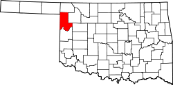
Geography

Shattuck is located west of the center of Ellis County. U.S. Route 283 passes through the center of town, leading north 30 miles (48 km) to Laverne and south 15 miles (24 km) to Arnett, the Ellis county seat. Oklahoma State Highway 15 passes through the southeast part of Shattuck, leading northeast 30 miles (48 km) to Woodward. The Texas border is 7 miles (11 km) west of Shattuck.

According to the United States Census Bureau, the town has a total area of 2.2 square miles (5.8 km2), all land. [5]

Demographics

Historical population
CensusPop.Note
1910 1,231
1920 1,36510.9%
1930 1,4909.2%
1940 1,275−14.4%
1950 1,69232.7%
1960 1,625−4.0%
1970 1,546−4.9%
1980 1,75913.8%
1990 1,454−17.3%
2000 1,274−12.4%
2010 1,3566.4%
2020 1,249−7.9%
U.S. Decennial Census [8]

As of the census [3] of 2000, there were 1,274 people, 567 households, and 369 families residing in the town. The population density was 880.5 inhabitants per square mile (340.0/km2). There were 699 housing units at an average density of 483.1 per square mile (186.5/km2). The racial makeup of the town was 95.76% White, 1.57% Native American, 0.86% from other races, and 1.81% from two or more races. Hispanic or Latino of any race were 3.85% of the population. There were 567 households, out of which 23.3% had children under the age of 18 living with them, 55.9% were married couples living together, 7.6% had a female householder with no husband present, and 34.9% were non-families. 33.2% of all households were made up of individuals, and 19.0% had someone living alone who was 65 years of age or older. The average household size was 2.16 and the average family size was 2.74.

In the town, the population was spread out, with 20.0% under the age of 18, 6.1% from 18 to 24, 20.4% from 25 to 44, 28.3% from 45 to 64, and 25.1% who were 65 years of age or older. The median age was 47 years. For every 100 females, there were 88.2 males. For every 100 females age 18 and over, there were 81.3 males.

The median income for a household in the town was $26,758, and the median income for a family was $35,250. Males had a median income of $32,375 versus $18,077 for females. The per capita income for the town was $17,420. About 7.5% of families and 10.2% of the population were below the poverty line, including 11.7% of those under age 18 and 12.7% of those age 65 or over.

Parks, recreation and attractions

City Park has playground equipment, tennis courts, covered picnic facilities, and a mile-long Lighted Walking Trail at Centennial Lake. [9] It also has Shattuck Public Swimming Pool. [10]

The municipal/semi-private Shattuck Golf and Country Club has nine holes and was built in 1950. [11]

Gage Beach, Oklahoma’s largest outdoor swimming pool, is seven miles east of Shattuck; the spring-fed waters of this 100-year-old pool are mineral-rich. [9]

Lake Lloyd Vincent and the Ellis County Wildlife Management Area are well south of town, but in Shattuck’s zip code. [12] [13]

The Shattuck Windmill Museum has a large number of vintage windmills, as well as versions of some early settler buildings. [14]

The following locations are NRHP-listed:

Shattuck National Bank Building was built in 1910, with a second floor added in 1913. It became the Shattuck Public Library in 1963. [15] Wall murals inside the building depict the history of Shattuck from 1838 to the present. [9]

The Ingle Brothers Broomcorn Warehouse was built in 1909, and is a gable-front brick building with a stepped gable. [16]

Related Research Articles

<span class="mw-page-title-main">Pawnee County, Oklahoma</span> County in Oklahoma, United States

Pawnee County is a county located in the U.S. state of Oklahoma. As of the 2020 census, the population was 15,553. Its county seat is Pawnee. The county is named after the Pawnee Nation, whose reservation used to encompass the county prior to allotment in 1893.

<span class="mw-page-title-main">Ellis County, Oklahoma</span> County in Oklahoma, United States

Ellis County is a county located on the western border of the U.S. state of Oklahoma. As of the 2020 census, the population was 3,749, making it the fifth-least populous county in Oklahoma. Its county seat is Arnett.

<span class="mw-page-title-main">Creek County, Oklahoma</span> County in Oklahoma, United States

Creek County is a county located in the U.S. state of Oklahoma. As of the 2020 census, the population was 71,754. Its county seat is Sapulpa.

<span class="mw-page-title-main">Gravette, Arkansas</span> City in Arkansas, United States

Gravette is a city in Benton County, Arkansas, United States. The population is 3,547 according to the 2020 census. The population was 3,547 as of the 2020 census. It is part of the Northwest Arkansas region.

<span class="mw-page-title-main">Malvern, Iowa</span> City in Iowa, United States

Malvern is a city in Mills County, Iowa, United States. The population was 1,046 at the time of the 2020 census. The Wabash Trace—a railroad converted to a bicycle trail—passes through Malvern. The Mills County Fair is held here, although Glenwood is the county seat. Malvern is the largest town in the eastern half of the county.

<span class="mw-page-title-main">Watonga, Oklahoma</span> City in Oklahoma, United States

Watonga is a city in Blaine County, Oklahoma. It is 70 miles northwest of Oklahoma City. The population was 5,111 at the 2010 census. It is the county seat of Blaine County.

<span class="mw-page-title-main">Seiling, Oklahoma</span> City in Oklahoma, United States

Seiling is a city in Dewey County, Oklahoma, United States. The population was 850 at the 2020 census. The town was named in 1899 for Louis Seiling, a local store owner who had acquired a homestead in the Cheyenne-Arapaho land run of April 1892. The Hobson Town and Improvement Company established a town called Hobson, but the name was changed to Seiling in January 1899. It incorporated in 1909. Seiling is now the largest city in Dewey County. Their girls basketball team has also won the Oklahoma State Championship four times in a row (2016-2019).

<span class="mw-page-title-main">Arnett, Oklahoma</span> Town in Oklahoma, United States

Arnett is a town in and the county seat of Ellis County, Oklahoma, United States. The population was 495 at the time of the 2020 census.

<span class="mw-page-title-main">Fargo, Oklahoma</span> Town in Oklahoma, United States

Fargo is a town in Ellis County, Oklahoma, United States. The population was 364 at the 2010 census. Fargo, like many towns in the region, has never fully recovered from the Dust Bowl years.

<span class="mw-page-title-main">Gage, Oklahoma</span> Town in Oklahoma, United States

Gage is a town in Ellis County, Oklahoma, United States. The population was 433 at the time of the 2020 census.

<span class="mw-page-title-main">Lindsay, Oklahoma</span> City in Oklahoma, United States

Lindsay is a city in Garvin County, Oklahoma, United States. The population was 2,840 at the 2010 census. It once promoted itself as "The Broomcorn Capital of the World" but no longer uses that slogan, as broomcorn is no longer raised in the area.

<span class="mw-page-title-main">Buffalo, Oklahoma</span> Town in Oklahoma, United States

Buffalo is a town and county seat of Harper County, Oklahoma, United States. As of the 2020 census, the town’s population was 1,039. It was named after the Buffalo Creek valley, in which it is located.

<span class="mw-page-title-main">Wilburton, Oklahoma</span> City in Oklahoma, United States

Wilburton is a city in Latimer County, Oklahoma, United States. It is the county seat of Latimer County. The city had a population of 2,285 as of the 2020 Census. Robbers Cave State Park is 5 miles (8.0 km) north of Wilburton.

<span class="mw-page-title-main">Sparks, Oklahoma</span> Town in Oklahoma, United States

Sparks is a town in Lincoln County, Oklahoma, United States. The population was 169 at the 2010 census, a 23.4 percent gain from the figure of 137 in 2000. The center of population of Oklahoma is located in Sparks.

<span class="mw-page-title-main">Jones, Oklahoma</span> Town in Oklahoma, United States

Jones is a town in Oklahoma County, Oklahoma. It is named after Charles G. Jones, a three-time mayor of Oklahoma City. The population was 2,692 at the time of the 2010 census.

<span class="mw-page-title-main">Pawnee, Oklahoma</span> City in Oklahoma, United States

Pawnee is a city and county seat of Pawnee County, Oklahoma, United States. The town is northeast of Stillwater at the junction of U.S. Route 64 and State Highway 18.

<span class="mw-page-title-main">Spearman, Texas</span> City in Texas, United States

Spearman is a city in and the county seat of Hansford County, Texas, United States. As of the 2010 census, the city population was 3,368. It is known for its collection of windmills from the J.B. Buchanan windmill collection.

<span class="mw-page-title-main">Cashion, Oklahoma</span> Town in Oklahoma, United States

Cashion is a town in Kingfisher and Logan counties in the U.S. state of Oklahoma. The Logan County portion of Cashion is part of the Oklahoma City Metropolitan Statistical Area. The town population was 802 at the 2010 census, up from 643 in 2000.

<span class="mw-page-title-main">Skiatook, Oklahoma</span> City in Oklahoma, United States

Skiatook is a city in Osage and Tulsa counties in the U.S. state of Oklahoma located in the northeastern part of the state, approximately 20 miles north and west of Tulsa. Due to its location on the border between Osage County and Tulsa County, Skiatook has been referred to as "the Gateway to the Osage." The town includes the state highway junction of Oklahoma State Highway 11 and Oklahoma State Highway 20. The population was 8,450 at the 2020 census, an increase of 14.24 percent over the figure of 7,397 recorded in 2010.

<span class="mw-page-title-main">Booker, Texas</span> Town in Texas, United States

Booker is a town in Lipscomb and Ochiltree counties in the U.S. state of Texas. The population was 1,516 as of the 2010 census. It was named for B.F. Booker, a civil engineer for the Panhandle and Santa Fe Railway.

References

  1. "ArcGIS REST Services Directory". United States Census Bureau. Retrieved September 20, 2022.
  2. 1 2 U.S. Geological Survey Geographic Names Information System: Shattuck, Oklahoma
  3. 1 2 "U.S. Census website". United States Census Bureau . Retrieved January 31, 2008.
  4. "Shattuck (town), Oklahoma". United States Census Bureau. Retrieved August 29, 2023.
  5. 1 2 "Geographic Identifiers: 2010 Demographic Profile Data (G001): Shattuck town, Oklahoma". American Factfinder. U.S. Census Bureau. Archived from the original on February 13, 2020. Retrieved March 10, 2016.
  6. 1 2 3 4 5 6 Everett, Dianna. "Shattuck," Encyclopedia of Oklahoma History and Culture, Oklahoma Historical Society, June 24, 2015.
  7. "Magnitude 4.1 earthquake rattles Oklahoma, also felt in Texas and Kansas".
  8. "Census of Population and Housing". Census.gov. Retrieved June 4, 2015.
  9. 1 2 3 "Shattuck". RedCarpetCountry.com. Retrieved August 11, 2020.
  10. "Shattuck Public Swimming Pool". Facebook. Retrieved August 11, 2020.
  11. "Shattuck Golf & Country Club". GolfAdvisor.com. Retrieved August 11, 2020.
  12. "Lake Lloyd Vincent". Google Maps. Retrieved August 11, 2020.
  13. "Ellis County Wildlife Management Area". Google Maps. Retrieved August 11, 2020.
  14. "Homepage". Shattuck Windmill Museum. Retrieved August 11, 2020.
  15. "National Register of Historic Places Inventory-Nomination Form, Shattuck National Bank Building". National Park Service. Retrieved August 11, 2020.
  16. "News 2009". Shattuck Windmill Museum. Retrieved August 11, 2020.