Tweed is a municipality located in central-eastern Ontario, Canada, in Hastings County.
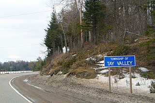
Tay Valley is a township in eastern Ontario, Canada, on the Tay River in the southwest corner of Lanark County, adjacent to the United Counties of Leeds and Grenville and Frontenac County. The township administrative offices are located in Glen Tay.

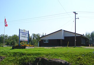
Central Frontenac is a township in eastern Ontario, Canada in the County of Frontenac.

The Municipality of Centre Hastings is a township in Eastern Ontario, Canada, in Hastings County. It was formed on January 1, 1998, through the amalgamation of Huntingdon Township with the Village of Madoc.
Marmora and Lake is a municipality along the banks of Crowe River and Beaver Creek, about midway between Toronto and Ottawa on provincial Highway 7 in Hastings County in Central Ontario, Canada.. It is home to approximately 4,000 full time and seasonal residents, many of whom enjoy outdoor recreation and relaxation on Crowe Lake.
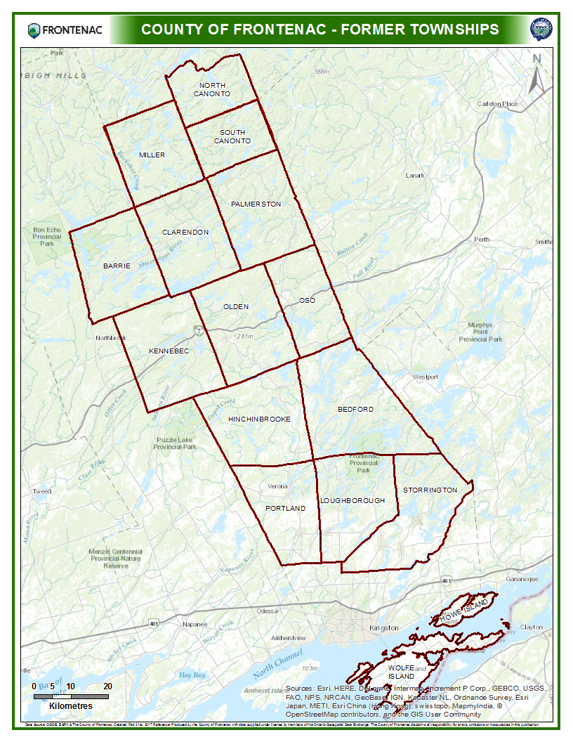
Frontenac County is a county and census division of the Canadian province of Ontario. It is located in the eastern portion of Southern Ontario. The city of Kingston is in the Frontenac census division, but is separated from the County of Frontenac.

Kingston and the Islands is a federal electoral district in Ontario, Canada, that has been represented in the House of Commons of Canada since 1968.
Hastings—Frontenac was a federal electoral district in Ontario, Canada, that was represented in the House of Commons of Canada from 1953 to 1968, and from 1979 to 1980.
Frontenac—Lennox and Addington was a federal electoral district represented in the House of Commons of Canada from 1968 to 1979. It was located in the province of Ontario. This riding was created in 1966 from parts of Hastings—Frontenac, Kingston, Lanark, Prince Edward—Lennox, Renfrew North and Renfrew South ridings.
Hastings—Frontenac—Lennox and Addington was a federal and provincial electoral district in Ontario, Canada, that was represented in the House of Commons of Canada from 1984 to 2003, and in the Legislative Assembly of Ontario from 1999 to 2007.
Limerick is a small township in Hastings County, Ontario, Canada, near Limerick Lake. It is located 80 kilometres (50 mi) north of Belleville between Madoc and Bancroft and served by Ontario Highway 62 and County Road 620. The Township is bordered by the Town of Bancroft, Township of Wollaston and the joined Townships of Tudor and Cashel. The township is heavily forested, as is the shoreline of the Limerick Lake, the main industry in the township being forestry and logging. The population of Limerick Township is approx. 300 full-year residents, and another 1000 seasonal residents.

Portland is a police village and unincorporated place located in the municipal township of Rideau Lakes, United Counties of Leeds and Grenville in eastern Ontario, Canada. The community is on Ontario Highway 15 about 60 kilometres (37 mi) northeast of Ontario Highway 401 at Kingston by road, and is situated in geographic Bastard Township on the southeast side of Big Rideau Lake.

The Township of Alnwick/Haldimand is a township in central Ontario, Canada, in Northumberland County, situated between Lake Ontario and Rice Lake. It was formed in 2001 by the merger of Alnwick Township in the north and Haldimand Township in the south. Alderville First Nation is an autonomously governed First Nation contained within the township boundaries, in two non-contiguous sections along County Roads 45 and 18.

The Township of Ashfield-Colborne-Wawanosh is a municipality in Huron County, Ontario, Canada. It was formed as an amalgamation of the former Ashfield, Colborne and West Wawanosh townships in 2001, in an Ontario-wide local government restructuring imposed by the government of that time. The three former townships now comprise the wards of the amalgamated municipality.

Cramahe is a rural township located in Northumberland County in central Ontario, Canada. It is situated just off Ontario Highway 401 approximately 140 km East of Toronto. It was named for Hector Theophilus de Cramahé, who was Lieutenant-Governor of the Province of Quebec. The seat of the Township and largest town is Colborne.
Rideau Lakes is a township located within Leeds and Grenville United Counties in Eastern Ontario, Canada. The township was incorporated on 1 January 1998 by amalgamating the former townships of North Crosby, South Crosby, Bastard, South Burgess and South Elmsley with the village of Newboro.
North Frontenac is a township in Frontenac County in eastern Ontario, Canada.

Stone Mills is a lower tier township located north of Greater Napanee in Lennox and Addington County, Ontario, Canada. According to the 2011 Canadian Census, the township has a population of 7,560

Frontenac Islands is a township located in Frontenac County, Ontario, Canada, that encompasses a number of islands at the beginning of the Saint Lawrence River near the outlet of Lake Ontario, including: Arabella, Bayfield, Black Ant, Garden, Goose, Hickory, Horseshoe, Howe, Wolfe and Simcoe.

Algonquin Highlands is a township located in Haliburton County, Ontario, Canada. It has a population of 2,351. The northeastern section of the township is included in Algonquin Provincial Park.


