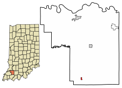
Spurgeon, Indiana | |
---|---|
Coordinates: 38°15′19″N87°15′31″W / 38.25528°N 87.25861°W | |
Country | United States |
State | Indiana |
County | Pike |
Township | Monroe |
Area | |
• Total | 0.17 sq mi (0.45 km2) |
• Land | 0.17 sq mi (0.45 km2) |
• Water | 0.00 sq mi (0.00 km2) |
Elevation | 489 ft (149 m) |
Population (2020) | |
• Total | 172 |
• Density | 982.86/sq mi (378.66/km2) |
Time zone | UTC-6 (Central (CST)) |
• Summer (DST) | UTC-5 (CDT) |
ZIP code | 47584 |
Area code | 812 |
FIPS code | 18-72440 [3] |
GNIS feature ID | 2397677 [2] |
Spurgeon is a town in Monroe Township, Pike County, in the U.S. state of Indiana. [2] The population was 207 at the 2010 census. It is part of the Jasper Micropolitan Statistical Area.
Spurgeon was originally called Pleasantville, and under the latter name was laid out in 1860. [4] A post office has been in operation under the name Spurgeon since 1867. [5]
According to the 2010 census, Spurgeon has a total area of 0.18 square miles (0.47 km2), all land. [6]
Census | Pop. | Note | %± |
---|---|---|---|
1930 | 375 | — | |
1940 | 360 | −4.0% | |
1950 | 327 | −9.2% | |
1960 | 269 | −17.7% | |
1970 | 285 | 5.9% | |
1980 | 250 | −12.3% | |
1990 | 149 | −40.4% | |
2000 | 227 | 52.3% | |
2010 | 207 | −8.8% | |
2020 | 172 | −16.9% | |
U.S. Decennial Census [7] |
As of the census [8] of 2010, there were 207 people, 78 households, and 57 families living in the town. The population density was 1,150.0 inhabitants per square mile (444.0/km2). There were 87 housing units at an average density of 483.3 per square mile (186.6/km2). The racial makeup of the town was 95.7% White, 3.9% from other races, and 0.5% from two or more races. Hispanic or Latino of any race were 3.4% of the population.
There were 78 households, of which 30.8% had children under the age of 18 living with them, 60.3% were married couples living together, 7.7% had a female householder with no husband present, 5.1% had a male householder with no wife present, and 26.9% were non-families. 20.5% of all households were made up of individuals, and 3.9% had someone living alone who was 65 years of age or older. The average household size was 2.65 and the average family size was 3.02.
The median age in the town was 40.4 years. 25.1% of residents were under the age of 18; 9.1% were between the ages of 18 and 24; 21.3% were from 25 to 44; 34.3% were from 45 to 64; and 10.1% were 65 years of age or older. The gender makeup of the town was 51.2% male and 48.8% female.
As of the census [3] of 2000, there were 227 people, 93 households, and 62 families living in the town. The population density was 1,299.1 inhabitants per square mile (501.6/km2). There were 101 housing units at an average density of 578.0 per square mile (223.2/km2). The racial makeup of the town was 99.12% White, 0.44% from other races, and 0.44% from two or more races. Hispanic or Latino of any race were 1.32% of the population.
There were 93 households, out of which 34.4% had children under the age of 18 living with them, 55.9% were married couples living together, 6.5% had a female householder with no husband present, and 32.3% were non-families. 30.1% of all households were made up of individuals, and 18.3% had someone living alone who was 65 years of age or older. The average household size was 2.44 and the average family size was 3.05.
In the town, the population was spread out, with 28.6% under the age of 18, 9.7% from 18 to 24, 30.8% from 25 to 44, 17.6% from 45 to 64, and 13.2% who were 65 years of age or older. The median age was 37 years. For every 100 females, there were 99.1 males. For every 100 females age 18 and over, there were 97.6 males.
The median income for a household in the town was $36,429, and the median income for a family was $44,375. Males had a median income of $27,031 versus $19,250 for females. The per capita income for the town was $16,850. About 3.2% of families and 4.1% of the population were below the poverty line, including 10.0% of those under the age of eighteen and 5.3% of those 65 or over.
There is one school district in the county, Pike County School Corporation. [9]
Prior to 1966, it had its own high school. The school colors were black and red, and the mascot was the Cardinals. That year, it merged into Winslow High School. That school in turn merged into Pike Central High School in 1974. [10]
St. Paul or Saint Paul is a small town on the border of Decatur and Shelby counties in the U.S. state of Indiana. The population was 1,031 at the 2010 census.
Birdseye is a town in Jefferson Township, Dubois County, in the U.S. state of Indiana. At the 2020 census, the town population was 417.
Lyons is a town in Washington Township, Greene County, Indiana, United States. The population was 742 at the 2010 census. It is part of the Bloomington, Indiana Metropolitan Statistical Area.
Fortville is a town in Vernon Township, Hancock County, Indiana, United States. The population was 4,784 at the 2020 census.
McCordsville is a town in Vernon Township, Hancock County, Indiana, United States. The town is a fast-growing suburb of Indianapolis with an estimated population of 8,592 in 2020.
Bargersville is a town in White River and Union townships, Johnson County, Indiana, United States. The population was 9,560 at the 2020 census.
New Whiteland is a town in Pleasant Township, Johnson County, Indiana, United States. The population was 5,550 at the 2020 census.
Prince's Lakes is a town in Nineveh Township, Johnson County, Indiana, United States. The population was 1,312 at the 2010 census.
Whiteland is a town in Pleasant, Franklin and Clark townships, Johnson County, Indiana, United States. The population was 4,599 at the 2020 census.
Syracuse is a town in Turkey Creek Township, Kosciusko County, in the U.S. state of Indiana. The population was 3,079 at the 2020 census. Syracuse is the location of Lake Syracuse and the nearby, larger Lake Wawasee, in addition to several other lakes in the region. The National Weather Service operates a Weather Forecast Office South of town, toward North Webster. It serves Northern Indiana, Northwestern Ohio and Southwestern Michigan.
Wolcottville is a town in Orange Township, Noble County and Johnson Township, LaGrange County in the U.S. state of Indiana. The population was 998 at the 2010 census.
Paragon is a town in Ray Township, Morgan County, in the U.S. state of Indiana. The population was 556 at the 2020 census, down from 659 in 2010.
Petersburg is a city within Washington Township and the county seat of Pike County, in the U.S. state of Indiana. The population was 2,304 at the 2020 census.
Winslow is a town in Patoka Township, Pike County, in the U.S. state of Indiana. The population was 764 at the 2020 census. It is part of the Jasper Micropolitan Statistical Area.
Town of Pines is a town in Pine Township, Porter County, in the U.S. state of Indiana. The population was 594 as of the 2020 census.
Fillmore is a town in Marion Township, Putnam County, in the U.S. state of Indiana. The population was 532 at the 2020 census.
Sunman is a town in Adams Township, Ripley County, in the U.S. state of Indiana. The population was 1,049 at the 2010 census.
Gentryville is a town in Jackson Township, Spencer County, in the U.S. state of Indiana. The population was 268 at the 2010 census.
North Liberty is a town in Liberty Township, St. Joseph County, in the U.S. state of Indiana. The population was 1,896 at the 2010 Census. North Liberty is part of the South Bend–Mishawaka, IN-MI, Metropolitan Statistical Area.
Beaver is a village in Pike County, Ohio, United States. The population was 442 at the 2020 census.
The village was laid out as Pleasantville in 1860...