Patoka Township Pike County | |
|---|---|
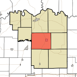 Location in Pike County | |
| Coordinates: 38°22′43″N87°14′48″W / 38.37861°N 87.24667°W | |
| Country | |
| State | |
| County | Pike |
| Government | |
| • Type | Indiana township |
| Area | |
• Total | 43.81 sq mi (113.5 km2) |
| • Land | 42.58 sq mi (110.3 km2) |
| • Water | 1.23 sq mi (3.2 km2) 2.81% |
| Elevation | 453 ft (138 m) |
| Population (2020) | |
• Total | 2,826 |
| • Density | 66.37/sq mi (25.63/km2) |
| ZIP codes | 47567, 47598, 47660 |
| GNIS feature ID | 453710 |
Patoka Township is one of nine townships in Pike County, Indiana, United States. As of the 2020 census, its population was 2,826 and it contained 1,284 housing units. [1]
Contents
- History
- Geography
- Cities, towns, villages
- Unincorporated towns
- Cemeteries
- Major highways
- School districts
- Political districts
- References
- External links
| Census | Pop. | Note | %± |
|---|---|---|---|
| 1890 | 3,095 | — | |
| 1900 | 3,926 | 26.8% | |
| 1910 | 4,253 | 8.3% | |
| 1920 | 4,738 | 11.4% | |
| 1930 | 3,947 | −16.7% | |
| 1940 | 4,150 | 5.1% | |
| 1950 | 3,808 | −8.2% | |
| 1960 | 3,084 | −19.0% | |
| 1970 | 2,898 | −6.0% | |
| 1980 | 3,213 | 10.9% | |
| 1990 | 2,935 | −8.7% | |
| 2000 | 3,169 | 8.0% | |
| 2010 | 3,062 | −3.4% | |
| 2020 | 2,826 | −7.7% | |
| Source: US Decennial Census [2] | |||
