During World WarII, Northwest Airlines employed up to 5,000 people at the site, modifying new B-24 Liberator bombers, some of which received the highly classified H2X radar, which proved to be an invaluable tool in the European theater.[4]
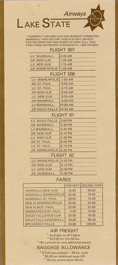
During the 1970s and early 1980s, commuter airline Lake State Airways offered scheduled airline service between the St. Paul Downtown Airport and Minneapolis–St. Paul International Airport in Minnesota. It cost US$5 for a one-way ticket between the two airports, and $10 round-trip.[5] Capitol Air flew MDW-STP with a Swearingen Metroliner for roughly a year starting in December 1993.
Facilities and aircraft
St. Paul Downtown Holman Field covers an area of 540 acres (220ha) which contains three asphalt paved runways: 14/32 measuring 6,491 x 150ft (1,978 x 46 m), 13/31 measuring 4,004 x 150ft (1,220 x 46 m) and 9/27 measuring 3,642 x 100ft (1,110 x 30 m).[1]
For the 12-month period ending December 31, 2014, the airport had 66,475 aircraft operations, an average of 182 per day: 74% general aviation, 15% military and 11% air taxi. In January 2017, there were 68 aircraft based at this airport: 20 single-engine, 12 multi-engine, 18 jet, 7 helicopter and 11 military.[1]
Annual aircraft operations
Based on annual reports and data released by the Metropolitan Airports Commission, aircraft operations declined 65.3% in the decade 2011-2020.
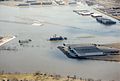
Recently, local debate has ensued over plans to build a flood wall around the airport. In 1993, 1997, and 2001, the airport was flooded due to its proximity to the Mississippi River. Supporters do not want to deal with the future inconvenience of having to deal with the flood again, while critics say that the proposed wall would ruin views and make the airport "ugly".[17] A dike to protect the airport from the nearby river was considered since the National Guard stated that they may leave if the dike is not constructed in a timely manner.[citation needed]
In 2009, a removable flood wall was installed that is only erected when flooding is imminent, leaving the views of the river intact for the rest of the year. Steel plates are embedded in the concrete on the river side of the runways. The flood wall is composed of steel posts that anchor to the embedded plates and aluminum planks that are stacked between the posts to form a flood barrier. These are then removed and stored when the flood event has passed.
Gallery
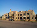
Holman Field administration building with historic control tower
Holman Field administration building
1990s flood
St. Paul Downtown Airport
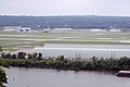
View from a plane landing on runway 32 at Holman Field
↑ "Ask An Historian". Ramsey County Historical Society. Archived from the original on 3 June 2012. Retrieved 31 May 2007. He tragically died at an air show in Omaha in 1931
This page is based on this Wikipedia article Text is available under the CC BY-SA 4.0 license; additional terms may apply. Images, videos and audio are available under their respective licenses.


