Stupava | |
---|---|
Town | |
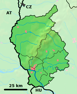
Location of Stupava in the Bratislava Region | |
Coordinates: 48°16′29.1″N17°01.904′0″E / 48.274750°N 17.03173°E | |
Country | Slovakia |
Region | Bratislava |
District | Malacky |
First mentioned | 1269 |
Government | |
• Mayor | Majko Kotlíž |
Area | |
• Total | 67.55 km2 (26.08 sq mi) |
(2022) | |
Elevation | 178 [2] m (584 [2] ft) |
Population | |
• Total | 12,685 |
• Density | 190/km2 (490/sq mi) |
Time zone | UTC+1 (CET) |
• Summer (DST) | UTC+2 (CEST) |
Postal code | 900 31 [2] |
Area code | +421 2 [2] |
Car plate | MA |
Website | www.stupava.sk |
Stupava (German : Stampfen; Hungarian : Stomfa) is a town in western Slovakia. It is situated in the Malacky District, Bratislava Region.
The name is derived from Proto-Slavic stǫpa (Slovak : stupa) - a wooden bowl carved from a tree trunk, but also the name of various crushing and pressing tools. [4]
The town is located in the Záhorie lowland, under the Little Carpathians, around 15 km (9 mi) north of Bratislava at an altitude of 182 metres. It has 15, 095 inhabitants as of 2021 and has a land area of 67.17 km2 (26 sq mi). Apart from the core part of the city, Mást (German : Maaßt, Hungarian : Mászt), located just south of the core part of the city, is another part of Stupava. It has been initially a separate village with ethnic Croatian majority, which was formally annexed by Stupava in 1953. [5]
However, traces of habitation go back to the Bronze Age, and the first known inhabitants were the Celts. The Romans built a military station as a part of the near Limes Romanus on the Danube. The first written mention about the town was in 1269 in a document of the King Béla IV under name Ztumpa. In the second half of the 13th century the now-ruined Pajštún Castle in the Little Carpathians was built. It was developing mainly as an agricultural and trading settlement. The name of the town comes from the pressing mills called stupa on the Stupavský potok brook, which were used for extracting oil from flax and hemp.
According to the 2021 census, the town had 12 595 inhabitants. 96.7% of inhabitants were Slovaks, 1% Czechs and 0.5% Hungarians. [6] The religious makeup was 70.4% Roman Catholics, 19.5% people with no religious affiliation and 2% Lutherans. [6]
Bytča is a town in northwestern Slovakia. It is located on the Váh River near the cities of Žilina and Považská Bystrica. It belongs to Upper Váh region of tourism.
Pezinok is a town in southwestern Slovakia. It is roughly 20 km (12.43 mi) northeast of Bratislava and, as of December 2018, had a population of 23,002.
Hlohovec, is a town in southwestern Slovakia, with a population of 21,508.
Sabinov is a small town located in the Prešov Region, approximately 20 km from Prešov and 55 km from Košice. The population of Sabinov is 12,700.
Kremnica is a town in central Slovakia. It has around 5,300 inhabitants. The well-preserved medieval town built above important gold mines is the site of the oldest still-working mint in the world.
Dubnica nad Váhom is a town in the Ilava District, Trenčín Region in Slovakia.
Modra is a city and municipality in the Bratislava Region in Slovakia. It has a population of 9,042 as of 2018. It nestles in the foothills of the Malé Karpaty and is an excellent centre for hiking.
Nové Mesto nad Váhom is a town in the Trenčín Region of Slovakia.
Gelnica is a town in the Košice Region of Eastern Slovakia. It has a population of 6,076.
Svätý Jur is a small historical town northeast of Bratislava, located in the Bratislava Region. The city is situated on the slopes of Little Carpathians mountains and surrounded by typical terraced vineyards with more than 700 years of winemaking tradition. In 1990, the intact city center was declared a protected city reservation. Cadastrially, Svätý Jur includes also the natural reserve Šúr, established in 1952 to protect one of the last and largest remnants of a tall-stem swamp alder forest in Central Europe.
Vráble is a small town in the Nitra District, Nitra Region, western Slovakia.
Stará Ľubovňa is a town with approximately 16,000 inhabitants in northeastern Slovakia. The town consists of the districts Podsadek and Stará Ľubovňa.
Senica is a town in Trnava Region, western Slovakia. It is located in the north-eastern part of the Záhorie lowland, close to the Little Carpathians.
Myjava is a town in Trenčín Region, Slovakia.
Veľký Šariš is a small town near Prešov in eastern Slovakia. The town is known as the site of the largest brewery in Slovakia – Šariš Brewery.
Modrý Kameň is a town and municipality in the Veľký Krtíš District of the Banská Bystrica Region of southern Slovakia.
Borinka is a village and municipality in western Slovakia in Malacky District in the Bratislava Region, at the foothills of the Little Carpathians, best known for the Pajštún Castle, and has many weekend homes. Dračí hrádok are another castle ruins located in its vicinity. The village is around 5 km east of Stupava and around 15 km north of Bratislava.
Holíč is a town in western Slovakia.
Stará Turá is a town in the Trenčín Region in western Slovakia.
Brezová pod Bradlom is a town in the Myjava District, Trenčín Region, western Slovakia, at the western foothills of the Little Carpathians, in the Myjavské Kopanice region.
{{cite web}}
: Check |archiveurl=
value (help)Media related to Stupava at Wikimedia Commons