Related Research Articles
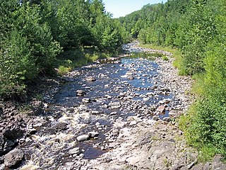
The Bad River is a river flowing to Lake Superior in northern Wisconsin in the United States. It flows for 119.6 kilometres (74.3 mi) in Ashland County, draining an area of 1,061 square miles (2,750 km2) in portions of Ashland, Bayfield and Iron counties. The Bad River sloughs were designated a Ramsar Wetland of International Importance on February 2, 2012.

The Kerala backwaters are a network of brackish lagoons and lakes lying parallel to the Arabian Sea coast of Kerala state in southern India, as well as interconnected canals, rivers, and inlets, a labyrinthine system formed by more than 900 kilometres (560 mi) of waterways, and sometimes compared to American bayous. The network includes five large lakes linked by canals, both man made and natural, fed by 38 rivers, and extending virtually half the length of Kerala state. The backwaters were formed by the action of waves and shore currents creating low barrier islands across the mouths of the many rivers flowing down from the Western Ghats range. In the midst of this landscape there are a number of towns and cities, which serve as the starting and end points of backwater cruises. There are 34 backwaters in Kerala. Out of it, 27 are located either closer to Arabian Sea or parallel to the sea. The remaining 7 are inland navigation routes.

Vembanad, also known as Punnamada is the longest lake in India, as well as the largest lake in the state of Kerala. With an area of 2033 square kilometers and a maximum length of 96.5 km, it is the second largest Ramsar site in India only after the Sunderbans in West Bengal. Spanning several districts in the state of Kerala, it is known as Vembanadu Lake in Kottayam, Vaikom, Changanassery, Punnamada Lake in Alappuzha, Punnappra, Kuttanadu and Kochi Lake in Kochi. Several groups of small islands including Vypin, Mulavukad, Maradu, Udayamperoor, Vallarpadam, Willingdon Island are located in the Kochi Lake portion. Kochi Port is built around the Willingdon Island and the Vallarpadam island.

The Sierra Leone River is a river estuary on the Atlantic Ocean in Western Sierra Leone. It is formed by the Bankasoka River and Rokel River and is between 4 and 10 miles wide (6–16 km) and 25 miles (40 km) long. It holds the major ports of Queen Elizabeth II Quay and Pepel. The estuary is also important for shipping. It is the largest natural harbour in the African continent. Several islands, including Tasso Island, Tombo Island, and the historically important Bunce Island, are located in the estuary.

Polar Bear Pass is a 262,400 hectare wetland and mountain pass on Bathurst Island within the Qikiqtaaluk Region, Nunavut, Canada. The pass is on federal Crown land.

The Quill Lakes is a wetland complex in Saskatchewan, Canada that encompasses the endorheic basin of three distinct lake wetlands: Big Quill Lake, Middle Quill Lake and Little Quill Lake. On May 27, 1987, it was designated a wetland of international importance via the Ramsar Convention. It was the first Canadian site in the North American Waterfowl Management Plan, is a site in the International Biological Programme and Saskatchewan Heritage Marsh Program, and was designated a Western Hemisphere Shorebird Reserve Network site of International significance in May, 1994. The site is an important staging and breeding area for spring and fall migration of shorebirds. The site qualifies as an Important Bird Area for its globally and nationally significant migratory and breeding populations of more than a dozen species of birds.
The Rasmussen Lowlands is a 3,000 km2 coastal plain complex of wetlands in the Kitikmeot Region, Nunavut, Canada. It was designated a Ramsar wetland of international importance by the Ramsar Convention on May 24, 1982. It is also classified as an Important Bird Area.
Shepody Bay is a tidal embayment, an extension of the Bay of Fundy in New Brunswick, Canada, which consists of 77 square kilometres (30 sq mi) of open water and 40 km2 (15 sq mi) of mudflats, with 4 km2 (1.5 sq mi) of saline marsh on the west, and eroding sand and gravel beaches covering an area of approximately 1 km2 (0.39 sq mi) on the eastern shore. The intertidal mudflats "support internationally important numbers of the crustacean Corophium volutator, the principal food source for millions of fall migrating shorebirds".

The Creston Valley Wildlife Management Area is a Canadian river delta wetland and Wildlife Management Area near Creston in south-central British Columbia, on the floodplain of the Kootenay River at the south end of Kootenay Lake. Predominantly marshland, it was classified as a wetland of international importance on February 21, 1994, and is also a globally significant Important Bird Area. It is one of the "few significant agricultural areas of the province", and is in the Montane Cordillera. It stretches north along Kootenay Lake for approximately 20 km, and south to the United States border. It is both the only breeding site of the Forster's tern and the only site with leopard frogs in the province, as well as one of the few Canadian habitats for the Coeur D'Alene salamander. Creston Valley provides staging and nesting areas for migratory birds on the Pacific Flyway.
The Grand Codroy Estuary is a 925 hectare wetland on the southwestern coast of the island of Newfoundland in Canada, approximately 30 km north of Port aux Basques. It is "[one] of the most productive of Newfoundland's few estuarine wetland sites", and is "the province's most important wetland". It is a Wetland of International Importance under the Ramsar Convention, receiving this designation on May 27, 1987. To the south is a globally significant Important Bird Area.
Hay-Zama Lakes is a 586-square-kilometre (226 sq mi) inland wetland and wildland park in northwestern Alberta, Canada. It was designated a Ramsar wetland of international importance on May 24, 1982, and is recognized as an Important Bird Area. It "constitutes one of the most extensive sedge wetlands in western North America".

Mary's Point is a 12 square kilometres (4.6 sq mi) wetland in Albert County, New Brunswick, Canada. It is at the head of the Bay of Fundy, just outside the small community of Harvey and approximately 40 km (25 mi) south of Moncton. Designated a Ramsar wetland of international importance on May 24, 1982, it is also part of the Fundy biosphere reserve established in 2007, which also contains the Shepody Bay wetland. It was also the first Canadian site in the Western Hemisphere Shorebird Reserve, as part of the Bay of Fundy Hemisphere Shorebird Reserve. It is within the Shepody Bay National Wildlife Area, which is administered by the Canadian Wildlife Service.
The Port Phillip Bay and Bellarine Peninsula Ramsar Site is one of the Australian sites listed under the Ramsar Convention as a wetland of international importance. It was designated on 15 December 1982, and is listed as Ramsar Site No.266. Much of the site is also part of either the Swan Bay and Port Phillip Bay Islands Important Bird Area or the Werribee and Avalon Important Bird Area, identified as such by BirdLife International because of their importance for wetland and waterbirds as well as for orange-bellied parrots. It comprises some six disjunct, largely coastal, areas of land, totalling 229 km2, along the western shore of Port Phillip and on the Bellarine Peninsula, in the state of Victoria. Wetland types protected include shallow marine waters, estuaries, freshwater lakes, seasonal swamps, intertidal mudflats and seagrass beds.

The Lakes Argyle and Kununurra Ramsar Site comprises an extensive system of artificial freshwater reservoirs, with their associated permanent wetlands, formed by damming the Ord River in the eastern part of the Kimberley region of northern Western Australia. The reservoirs include Lake Argyle and Lake Kununurra. There are numerous endemic plants and a rich fauna. The 1,500 km2 (580 sq mi) site was designated a wetland of international importance under the Ramsar Convention on 7 June 1990, making it Ramsar Site 478.

The Hunter Estuary Wetlands comprise a group of associated wetlands at and near the mouth of the Hunter River in the city of Newcastle, New South Wales, Australia. Some 30 km2 of the wetlands has been recognised as being of international importance by designation under the Ramsar Convention. It was listed on 21 February 1984 as Ramsar site 287. A larger area of the wetlands has been identified by BirdLife International as an Important Bird Area (IBA). The wetlands are recognised as the most important area in New South Wales for waders, or shorebirds.

Moulting Lagoon Important Bird Area is a composite wetland site in eastern Tasmania, Australia. It comprises two adjacent and hydrologically continuous wetlands – Moulting Lagoon and the Apsley Marshes – at the head of Great Oyster Bay, near the base of the Freycinet Peninsula, between the towns of Swansea and Bicheno. Both components of the site are listed separately under the Ramsar Convention as wetlands of international significance. Moulting Lagoon is so named because it is a traditional moulting place for black swans. It is an important site for waterbirds.
Jubho Lagoon is a large shallow brackish lagoon located in Sindh, Pakistan. In May 2011 Jubhoo lagoon was inducted into the list of Ramsar sites, consisting of wetlands of international importance.

Logan Lagoon is a 2172 ha wetland Conservation Area on Flinders Island, the largest of the Furneaux Group at the eastern end of Bass Strait, which is part of the Australian state of Tasmania.
The Divjakë-Karavasta National Park is a national park in western Albania, sprawling across the Myzeqe Plain in the direct proximity to the Adriatic Sea. The park spans a territory of 222.3 square kilometres (22,230 ha) containing remarkable features such as wetlands, salt marshes, coastal meadows, floodplains, woodlands, reed beds, forests and estuaries. Because of the park's important and great availability of bird and plant species, it has been identified as an important Bird and Plant Area of international importance.

The Albanian Adriatic Sea Coast stretches in the Southeastern Adriatic Sea beginning at the Gulf of Drin in the north, across the port cities of Shëngjin, Durrës and Vlorë, to the Bay of Vlorë in the south, where the Albanian Riviera as well as the Albanian Ionian Sea Coast begins.
References
- ↑ "Tabusintac Lagoon and River Estuary". Ramsar Sites Information Service. Retrieved 25 April 2018.
- ↑ "Tabusintac Lagoon & River Estuary". IBA Canada. Archived from the original on 2011-06-12. Retrieved 2008-01-31.
- 1 2 "Tabusintac Lagoon and River Estuary". Environment Canada. Archived from the original on February 25, 2007. Retrieved 2008-01-31.
- ↑ "The Annotated Ramsar List: Canada". The Annotated Ramsar List of Wetlands of International Importance. Ramsar Convention Bureau. 2000-01-10. Archived from the original on 2008-01-29. Retrieved 2008-01-31.
- ↑ Underhill, Kellie (October 2006). "Where the River Meets the Ocean, Tabusintac". Bread ‘n Molasses. Archived from the original on February 6, 2005. Retrieved 2008-01-31.
- ↑ "Tabusintac Ramsar Site". inmgroup.net. 2017-10-27. Archived from the original on 2017-10-27. Retrieved 2022-06-21.