Acheron is a locality in Victoria, Australia. At the 2021 census, Acheron had a population of 146.

Bungowannah is a locality in the Riverina region of New South Wales, Australia. The locality is on the Riverina Highway, about 16 kilometres (9.9 mi) north west of Albury and 8 kilometres (5.0 mi) south east of Howlong.

Ninda is a locality in Victoria, Australia, located approximately 13 km from Sea Lake, Victoria.
Towaninny is a locality in the Victoria, Australia, located approximately 35 km from Wycheproof, Victoria.
Reefton is a locality in Victoria, Australia, on the Warburton Woods Point Road, located within the Shire of Yarra Ranges local government area. Reefton recorded a population of 102 at the 2021 census.
Speewa is a rural locality in the Riverina District of New South Wales, Australia near the Murray River in Murray River Council local government area.
The Range is a rural locality, south of Adelaide, South Australia. The Range Post Office opened on 1 June 1947 and closed in 1962.
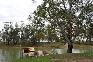
Burramine is a locality in the local government area of the Shire of Moira in Australia.
Jil Jil is a locality in the local government area of the Shire of Buloke, Victoria, Australia. The post office opened as Reseigh on 25 November 1924 and was closed on 1 March 1929.
Marlbed is a locality in the Shire of Buloke, Victoria, Australia. Marlbed post office opened on 1 August 1888, was renamed Jil Jil on 1 May 1911 and was closed on 31 January 1943.
Whirily is a locality in the local government area of the Shire of Buloke, Victoria, Australia. Whirily post office opened on 1 October 1912 and was closed on 1 October 1913.
Narraport is a locality in the Shire of Buloke, Victoria, Australia. There is a rural CFA station in Narraport. The post office there opened on 1 February 1879 and was closed on 29 February 1968.
Reedy Dam is a locality in the Shire of Buloke, Victoria, Australia. There is a rural CFA station in the locality. A post office was opened in 1902 and closed on 31 July 1929.
Wilkur is a locality in the Shire of Buloke and Shire of Yarriambiack, Victoria, Australia. Wilkur post office there opened in 1905, closed on 30 September 1912 reopened on 1 February 1926 and later closed on 27 May 1950. Wilkur South post office opened on 28 June 1920 and was closed on 31 July 1957. Cameron's post office opened on 1 October 1904 renamed Beyal in April 1911 and was closed on 31 August 1929.
Warmur is a locality in the local government area of the Shire of Buloke, Victoria, Australia. There is a rural CFA station in Warmur. The post office there opened as Warmur West State School on 1 July 1905, renamed to Warmur West in 1907 and was closed in 1930.
Nareewillock is a locality in the Shire of Buloke, Victoria, Australia.

Joskeleigh is a coastal rural locality in the Livingstone Shire, Queensland, Australia. In the 2021 census, the locality of Joskeleigh had a population of 60 people.

Pechey is a rural locality in the Toowoomba Region, Queensland, Australia. In the 2021 census, the locality of Pechey had a population of 98 people.

Gooroolba is a rural locality in the North Burnett Region, Queensland, Australia. In the 2021 census, the locality of Gooroolba had a population of 21 people.

Ravensbourne is a rural locality in the Toowoomba Region, Queensland, Australia. In the 2021 census, Ravensbourne had a population of 307 people.

