
Eromanga is an outback town and locality in the Shire of Quilpie, Queensland, Australia. In the 2021 census, the locality of Eromanga had a population of 98 people.
Joel Joel is a locality in the Shire of Northern Grampians, 23 km east of Stawell in the Wimmera region of Victoria, Australia.

Waratah is a locality and town in North Western Tasmania adjacent to Savage River National Park. The town was constructed to support a tin mine at Mount Bischoff. It is built at the top of a waterfall, and water was diverted from the stream to provide water for mine sluicing and processing. At the 2021 census, Waratah had a population of 249. It was also the first town in Australia to have electric street lights in 1886.

Hampton East is a suburb in Melbourne, Victoria, Australia, 14 km south-east of Melbourne's Central Business District, located within the City of Bayside local government area. Hampton East recorded a population of 5,069 at the 2021 census.
Tarrawarra is a locality in Victoria, Australia, 45 km north-east of Melbourne's central business district, located within the Shire of Yarra Ranges local government area. Tarrawarra recorded a population of 81 at the 2021 census.

Ournie is a rural community in the far south east part of the Riverina and situated about 15 kilometres north west from Welaregang and 20 kilometres south from Munderoo. Ournie is situated on the banks of the Ournie Creek which flows into the Murray River and the area is only about 4 kilometres from the border of Victoria.

Carabost is a foresting community in the southeast part of the Riverina. It is about 16 kilometres north west of Rosewood and 22 kilometres southeast of Kyeamba.

Tabbita is a village community in the central part of the Riverina. It is situated by road, on the Kidman Way, about 10 kilometres north west of Warburn and 19 kilometres south east of Goolgowi. The Tabbita area is used prominently for agricultural purposes.

Lankeys Creek is a rural community in the east part of the Riverina. It is situated by road, about 18 kilometres north west of Jingellic and 36 kilometres south east of Holbrook.
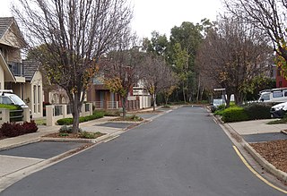
Underdale is a western suburb of South Australia's capital city Adelaide on Kaurna land. It sits between Henley Beach Road and the River Torrens. It is largely residential with a very small industrial section on the eastern side of Holbrook's Road near the river.
Dulacca is a rural town and locality in the Western Downs Region, Queensland, Australia. In the 2021 census, the locality of Dulacca had a population of 131 people.
Burramine is a locality in the local government area of the Shire of Moira in Australia.
Wilkur is a locality in the Shire of Buloke and Shire of Yarriambiack, Victoria, Australia. Wilkur post office there opened in 1905, closed on 30 September 1912 reopened on 1 February 1926 and later closed on 27 May 1950. Wilkur South post office opened on 28 June 1920 and was closed on 31 July 1957. Cameron's post office opened on 1 October 1904 renamed Beyal in April 1911 and was closed on 31 August 1929.

Garradunga is a rural locality in the Cassowary Coast Region, Queensland, Australia. In the 2021 census, Garradunga had a population of 170 people.
Maidenwell is a rural town and locality in the South Burnett Region, Queensland, Australia. In the 2021 census, the locality of Maidenwell had a population of 227 people.

Ambrose is a rural town and locality in the Gladstone Region, Queensland, Australia. In the 2021 census, the locality of Ambrose had a population of 217 people.

Mongolata is a rural locality in the Mid North region of South Australia, situated in the Regional Council of Goyder. The modern locality was established in August 2000, when boundaries were formalised for the "long established local name".
Grace Plains is a rural locality in South Australia on the northern Adelaide Plains about 64 kilometres (40 mi) north of the state capital of Adelaide. It is divided between the Adelaide Plains Council and the Wakefield Regional Council. The formal boundaries were established in June 1997 for the long established local name with respect of the section in the District Council of Mallala ; the portion in the Wakefield council was added in January 2000. It is named after Grace Montgomery Farrell, widow of Rev C. B. Howard, the first South Australian Colonial Chaplain; she later married James Farrell, Dean of Adelaide.

Jimbour East is a rural locality in the Western Downs Region, Queensland, Australia. The town of Jimbour in the locality. In the 2021 census, Jimbour East had a population of 197 people.
Glen Aplin is a rural locality in the Southern Downs Region, Queensland, Australia. In the 2021 census, Glen Aplin had a population of 566 people.

