
Patchewollock is a town in north-west Victoria, Australia. At the 2016 census, Patchewollock had a population of 133.

Speewa is a locality in Victoria, Australia, located approximately 19 km from Swan Hill, Victoria on the Murray River. It is unusual in that it shares its name with a contiguous locality in New South Wales.

Balliang is a locality in Victoria, Australia. It is divided between the Shire of Moorabool and City of Greater Geelong local government areas. It lies north of Geelong and 54 kilometres (34 mi) from the state capital, Melbourne. At the 2016 census, Balliang had a population of 290.

Hesket is a locality in the Macedon Ranges Shire, in Victoria, Australia on the northern side of the Mount Macedon Range. The settlement was originally known as Ferny Creek.

Reefton is a bounded rural locality in Victoria, Australia, on the Warburton Woods Point Road. Its local government area is the Shire of Yarra Ranges. At the 2006 Census, Reefton had a population of 325. The Upper Yarra Reservoir lies within the locality.

Tyrrell is a locality in the local government area of the Rural City of Swan Hill and the Shire of Buloke, Victoria, Australia. Tyrrell West post office opened on 29 May 1909 and was closed on the 2 November 1914. Long Plains post office opened in 1902 and was closed on 31 July 1940.

Beauchamp is a place in Victoria, Australia in the local government area of the Rural City of Swan Hill and the Shire of Gannawarra. The post office opened in 1902 and closed on 31 December 1944.

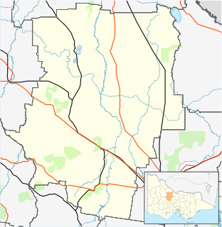
Tyrrell Downs is a locality in the northern part of the Shire of Buloke, Victoria, Australia. The post office there opened in April 1898 and was closed on 1 July 1927.
Straten is a town in the 'Mallee' Ward of the Shire of Buloke, Victoria, Australia that was also previously called 'Stratton'. Speed East post office was in the locality and was opened on the 15 January 1923, renamed Stratton on the 15 April 1924 and was closed on the 12 July 1952.
Watchupga is a locality in Northern Victoria, Australia. The local government area of Watchupga is the Shire of Buloke. Watchupga has a grain station on the Mildura railway line with a grain silo on the site which is 84 metres tall. However, the station was closed to passenger and parcels traffic on 11 November 1975. Watchupga Post Office opened on 23 July 1900 and was closed on 29 February 1972.
Reedy Dam is a town in the Mallee and Mount Jeffcot wards in the Shire of Buloke, Victoria, Australia. There is a rural CFA station in Reedy Dam. The post office there opened in 1902 and was closed on the 31 July 1929. There is a population of approximately 20 people in Reedy Dam (2017).
Wilkur is a town in the Mount Jeffcot ward of the local government area of the Shire of Buloke and the Warracknabeal ward of the Shire of Yarriambiack, Victoria, Australia. Wilkur post office there opened in 1905, closed on the 30 September 1912 reopened on the 1 February 1926 and later closed on the 27 May 1950. Wilkur South post office opened on the 28 June 1920 and was closed on the 31 July 1957. Cameron's post office opened on the 1 October 1904 renamed Beyal in April 1911 and was closed on the 31 August 1929.
Warmur is a locality in the local government area of the Shire of Buloke, Victoria, Australia. There is a rural CFA station in Warmur. The post office there opened as Warmur West State School on the 1 7 1905, renamed to Warmur West in 1907 and was closed in 1930.
Morton Plains is a town in the local government area of the Shire of Buloke, Victoria, Australia. The post office there opened on the 1 August 1864 and was closed on the 9 May 1931.
Nareewillock is a locality in the Lower Avoca ward of the local government area of the Shire of Buloke, Victoria, Australia.
Terrappee is a town in the local government areas of the Shire of Buloke and the Shire of Loddon, Victoria, Australia which is possibly named after the lake in the area. The post office there opened as Terrapee [sic] on 13 October 1887 and was closed on 1 December 1927.
Teddywaddy is a locality in the Lower Avoca ward of the local government area of the Shire of Buloke, Victoria, Australia. A rural CFA station is located on 'Lot 1 Teddywaddy Road.'
Chirrip is a locality in the Mount Jeffcott ward of the local government area of the Shire of Buloke, Victoria, Australia.
Granite Flat is a locality in the local government area of the Shire of Buloke, Victoria, Australia. Its post office opened in 1902, and was closed on 27 March 1908.
Corack East is a locality in the Mount Jeffcott ward of the local government area of the Shire of Buloke, Victoria, Australia. A rural CFA station is located in the town. Corack East post office opened on 1 August 1891 and was closed on 24 May 1976.


