
Myanmar is the northwestern-most country of mainland Southeast Asia. It lies along the Indian and Eurasian Plates, to the southeast of the Himalayas. To its west is the Bay of Bengal and to its south is the Andaman Sea. It is strategically located near major Indian Ocean shipping lanes.The neighboring countries are China, India, Bangladesh, Thailand and Laos.

The Moken are an Austronesian people of the Mergui Archipelago, a group of approximately 800 islands claimed by both Burma and Thailand. Most of the 2,000 to 3,000 Moken live a semi-nomadic hunter-gatherer lifestyle heavily based on the sea, though this is increasingly under threat.

Myeik, is a city in Tanintharyi Region in Myanmar (Burma), located in the extreme south of the country on the coast of an island on the Andaman Sea. As of 2010 the estimated population was over 209,000. The area inland from the city is a major smuggling corridor into Thailand. The Singkhon Pass, also known as the Maw-daung Pass, has an international cross-border checkpoint.

The Surin Islands is an archipelago of five islands in the Andaman Sea, 60 km from the Thai mainland. Administratively, the islands are part of Tambon Ko Phra Thong, Khura Buri District, in Phang Nga Province, Thailand.

Tanintharyi or Taninthayi is a small town in Taninthayi Township, Myeik District, in the Tanintharyi Region of south-western Myanmar. It is the administrative seat for the township. The town is located on the Great Tenasserim River which eventually enters the sea at Myeik. The town is located at the confluence of this river and a tributary known as the "Little Tenasserim River" which runs south.
Kadan Kyun is the largest island in the Mergui Archipelago, Myanmar. Its area is 450 km². The highest point is French Bay Peak, which is the highest point in the archipelago.
Saganthit Island is an island in the Mergui Archipelago, Burma (Myanmar). Its area is 257 km².
Letsok-aw Island is an island in the Mergui Archipelago, Burma (Myanmar). With a length of 38 km and an area of 250 km² it is one of the largest islands of the archipelago. This hilly and thickly wooded island lies 14 km east of Bentinck Kyun. It stretches from north to south and has a maximum width of 9.7 km. Highest point 683 m.

Lanbi Kyun, also Lambi Island and Lampi Island, is an island in the Mergui Archipelago, Burma. Having an area of 188 km2 (73 sq mi), thickly wooded Lanbi is one of the largest islands of the group.
Mali Kyun is an island in the Mergui Archipelago, Burma (Myanmar). This long and narrow island at the northern end of the archipekago occupies an area of 99 km2 (38 sq mi), stretching roughly from north to south.
Bentinck Kyun is an island in the Mergui Archipelago, Burma (Myanmar). It lies 14 km west of Letsok-aw Kyun in the Andaman Sea. Bentinck has a very irregular indented shape. The island is thickly wooded and its area is 78 km².
The Ye River is a river of Burma. It has its source in the Tenasserim Hills and drains into the Andaman Sea along the Mon State coast. Wa Kyun is an island located 3 kilometres west-northwest of the mouth of the Ye River. The Ye River flows through the eastern part of the town of Ye town.
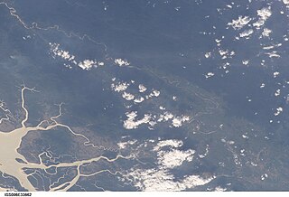
The Great Tenasserim River or the Tanintharyi River is a major river of southeastern Burma. It flows through the Tanintharyi Region, past the town of Tanintharyi, and enters the sea at Myeik (Mergui). The river rises from the Tenasserim Range at an altitude of 2,074 m (6,804 ft), and flows into the Andaman Sea. The region formed by this river is also known as Tenasserim, or Tanintharyi in Burmese. It is in a constricted coastal region in southeastern Myanmar, which borders Thailand on the east and the Andaman Sea on the west.

Kanmaw Kyun or Kanmaw Island is an island in the Andaman Sea along the coast of southeastern Burma (Myanmar), and is part of the Mergui Archipelago. Administratively, it is located in Kyunsu Township, Myeik District, in the Taninthayi Region. On the northeastern side of the island is the town of Kyunsu which is the administrative seat for the township. The island covers a total area of 409 km².
Zadetkyi Island or Zadetkyi Kyun, also known as Saint Matthew's Island, is an island at the southern end of the Mergui Archipelago, Burma. Its northern side forms the southern shore of Hastings Harbor, where there is a base of the Myanmar Navy.

The Moscos Islands are an island chain in the Andaman Sea, right off the northern coast of the Tanintharyi Region, in the southern area of Burma.
Christie Island is an island in the Mergui Archipelago and the southernmost point of Burma (Myanmar). It lies at the southern end of the archipelago 18 km (11 mi) to the NNE of Ko Surin Nuea, and the Thai-Burmese oceanic border is located between these two islands.


