Kokunye Kyun

Last updated

Kokunye Kyun
Island
Myanmar adm location map.svg
Red pog.svg
Kokunye Kyun
Coordinates: 15°18′0″N97°42′35″E / 15.30000°N 97.70972°E / 15.30000; 97.70972
Country Myanmar
State Mon
Area
  Total 0.7 km2 (0.3 sq mi)
Elevation 140 m (460 ft)
Time zone Myanmar Standard Time (UTC+6:30)

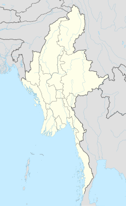
Kokunye Kyun is an island in the Andaman Sea, right off the coast of Mon State, in the southern area of Burma. It is located in an area of shoals. This island is 1.4 kilometres (0.87 mi) long and its maximum width is 0.4 kilometres (0.25 mi). It is covered with dense forest and rises to a height of 140 metres (460 ft).
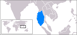
Andaman Sea Marginal sea of the eastern Indian Ocean

The Andaman Sea is a marginal sea of the eastern Indian Ocean separated from the Bay of Bengal by the Andaman Islands of India and Myanmar and the Nicobar Islands of India and touching Myanmar, Thailand, and the Malay Peninsula. Its southernmost end is defined by Breueh Island, an island just north of Sumatra.

Mon State State in South, Myanmar

Mon State is an administrative division of Myanmar. It lies between Kayin State to the east, the Andaman Sea to the west, Bago Region to the north and Tanintharyi Region to the south, also having a short border with Thailand's Kanchanaburi Province at its south-eastern tip. The land area is 12,155 km2. The Dawna Range, running along the eastern side of the state in a NNW–SSE direction, forms a natural border with Kayin State. Mon State includes some small islands, such as Kalegauk, Wa Kyun and Kyungyi Island, along its 566 km of coastline. The state's capital is Mawlamyine.
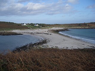
Shoal A natural landform that rises from the bed of a body of water to near the surface and is covered by unconsolidated material

In oceanography, geomorphology, and earth sciences, a shoal is a natural submerged ridge, bank, or bar that consists of, or is covered by, sand or other unconsolidated material, and rises from the bed of a body of water to near the surface. Often it refers to those submerged ridges, banks, or bars that rise near enough to the surface of a body of water as to constitute a danger to navigation. Shoals are also known as sandbanks, sandbars, or gravelbars. Two or more shoals that are either separated by shared troughs or interconnected by past or present sedimentary and hydrographic processes are referred to as a shoal complex.
Contents

Geography

Kokunye Kyun is the northernmost of a chain of small coastal islands that lie close to the mouth of the Ye River. It is located 10 kilometres (6.2 mi) to the north of Wa Kyun, the next island along the coast to the south. [1]

The Ye River is a river of Burma. It has its source in the Tenasserim Hills and drains into the Andaman Sea along the Mon State coast. Wa Kyun is an island located 3 kilometres west-northwest of the mouth of the Ye River. The Ye River flows through the eastern part of the town of Ye town.

Wa Kyun Island in Mon, Myanmar

Wa Kyun is an island in the Andaman Sea, right off the coast of Mon State, in the southern area of Burma. This 2 kilometres (1.2 mi) long island is located in the midst of a shoal or shallow area. It is covered with dense forest and rises to a height of 135 metres (443 ft).

See also

Related Research Articles

Geography of Myanmar

Myanmar is the northwestern-most country of mainland Southeast Asia. It lies along the Indian and Eurasian Plates, to the southeast of the Himalayas. To its west is the Bay of Bengal and to its south is the Andaman Sea. It is strategically located near major Indian Ocean shipping lanes.The neighboring countries are China, India, Bangladesh, Thailand and Laos.

Mergui Archipelago island group

The Mergui Archipelago is located in far southern Myanmar (Burma) and is part of the Tanintharyi Region. It consists of more than 800 islands, varying in size from very small to hundreds of square kilometres, all lying in the Andaman Sea off the western shore of the Malay Peninsula near its landward (northern) end where it joins the rest of Indochina. Occasionally the islands are referred to as the Pashu Islands because the Malay inhabitants are locally called Pashu.

Cheduba Island Island in Rakhine, Myanmar

Cheduba Island is an island in the Bay of Bengal close to Ramree Island and belongs to Myanmar, formerly Burma. It has a maximum length of 33 km (21 mi), with an area of approximately 523 km2 (202 sq mi)

Ramree Island Island in Rakhine, Myanmar

Ramree Island is an island off the coast of Rakhine State, Burma. The area of the island is about 1,350 square kilometres (520 sq mi) and the main populated center is Ramree.

Daung Kyun Island of the Mergui Archipelago in Taninthayi, Myanmar

Daung Kyun, also known as Ross Island, is an island in the Mergui Archipelago, Burma.

Mali Kyun island in Myanmar

Mali Kyun is an island in the Mergui Archipelago, Burma (Myanmar). This long and narrow island at the northern end of the archipekago occupies an area of 99 km2 (38 sq mi), stretching roughly from north to south.

Mein-ma-hla Kyun Wildlife Sanctuary

Mein-ma-hla Kyun Wildlife Sanctuary is a wetland reserve in Myanmar's Ayeyarwady Delta, located in Bogale Township, Ayeyarwady Division. It was established in 1986, is classified as a mangrove ecosystem reserve and occupies an area of 137 square kilometres (52.79 sq mi).

Kanmaw Kyun island in Myanmar

Kanmaw Kyun or Kanmaw Island is an island in the Andaman Sea along the coast of southeastern Burma (Myanmar), and is part of the Mergui Archipelago. Administratively, it is located in Kyunsu Township, Myeik District, in the Taninthayi Region. On the northeastern side of the island is the town of Kyunsu which is the administrative seat for the township. The island covers a total area of 409 km².

Myingun Island Island in Rakhine State, Myanmar

Myingun Island, also known as Myengu Island, is an island in the Bay of Bengal. It is administrated by Myanmar and belongs to Rakhine State. The island is located 5 kilometres to the south of Sittwe, separated from the continental shore by a 2-kilometre-wide (1.2 mi) strait.

Zadetkyi Island of the Mergui Archipelago in Taninthayi, Myanmar

Zadetkyi Island or Zadetkyi Kyun, also known as Saint Matthew's Island, is an island at the southern end of the Mergui Archipelago, Burma. Its northern side forms the southern shore of Hastings Harbor, where there is a base of the Myanmar Navy.

Than Kyun island in Myanmar

Than Kyun or Davis Island is an island at the southern end of the Mergui Archipelago, Burma. It is the largest and highest island of the Alladin Islands, a scattered cluster of islands extending to the W and SSW of Zadetkyi Island. This densely wooded island has two main peaks, each with a height of around 450 metres. The island has a roughly round shape with a diameter of about 6 kilometres. Off its eastern shore rises a 5.5-metre-high (18.0-foot) rock surrounded by a reef. Than Kyun lies 4.5 kilometres west of the southern end of Zadetkyi Island.

Kalegauk Island Island in Mon, Myanmar

Kalegauk Island is an island in Ye Township, Mon State, Burma (Myanmar). It is located in the Andaman Sea, 8.25 kilometres (5.13 mi) from the coast of Mon State.

Kyungyi Island Island in Mon, Myanmar

Kyungyi Island is an island in the Andaman Sea, right off the coast of Mon State, in the southern area of Burma.

Nantha Kyun Island in Rakhine, Myanmar

Nantha Kyun is an island off the coast of Rakhine State, Burma.

Unguan Island in Rakhine, Myanmar

Unguan is a small island off the coast of Rakhine State, Myanmar.

Apaw-ye Kyun Island in Rakhine, Myanmar

Apaw-ye Kyun or Apaw Ye Kyun is an island off the coast of Rakhine State, Burma.

Myingyi Kyun Island in Ayeyarwady, Myanmar

Myingyi Kyun, also known as High Island, is a small island off the coast of Ayeyarwady Region, Burma.

Be-in Kyun Island in Rakhine, Myanmar

Be-in Kyun, also known as Abhay Island, is a small island off the coast of Rakhine State, Burma.

Gwa Kyun Island in Rakhine, Myanmar

Gwa Kyun, also known as Gwa Chaung, is a small island off the coast of Rakhine State, Burma.

References

  1. Prostar Sailing Directions 2005 India & Bay of Bengal Enroute By National Geospatial-intelligence Agency